How to Make a Subway Map with John Tauranac
Hear from an author and map designer who has been creating maps of the NYC subway, officially and unofficially, for over forty years!


New York City life is shaped by the archipelago upon which it lies. Nearly thirty of these islands bear names and distinct, if peculiar, backstories. We rounded up eleven such islands, all linked through the common themes of abandonment and obscurity. Many were at one point inhabited, either by individuals or institutions, but today all have slipped out of the public’s consciousness. Even to many native New Yorkers, their existence remains unnoticed.
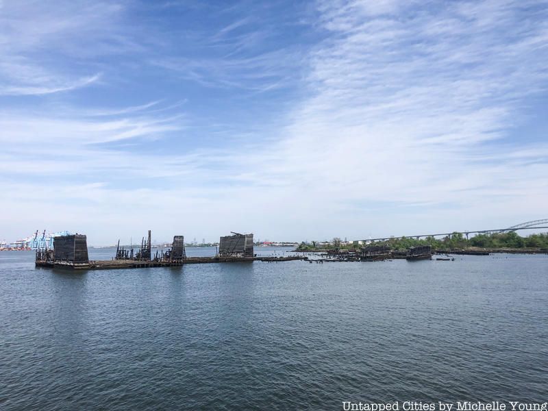
This 43-acre island straddles the border between New York and New Jersey and derives its name from the hunting activities that took place here during the Colonial Era. As New York grew as an industrial port, the island accommodated an oil refinery and shipyard during the 19th century.
Today, the island is owned by the Department of Parks and Recreation, with the Audubon Society managing wildlife research. Many prominent historical figures from George Washington to Theodore Roosevelt and Prince Henry of Prussia once made use of the island, with the former utilizing it as a location to drop off covert messages during the Revolutionary War.

This duo of artificial islands rests close enough to Staten Island’s shore that a proposal once existed to fill the gap between the landmasses to create a park. Such a proposal might not have existed if the planners had known that the islands originally hosted quarantine stations during the height of immigration into the U.S. in the late 19th/early 20th centuries.
Constructed entirely of iron in order to keep the structures as airtight as possible, the facilities on the islands included a crematory and a mortuary for the less fortunate patients. Advances in the medical treatment of infectious diseases led to the decline of such facilities, with these two closing in 1923. Having been owned by the Department of Parks and Recreation since 1966, the islands were ironically preserved in order to maintain the “natural” topography of New York Bay.
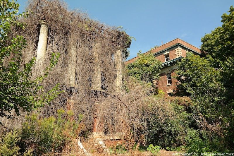
Another duo of islands, these brothers are common in name only. North Brother's backstory features elements that have become typical for the avid New York historian, with a history of housing the sick, the addicted, and the condemned in confined spaces away from the public. The tuberculosis pavilion has been documented by photographer Christopher Payne, and much literature has been written about the site.
For what South Brother lacks in foreboding tales of the infirm, it makes up for in humorous eyebrow-raising real estate ventures. Originally the property of Jacob Ruppert–the owner of the Yankees largely responsible for bringing Babe Ruth to New York–the island’s only structure burned down in 1909. After Rupper sold the island, the real estate transactions went something like this: private ownership to public ownership to private again to public again, with prices ranging from $10 from an investment firm in 1975 to $2 million of Federal Grant money in 2007.
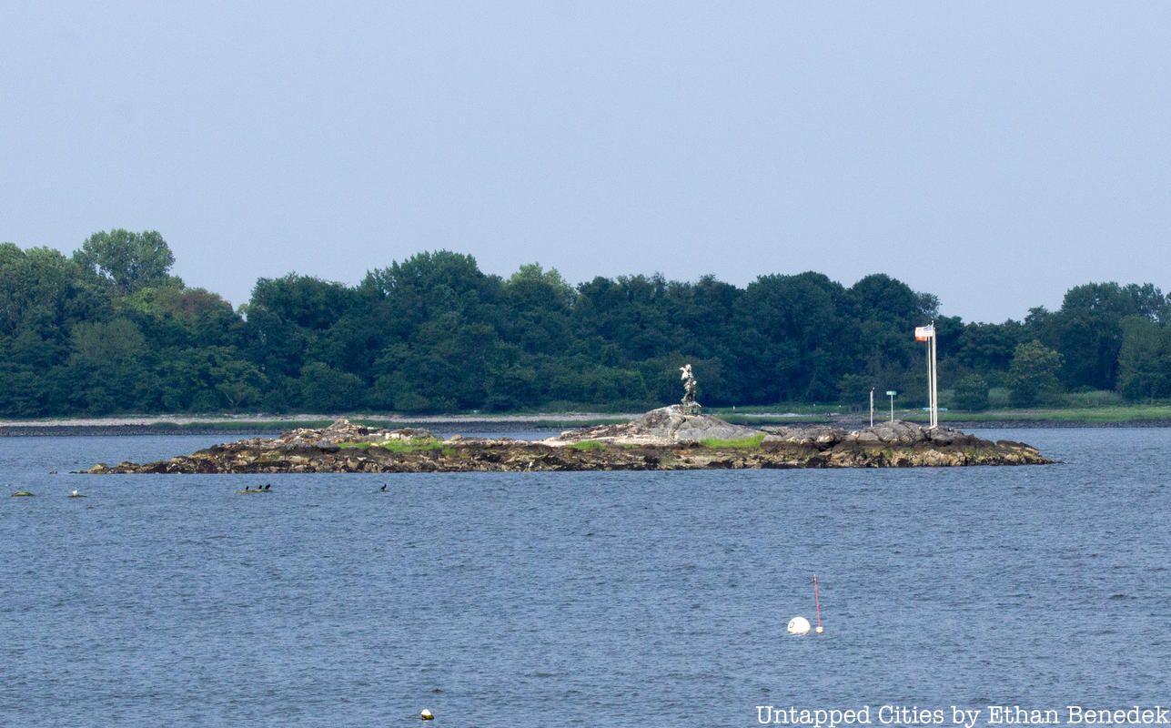
As is to be guaranteed in New York, for every obscure real estate venture there is always one that tops the last. Enter Rat Island, a 2.5-acre mass of bedrock and broken glass with no vegetation. To the average investor, the island is as devoid of value as it is devoid of life. But you won’t be able to discourage Alex Schibli, a former Port Authority employee and City Island resident who purchased the island for $176,000 in 2011.
Schibli claims that he has always wanted an island getaway, but perhaps he’s realized that such a development would be impractical on a landmass that is known for being completely submerged during average summer thunderstorms.
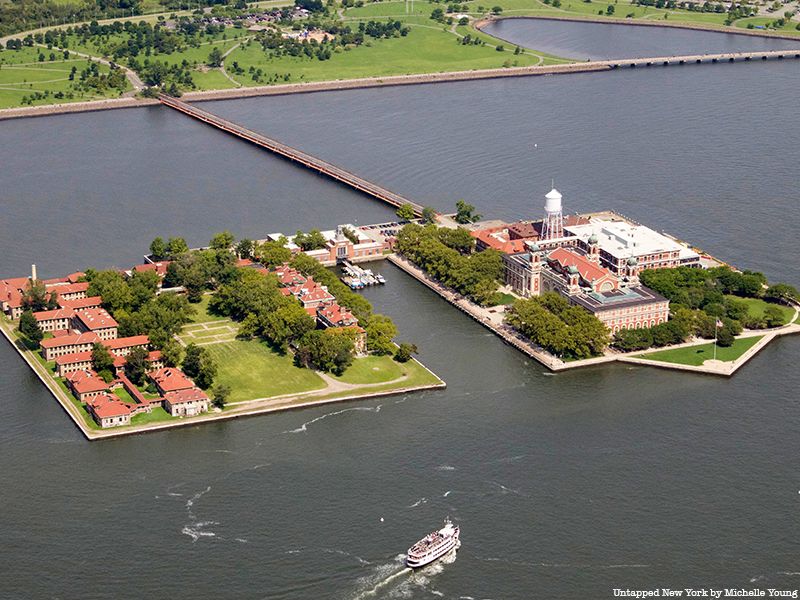
While Ellis Island has become one of New York City’s top tourist attractions, drawing over two million visitors per year, the 22-building South Side hospital complex is hidden in plain sight, just to the left of disembarking passengers headed towards the Great Hall. Looking at its desolate, skeletal frame now, it’s difficult to imagine its backstory as one of the largest public health undertakings in American history.

Gain access to spaces usually off-limits to the public!
But the abandoned Ellis Island Hospital complex—once the standard for United States medical care (and later transformed into the FBI headquarters when the island served as a detention center)—has been left to decay for nearly 60 years. Join us for our upcoming hard hat tour, guided by a Save Ellis Island docent, where we’ll uncover its many, buried secrets. In this experience, you’ll visit the contagious disease wards, and the autopsy rooms, and have exclusive access to places usually closed to the public.

Islands have historically played strategic roles for nations and their militaries, and those in New York City are no exception. While the battles on Long Island and Manhattan have been well documented, the naval skirmish that took place on Mau Mau is a little less well-known. That might have had more to do with the post-battle bar hop, though.
In 2011, the artist collective Swimming Cities hosted a raucous day of competitive naval events that pitted “gangs” sailing homemade vessels against one another. The manmade island sits across from Marine Park golf course and has attracted little media attention–save for the construction of a bird sanctuary–since.
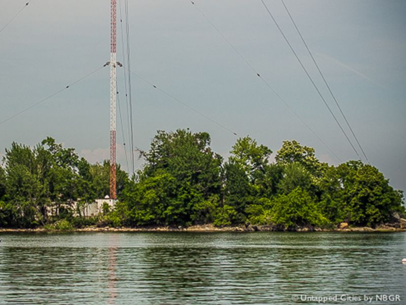
A stone’s throw from New York City’s most treasured obscure landmass, City Island, High Island has also proved a cozy home, first for sharks and then for humans. The bungalow dwellers were kicked out in 1962 to make way for a radio transmission tower, which was hit by a small plane just one day before owner WCBS switched to an all-news format. A new tower has stood in place since the incident and has a daytime broadcast frequency range from Cape Cod to Cape May.
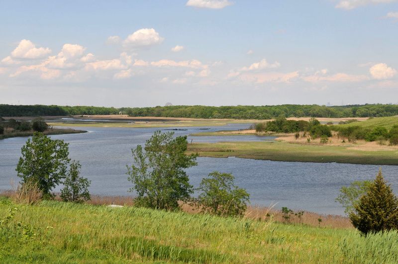
This 100-acre plot of land is as natural as they come, which is why the Audubon Society has fought so hard for its preservation over the years. Plans for its inclusion in the Fresh Kills Landfill were met with volatile opposition in the early 1990s, and today the island consists entirely of a nature preserve. Once declining populations of herons, ibis, and egrets now call the island home, and it has been considered one of the most crucial such refuges in the New York area.
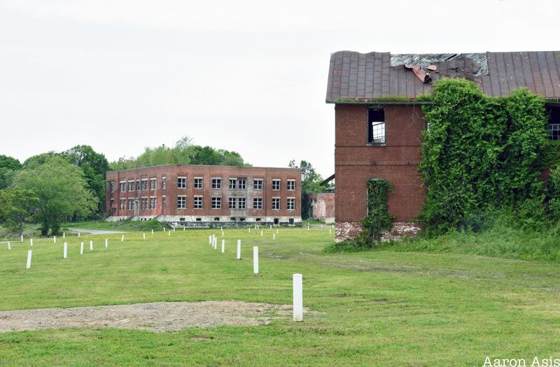
Home to the largest tax funded cemetery in the world, Hart Island has been the final resting place for over 800,000 since 1869. Jacob Riis documented the island in his book, How the Other Half Lives, and estimated that 1 in 10 New Yorkers were buried on the island by the end of the 19th century. Like North Brother Island, it has often been associated with society’s unwanted, though a recent interview with a former resident indicates that it did not always bare a haunting persona.
Today, the Hart Island Project seeks to reconfigure the island’s image with the construction of a public park. Management of the island was transferred from the Department of Corrections to the New York City Parks Department in 2019. Since then, Parks has demolished many of the historic buildings that stood on the island.
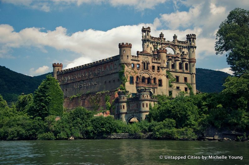
The decaying castle structures on Bannerman Island were built near the town of Beacon, New York by Scottish-American entrepreneur Francis Bannerman as warehouses for his business “Bannerman’s,” a catalog business for war surplus (including munitions and large artillery).
The Bannermans discovered the island by accident while canoeing on the Hudson and purchased it from an eccentric husband and wife duo named Mary and Anthony Taft for $600 (plus $1000 in notes that were paid off over two years). The Bannermans had to promise in writing that the island would not go back to its past use as a haven for illegal alcohol and prostitution. Francis Bannerman built the structures gradually. He was not an architect but would draw elements on napkins and envelopes based on castles he saw on travels to Europe, and give the sketches to his construction workers to build.
The current state of the structures is the result of a number of unfortunate incidents. In 1918, Francis Bannerman died and his family lost interest in maintaining the buildings. The powerhouse exploded in 1920, sending debris all the way across the Hudson and blowing out some of the warehouse windows. The gradual construction of the warehouses meant that buildings were supported by one another, lending a fundamental weakness to the design. In addition to the natural toll of time, a particularly harsh winter in 2010 led to the collapse of two major walls of the tallest warehouse.
Like High Island, the Chimney Sweep Islands lie just beneath City Island’s nose. Or, at least, just across Pelham Bay. Both are part of a group of 20 islands situated within the borders of Bronx County known as the “Devil’s Stepping Stones.” With a history of waxing and waning fortunes, they have provided both key landmarks for sailors during the 18th century and have hosted asylums.
As with much of the New York area’s etymology, the island group’s namesake harkens back to Native American origins. According to folklore, the “Devil’s Stepping Stones” are believed to have been formed during a skirmish between a local tribe and the Devil. Every time the Devil set his foot down into the water, a small landmass emerged. Regardless of the accuracy of such tales, the names are indicative of the barren nature of these uninhabited land formations, most of which are composed entirely of bedrock and are devoid of any discernible vegetation.
It is no surprise then that the Chimney Sweep Islands, whose name was probably derived from the fact that they look like chimney sweep tools, have never been inhabited by humans. Rather, flocks of seagulls and blue herons have long called them home, and they have now become popular with kayakers as a resting point.
Next, check out 20 abandoned places in NYC!
Subscribe to our newsletter