

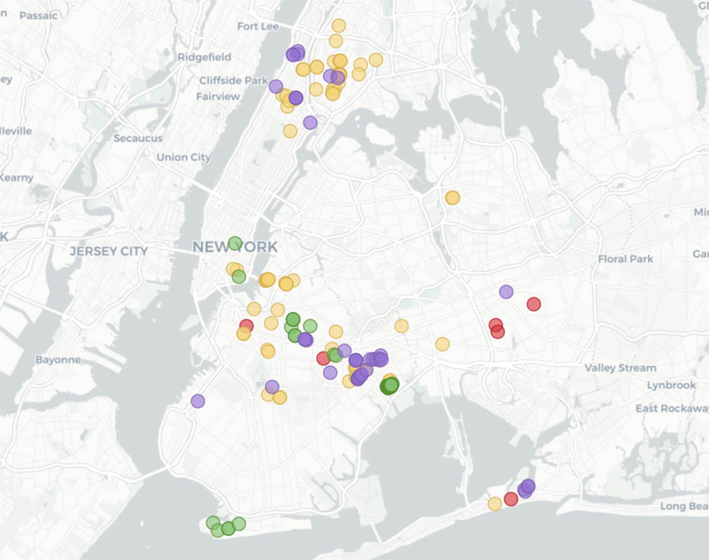
New York City has a tradition of selling property for only $1. This token transaction amount, as we mentioned in a previous post, is often used as a development incentive for potential buyers, who need to show they have plans and the funds to execute their vision. Now, thanks to the ONE DOLLAR LOTS project by 596 Acres, we can see all of the city-owned lots of land sold to developers for $1 since Mayor Bill de Blasio took office in January 2014.
According to onedollarlots.org, some of the land has been bought by organizations doing “valuable and necessary work for the city,” like establishing shelters for LBTQ youth and building homes for the extremely-low income. Meanwhile, other lots have gone to for-profit housing developers who build market-rate apartments. Yet, out of 202 city-owned lots that were sold and plotted on the map — 41 of which are pending final sale — only one of them has become permanently affordable housing,” the website states.
Additionally, many of these sales are taking place without input from the communities most impacted by the transactions. By creating this archive, 596 Acres is providing local residents and organizers with information about pending sales that might affect their neighborhoods. It also allows people to better imagine effective uses for cheap public land. Such lots are essential for building communities, but only if organized specifically to ensure long-term public benefit, such as affordable housing, cultural spaces, community co-ops, among other community-friendly spaces.
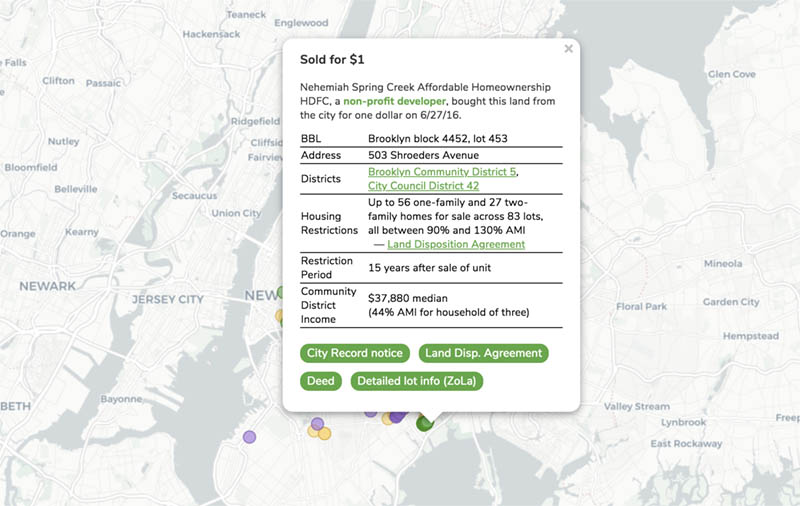 Image via onedollarlots.org
To use the map and view the details of each sale, click on the various dots, which have been color-coded according to whether the lots were bought by a for profit or a non-profit developer. 596 Acres conveniently hyperlinks the contact sheet for the local Council Members, which users can access by clicking on the “City Council District” link. The sections titled “Housing Restrictions” and “Community District Income” also give an idea of how useful the sale may be to locals.
Next, check out an Interactive Street Map of NYC in the 1980s and the Judgmental Map of NYC.