

Visited by over four million people a year and housing two restaurants, a historic railroad terminal, and a marina, Liberty State Park is not only a newer American landmark and world-class destination but also one of the best examples of urban environmental restoration in the country. It was created by reclaiming land once used for the Railroad industry and was one of the busiest transportation hubs in the country during its peak years (as well as the closest you can get to the Statue of Liberty without going to Liberty Island).
Now serving as a habitat for the protection of wildlife, it consists of over 1200 acres of land, water, and shoreline, providing an urban oasis in Jersey City and New York harbor. The Central Railroad of New Jersey created most of the land for the Park by filling in Communipaw Cove, which is the native name of the area. Up until the 19th century, the land that is now Liberty State Park was mostly water and teeming with life, including oyster beds and native Lenape encampments before colonial contact.
The Dutch West India Company ultimately brought Dutch farms or “Bouweries” along the shoreline and inland in the form of land patents, giving their higher-ranking employees the opportunity to promote the creation of villages, though few were successful. By the 1640s, Communipaw Cove stretched from the Morris Canal to the North and to Caven Point to the South. The shoreline went as far back as where the New Jersey Turnpike is today behind the Park, near Liberty Science Center.
The railroad eventually filled in these salt marshes and tidal mudflats with oceangoing vessel ballast, Jersey City construction debris, and approximately 200 million cubic yards of historic debris (trash to be clear, but it’s old and deeply buried beneath the soil) between 1860 and 1928, creating the land used by park goers today. The Park lies directly behind the Statue of Liberty and is managed by the state of New Jersey’s Department of Environmental Protection Division of Parks and Forestry.
While it officially opened in 1976, portions of the park were being still restored into the 2000s, and a major revitalization plan is currently in the works, set to be announced by the DEP in May 2023. An ongoing effort is taking place to protect the park, created by the sacrifice and hard work of a few dedicated individuals, such as Morris Pesin and Audrey Zapp. It has been continually cared for by hundreds of state park employees since its official creation during America’s centennial year on Flag Day, June 14th, 1976. Today, we’re taking a look back at its history and many interesting secrets:
1. There’s an Abandoned Rail Station at Liberty State Park
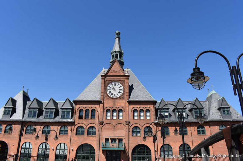
Liberty State Park was once the location of the terminus of the Lehigh Valley, Central Railroad of New Jersey, and Baltimore and Ohio Railroads from 1889 to 1967. After arriving in Jersey City, visitors had to ferry on to Lower Manhattan as there were no tunnels under the Hudson River until 1910 when the North River tunnel was built much further north for train service from Weehawken, New Jersey to Manhattan’s Penn Station.
The CRRNJ Terminal building is one of the grandest of its kind and recently received its best restoration ever after it suffered damage due to Superstorm Sandy. Built in 1889 and designed by the architects Peabody & Stern in a French renaissance style, it served as the main passenger terminal for the Central Railroad of New Jersey for over 80 years. It is considered a part of the “Historic Trilogy,” which also includes the Statue of Liberty and Ellis Island. Immigrants would arrive by steamship and pass the Statue, be processed at Ellis Island, and then two thirds of them would come to this train terminal building for further destinations in the U.S. to begin their new lives. There was even a separate immigrant waiting room for new arrivals on their way to all points west. This terminal is actually the second one built at this location; the first was a smaller wooden structure, built in 1864.
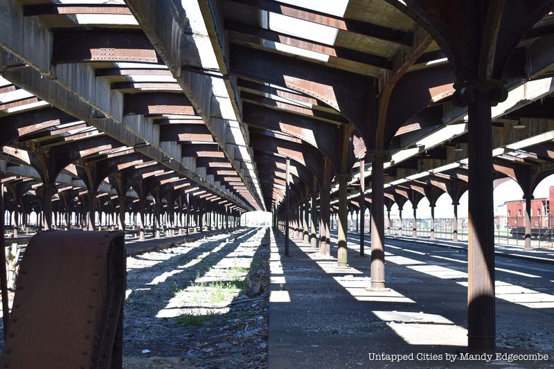
When approaching the terminal building by car, the first thing you see is the Abraham Lincoln Bush-designed train shed behind the terminal. You can take great photos but the area is too hazardous to enter due to its bad state of decay. It was built in 1913 during a major expansion of the terminal with its primary function to keep people protected from weather as they stepped on and off the trains. The large concourse connecting it with the terminal was also constructed at this time.
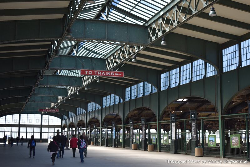
The largest of its kind, it contained 20 tracks that can cover the equivalent of four football fields and large ferry sheds in front for service to Manhattan. At its peak, 65,000 people a day passed through here riding on over 350 trains. Train sheds of this type are most commonly found on the west coast. The New Jersey Department of Environmental Protection, the governing agency who operates Liberty State Park, is currently reviewing the train shed to be able to protect it further historically, or perhaps demolish it. There is no definitive answer at this time.
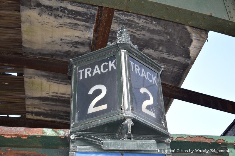
In addition, many luxury trains would leave and arrive from this terminal, including the famous Jersey City to Atlantic City train, the Blue Comet, operating from 1929 to 1941 (think the era of Boardwalk Empire). The Blue Comet historical society donated the new, yet antique train destination signs you’ll see by the tracks from the terminals heyday, when the highest number of trains operated here from 1938 to 1941. CRRNJ declared bankruptcy in 1967 and closed the terminal. It was purchased with state and federal funds in 1968. Look closely around the clock on the front of the building, it says the words Industry, Science, Agriculture, and Commerce!
Different types of history tours of the Terminal are offered throughout all seasons with more programming in the summer. See the interpretive center schedule for more details. The programs often require pre-registration, but park docents are there to answer any questions and share their knowledge!
2. An Explosion Near Liberty State Park Damaged the Statue of Liberty
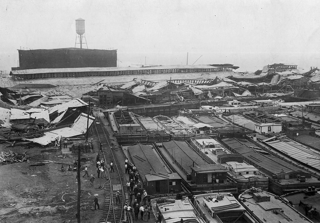
In 1916, Black Tom, once a small island in New York Harbor adjacent to what is now Liberty State Park, was racked by a massive explosion that would have registered as a 5.5 magnitude earthquake, with shocks felt all the way to Connecticut and Philadelphia. The island was originally used as a freight facility with a dock and then connected to the mainland and used as a work yard and storage facility for the Lehigh Valley Railroad between 1905 and 1916. By the late 1910s, before the United States officially joined World War I, Black Tom had become a major munitions hub where American arms dealers sold weapons to which ever side was buying. In 1915, British troops established a blockade that prevented opposing forces from gaining access to the American armaments. In retaliation to being shut out of the arms deals, German troops planned an attack.
On the evening of July 30, 1916, as freight cars and barges, supposedly stocked full with over 2 million pounds of ammunition, sat waiting to be shipped overseas, a series of small fires broke out causing a major explosion. The shock blew out windows within a 25-mile radius: shrapnel damaged the outside wall of Jersey City’s City Hall and flying pieces of metal struck the skirt of the Statue of Liberty. Over 100 years later, the torch of the statue is still closed off to visitors because of damage from the explosions. The blast even made it necessary to temporarily evacuate Ellis Island. The total cost of losses was estimated at $20 million and seven people were killed.
Though lax safety precautions and poor handling of hazardous materials on Black Tom led to speculation about the actual cause of the fires that sparked the explosion, a special commission officially ruled in 1939 that the German Government had authorized the sabotage. This event spurred the Federal Government to create the Espionage and Sedition Acts, and the newly formed Bureau of Investigation (FBI) was very involved. Another world war got in the way of the U.S. receiving any reparations, and the $95 million owed to the USA by Germany for various claims, including the explosion at Black Tom, was not fully paid off until 1979.
The site of the former island can be found along Morris Pesin Road and encompasses the land under the park office and Flag Plaza. A plaque commemorating the explosion sits inside a circle of American flags. You can even see remnants of the explosion! Near the offices of Liberty State Park, at the kayak launch are the train tracks that went straight from Black Tom island to deliver goods directly to ships, poking out of the water at low tide. If you’re lucky, you might even see a piece of charred wood or two from the blast sticking out of the soil profile of the jetties nearby.
3. The Largest Planetarium in the Western Hemisphere is in Liberty State Park
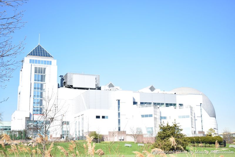
City dwellers don’t get to enjoy the beauty of a star filled sky when night falls, but a short trip across the river can provide a substitute for that experience. The Liberty Science Center, a 300,000-square-foot learning center in Liberty State Park, is home to the largest planetarium in the western hemisphere. The Jennifer Chalsty Planetarium and LSC Giant Dome Theater is exceeded in size by only four other planetariums in the world — two in Japan, one in China and one in Russia. The 89 foot, full-dome theater boasts a resolution of 88 million pixels, a lighting system that can produce over 281 trillion individual colors, and new speakers capable of producing 30,000 watts of digital sound.
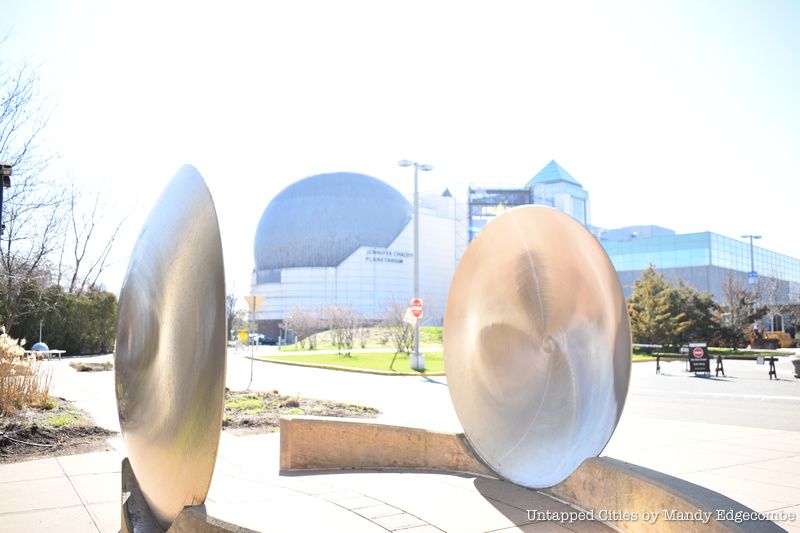
The planetarium and theater currently show live planetarium shows, films, and laser shows. The LSC’s signature live-planetarium show is Wonders of the Night Sky, a 45-minute adventure through the galaxy that shows viewers the Milky Way as it appears to the naked eye, NASA’s robot probes and arrays of telescopes from around the world.
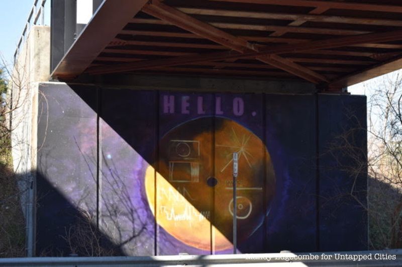
For more space exploration, head outside the museum to view the space inspired murals painted by local artist Sam Pullin under a bridge near the Light Rail. The murals were curated by Untapped Cities’ very own Mandy Edgecombe, a board member of the friends of Liberty State Park and co-author of this article, and were completed in conjunction with Jersey City’s mural program led by Brooke Hansson. The images were inspired by NASA’s Voyager Satellite mission and they depict the Voyager I satellite and the face of the Golden Record. The Voyager I satellite was launched in 1977 to study the outer planets of our solar system and is now the furthest man-made object in space. Aboard the Voyager Satellite is the Golden Record, the result of a project led by astrophysicist Carl Sagan to send a message into space. The record contains images and sounds of Earth such as music, multilingual greetings and a sound essay. The symbols etched into the record, which are seen in Pullin’s murals, are instructions on how to play the record and how to find Earth.
Visitors to The Liberty Science Center can also expect to find 12 museum exhibition halls, a live animal collection with 110 species, giant aquariums, a 3D theater, live simulcast surgeries, and hurricane-and tornado-force wind simulators.
4. The Northern Edge of Liberty State Park Follows the Old Morris Canal
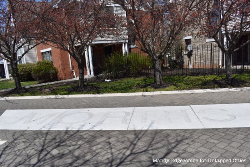
The old Morris Canal used to run 109 miles from the Delaware River in Philipsburg, New Jersey, through Jersey City to the Hudson River, and south to New York Bay through Bayonne. When the canal was connected to Jersey City in 1836, the shipment of “black gold” from northeastern Pennsylvania to the growing industrial city of Manhattan boomed.
By way of the Morris Canal, designed by Morristown engineer George P. MacCulloch, coal was transported from the anthracite coal fields of PA, through New Jersey and over to Manhattan on flat-bottom boats. The warehouses and freight yards of Jersey City, manned by Irish day laborers, played a key part in the shipment process, getting raw materials to and finished products from the industrial factories of city of New York. It was nicknamed the “Mountain Climbing Canal” due to its 1,674 foot change in elevation, an engineering feat accomplished by a series of locks and inclined planes.
With the development of the railroads in the northeast, the use of the Morris Canal declined. It reached its peak operation after the Civil War, carrying 900,000 tons of coal. Because the canal route took a delivery time of five days, it was eventually overtaken by the introduction of the railroad, which took only eight hours. The Jersey City extension of the canal on the Hudson River waterfront remained the only viable part of the canal after 1871. That year, the Lehigh Valley Railroad leased the Morris Canal to eliminate competition. In 1922, New Jersey took over the canal, except in Philipsburg and Jersey City, and drained it in 1924. The route is listed on the New Jersey and National Register of Historic Places. Morris Canal Working Group is working to preserve the former Morris Canal right of way for conversion into a public greenway.
5. It was the Site of a British Fort and Revolutionary War Battle
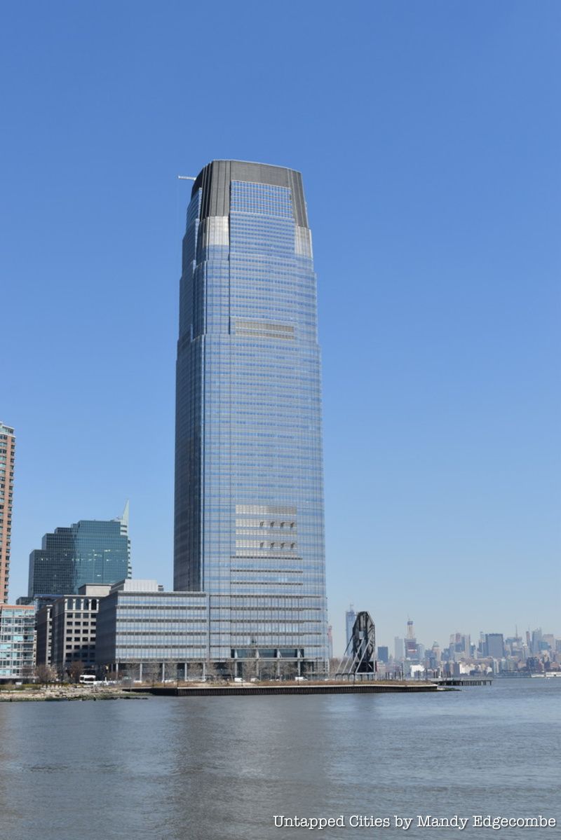
Once a site housing a colonial British fort with several cannons, Paulus Hook is a neighborhood located in downtown Jersey City, as well as a little known portion of Liberty State Park land on the other side of the Morris Canal.
On August 18th, 1779, 23-year-old Major Lighthorse Harry Lee of the Continental Army and 300 weary soldiers launched a pre-dawn attack there hoping to regain the fort. Lee took most of it in his “hit and run” maneuver directed by General Washington himself even though he suffered water damage to ammunition. His soldiers captured 159 British prisoners but ended up retreating to the Hackensack River before British soldiers in New York noticed anything.
Major Lee won a gold medal for his efforts and this small battle was considered a major exploit in the War and boosted American morale. This fort was abandoned by patriots in September of 1776, just after the Battle of Brooklyn the month prior, and before subsequent occupation by the British who were there until 1783. Paulus Hook was a strategic point for defense as it originally was an island in the Hudson River with views to the mouth of the harbor, Manhattan, and some distance northward. It was connected by a causeway to the mainland in the early to mid 1700’s, stretching over marshland and creek.
Paulus Hook derives it name from Michael Paulusen, an agent on behalf of the Dutch West India Company who oversaw Pavonia, a town originally a part of the New Netherlands (and what is now Northern central Jersey City). It was from Pavonia that Lee surprise attacked the British. A masonry fort, similar in design to Castle Clinton and Castle Williams at Governors Island, was intended to be constructed there in preparation for the War of 1812. The engineer of those fortifications, Jonathan Williams mentioned the structure in his plans but the infant federal governments coastal defense plan only included New York State in its budget and the fort at Paulus Hook was never built.
6. Liberty State Park is the People’s Park
In 1957, Morris Pesin, a Jersey City businessman, lawyer, councilman, and activist, took a grueling trip three hour trip with his family to visit the Statue of Liberty by driving through the Holland Tunnel and accessing a boat at New York City’s Battery Park, the only way to get there at the time. They ended up missing the boat, and waited even longer.
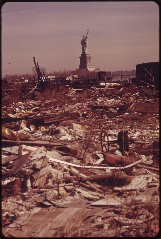
When Pesin finally arrived to Liberty Island and looked back at the desolate, decaying shoreline with rotting piers behind him, he knew he had to take action. He decided to make a statement and took what would end up being a very famous canoe trip directly to Liberty Island. He was accompanied by a friend, the editor of the Jersey Journal, who reported on the event to garner attention and spearhead Pesin public crusade to clean up the area now known as Liberty State Park and create a fitting backdrop for the symbol of the nation.
By the late 1950’s, the waterfront of Jersey City was overflowing with abandoned buildings and train tracks and debris from industry and the Black Tom explosion. Pesin initiated his campaign not only to create an access point for boats to take people to the Statue of Liberty from New Jersey, but also for Jersey City residents to have green space to enjoy, as well as to properly represent the values of Liberty and the State of New Jersey by providing a proper vista behind her.
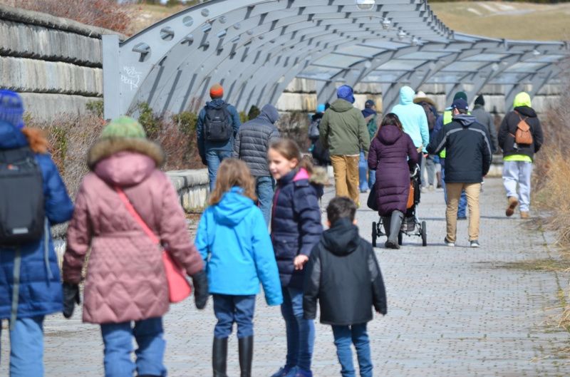
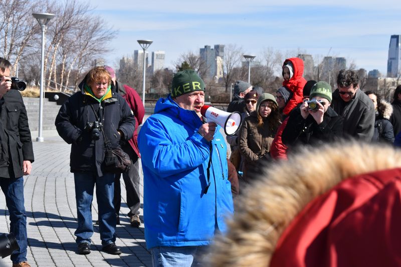
Liberty Island is actually even closer to the Jersey coastline than it is to New York’s! In the 1960’s, Jersey City kids would go there and taunt the men living in shacks around the decaying site (this is not condoned but was told to us directly by someone who used to do this). They would also take their boats to Ellis Island and hang out in the old buildings before it became a National Monument in 1965 after approval from Lyndon B. Johnson, who set aside six million dollars for the creation of Liberty State Park, or the “People’s Park” as the insiders like to call it.
Morris Pesin was joined by Theodore Conrad, an architectural model maker, Audrey Zapp (the Godmother of Liberty State Park), and many dedicated citizens while they fought against development and privatization threats for 18 years in order to convince the State of New Jersey to purchase and acquire land. Zapp and a group of religious leaders and business leaders known as the Statue of Liberty and Park association, persuaded Federal and State officials to save and preserve the abandoned Central Railroad of New Jersey train terminal complex in 1968 and to convert the entire area into a park. Note the names of these environmental pioneers on the streets of the Park!
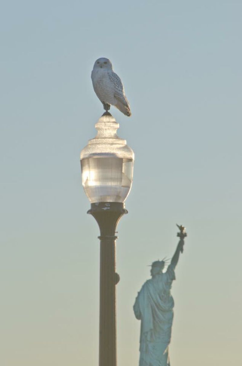
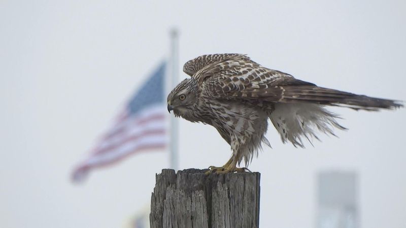
The first naturalist, the then Chief of Interpretive Services of Parks and Forestry of New Jersey, Dr. Frank Gallagher — of Rutgers University’s Department of Landscape Architecture, where he serves as the Director of the Environmental Planning and Design program — has also been a crucial member in the fight to create and protect Liberty State Park. Currently, he is conducting a carbon sequestration project inside the 251-acre Interior of the Park, measuring how much carbon dioxide the trees there absorb yearly while also teaching urban ecological restoration. The area is currently in need of remediation, and is off-limits to the public because of contamination.
Funding has finally been released by the State of New Jersey to restore the Interior, and the NJDEP division of Parks and Forestry is drafting plans for public nature paths and walkways, which will take some years before they’re completed. Liberty State Park is still at risk of privatization and development and the non-profit group that is advocating, fundraising for, and protecting the Park, the Friends of Liberty State Park, is making sure the space doesn’t get sold off to private hands.
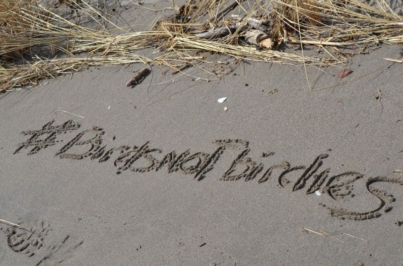
The President of this Friends of Liberty State Park is the son of Morris Pesin, Sam Pesin. Not only has he taken over his father’s legacy, but his determination, pride, and love for the Park are what make it free for all people to continue to enjoy today. Greg Remaud, CEO of the NY/NJ Baykeeper, which is a close ally in protecting the Park politically, has fought on behalf of it, protecting it from numerous threats of development for many years.
Currently, Greg and Sam and many Park supporters are battling to protect Caven Point peninsula from being sold and turned into a portion of a golf course. The Friends of Liberty State Park have a volunteer gardening program on Saturday mornings for all ages to join, and it’s a good way to experience the Park while also playing a role in the care of it. Check out the Friends of Liberty State Park website for its upcoming summer concert series schedule. (The bands face the skyline of New York City!) Also make sure to follow “Wild Jersey City” on Instagram and Facebook to see nature films and photography filmed at Liberty State Park by John Dunstan, a long time Jersey City resident and dear friend of the Park.
7. Take a Kayak Eco-Tour at Liberty State Park
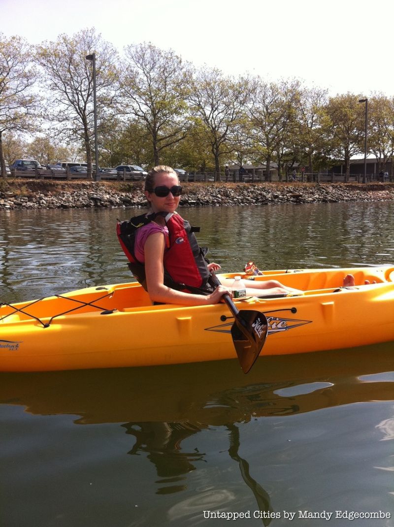
Kayak eco-tours are conducted most weekends and some weekdays throughout the summer by the Interpretive Center’s naturalists. The tour takes you to the cove behind the Statue of Liberty, an inlet in the harbor-estuary that is teeming with more life than you can imagine. Depending on the tide, you’ll most likely get a chance to pull up to Caven Point beach, which is the last natural salt marsh and longest stretch of natural beach remaining in New York Harbor.
Your guide will help you identify the myriad of fauna you’ll see and hear, including great and snowy egrets, live horseshoe crabs, great blue herons, and so much more as you traverse the coastline. It is truly an experience to be able to see that much diversity in the backyard of Manhattan. There’s even a point on the tour where the marsh grasses completely block out the skyline and you feel like the city is hundreds of miles away. The naturalists give a brief instruction on the basics of kayaking so this trip is appropriate for beginners as well as advanced kayakers. (The kayaks even have pedals in case your arms get tired!) Pre-registration is required and spaces fill up fast! The tour has an age limit of 16 and up and only costs $20 per person. For more information, click here.
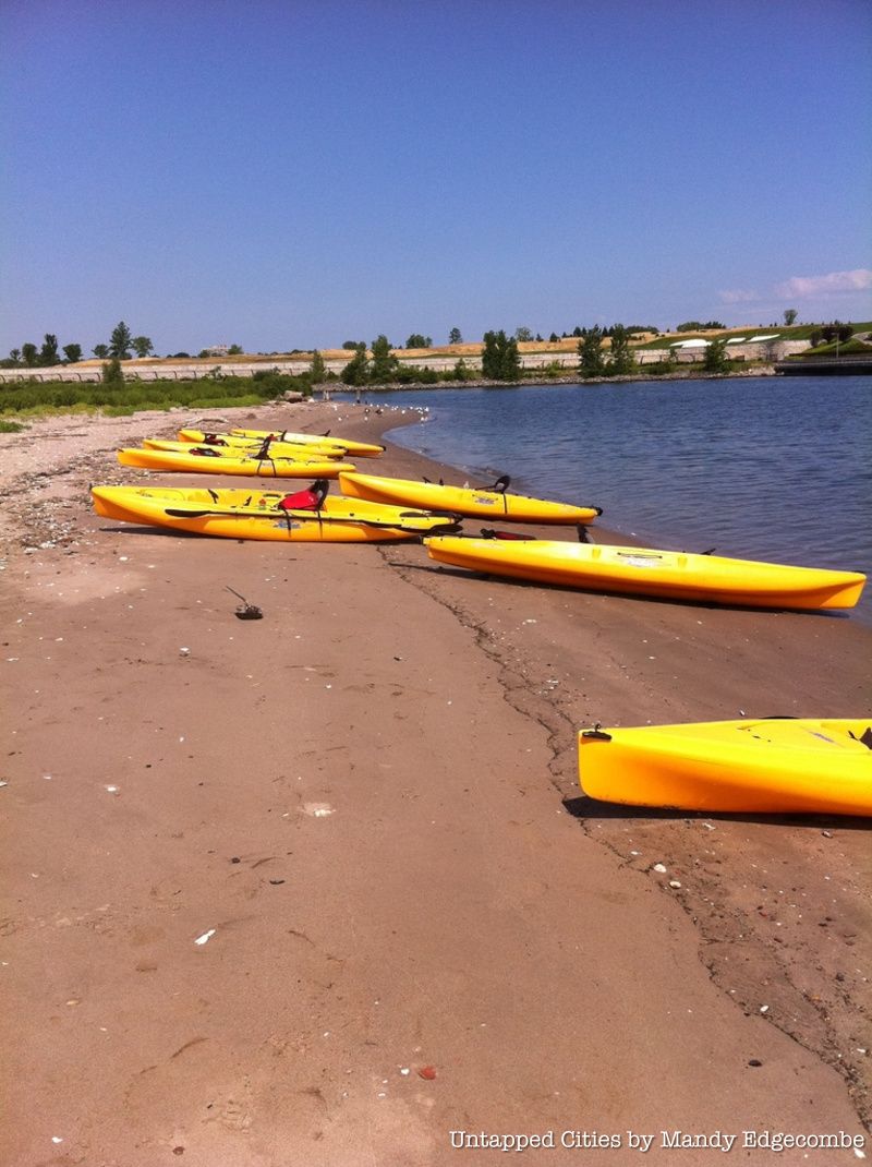
Pro tip: if you have your own kayak: the launch point is public and can be used any time. Just pop into the park office right next to it and give them your name and time you go out. Ask for a harbor map in the office, and remember to give proper distance to wildlife!
8. Take a Ride at Liberty State Park’s Liberty Landing Ferry
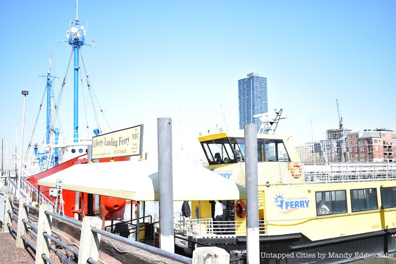
The Liberty Landing Ferry is owned and operated by Statue Cruises, the same ferry company that takes people to the Statue of Liberty and Ellis Island. It is located at the Liberty Landing Marina near Liberty House restaurant on Audrey Zapp Drive and provides ferries daily, every half hour, to World Financial District. It’s a great way to get to Manhattan or Jersey and back, and you’re allowed to bring dogs and bicycles on board for no extra fee!
Here’s an insider tip: if you visit the Statue and Ellis via the New Jersey side, you can take this ferry to Manhattan after your trip to the islands, see some sights, and get $2 off your ride back to Liberty State Park on the “Little Lady,” as she’s also called. And it’s only a dollar ride to go across the water to Warren St. for access to the William Wall floating bar in the summer!
9. There’s a Hidden Sculpture among the Marsh Grasses in Liberty State Park
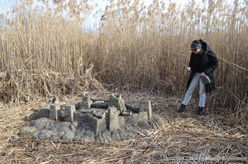
Along Freedom Way, the road that cuts across the park, and just behind the Interpretive Center to the right, lies a miniature version of the ruins of an ancient city. Comprised of tiny cement bricks, the piece was constructed by Charles Simonds in 1982. It’s called “Left Turns” and originally included two other sculptures that have since been reclaimed by nature and tidal forces.
Simonds placed these ruin sculptures against the backdrop of Manhattan as a statement on the relationship between nature and civilization, and to make viewers feel like they’re stumbling across the ruins in the middle of nowhere, a feeling of the discovery of a lost world. The project was sponsored by the State Art in Public Places program in conjunction with the National Endowment for the Arts. “Left Turns” is just one of Simond’s outdoor installations, intended to invoke the presence of tiny migrating people who have a civilization remote from our own. Yet, this series of his works is often placed within the context of major cities.
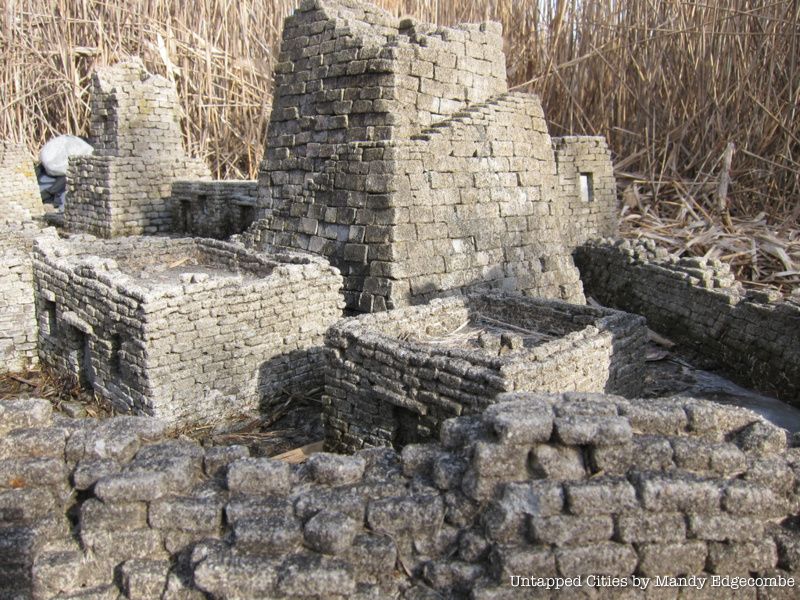
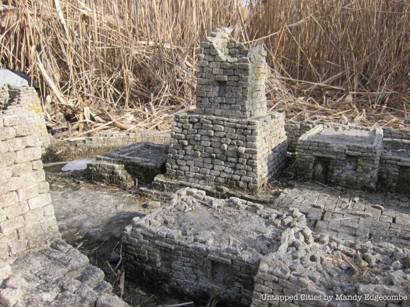
To find it, follow the path behind the Interpretive Center to the right. It is down one of the very overgrown trails through tall grasses facing the Statue of Liberty and Ellis Island. We have found it once, but got lost looking for it again and couldn’t come across it so good luck in your search!
10. Liberty State Park’s Caven Point Natural Area is a Hidden Gem
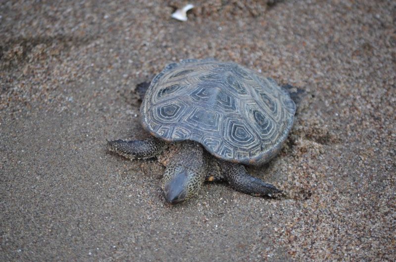
Caven Point natural area is a hidden treasure of the park and of Jersey City. It’s a 23.5 acre restored and reclaimed salt marsh, peninsula, and cove of the Hudson river estuary (where the river meets the sea) and the last of its kind in New York harbor. It’s a scene that would be similar to what Henry Hudson saw upon entering the Harbor over four hundred years ago. Originally spelled Kavans Point, this portion of land was later granted as a land patent to employees of the Dutch West India company to help them set up farms and villages.
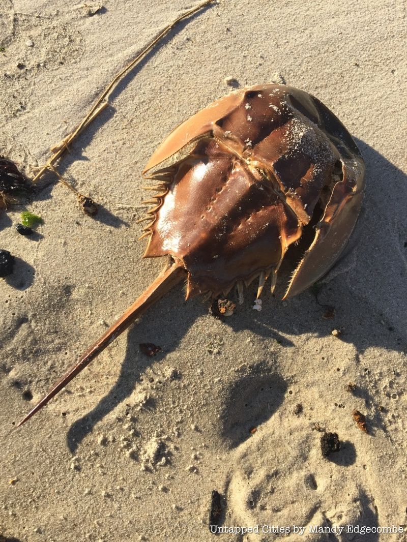
Today, it is a fully functioning estuary exhibiting ecologically typical upland and wetland habitats. Even though this area has been disturbed in the past couple hundred years, nature has taken over again. Estuaries are considered to be the nurseries of the sea and second in bio-diversity to rainforests so the amount of wildlife at Caven Point is almost shocking and a clear indicator that the Hudson River estuary is healthy enough to provide food and safe shelter.
Be on the lookout for harbor seals if you visit soon or threatened species as the black skimmer and green crowned night heron in the summer, or the local regulars such as blue crab or even sand sharks! Caven Point is dominated by salt marsh cord grass and contains extensive mudflats providing feeding grounds for numerous wading birds on this stop along the Atlantic Flyway, a route taken by migratory shorebirds along the eastern seaboard of the United States and a paradise for birders and nature seekers.
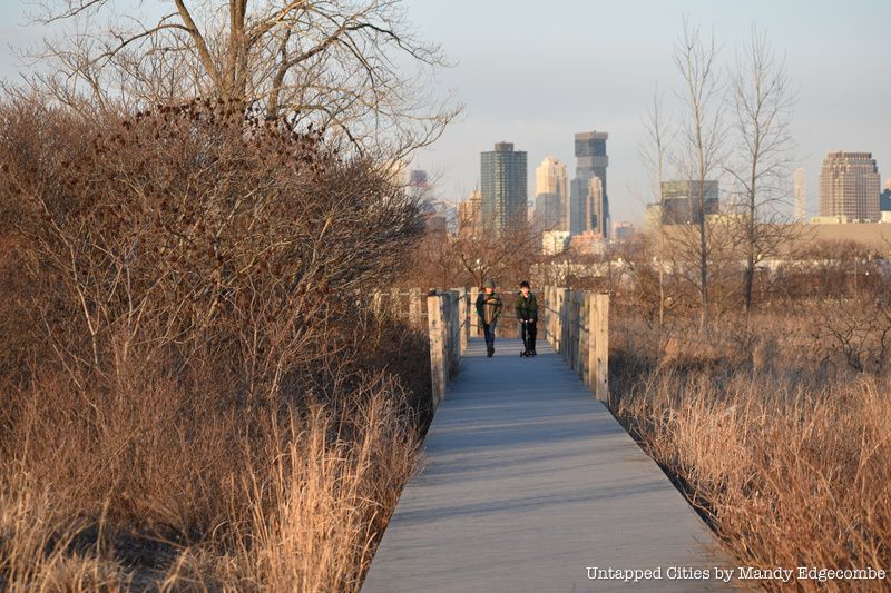
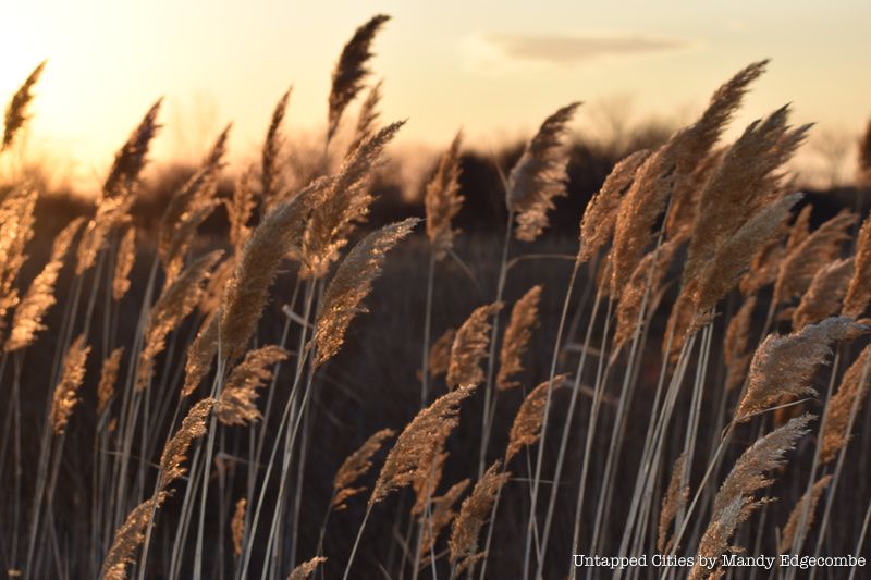
Public access is from October to March due to nesting and spawning in the spring and summer months but there are plenty of Park-led events here throughout the summer to take advantage of. Horseshoe crabs also use Caven Point as a migratory stop to lay eggs and feed as the Grand Central of their migratory route is just to the south at Cape May, New Jersey. Unfortunately, Caven Point is currently at risk of private development and this beautiful oasis could be lost forever. You can visit the Friends of Liberty State Park webpage to see how the organization is trying to stop it. The Parks Interpretive Center, directed by Lori Garth, have naturalists who provide numerous programs for thousands of people on Caven Point throughout the year for all ages, and most for free!
Whether it is a horseshoe crab walk, seining, bird watching or kayaking, families, school groups, and individuals can sign up for these programs here.
Next, check out The Abandoned (but accessible) Rail Station at Liberty State Park and The Top 10 Secrets of the Statue of Liberty in NYC. This article has been put together by Nicole Saraniero and Mandy Edgecombe.


