NYC’s Forgotten ‘War on Christmas Trees’
Discover how an obscure holiday crackdown affects festive street vendors today!


According to a New York Times article from 1904, the creation of the New York City subway‘s first twenty-two miles of tunnels required the removal of 3.6 million cubic yards of stone and dirt, so much dirt that if organized into a pile it would reach twelve miles into the air. Since then, the subway system has continued to expand with new extensions like the Second Avenue Subway on Manhattan’s Upper East Side. So what happens to all those tons of dirt and stone misplaced by the giant tunnels of the subway? Here are six places that were built or extended using material extracted from New York City’s subway tunnels:
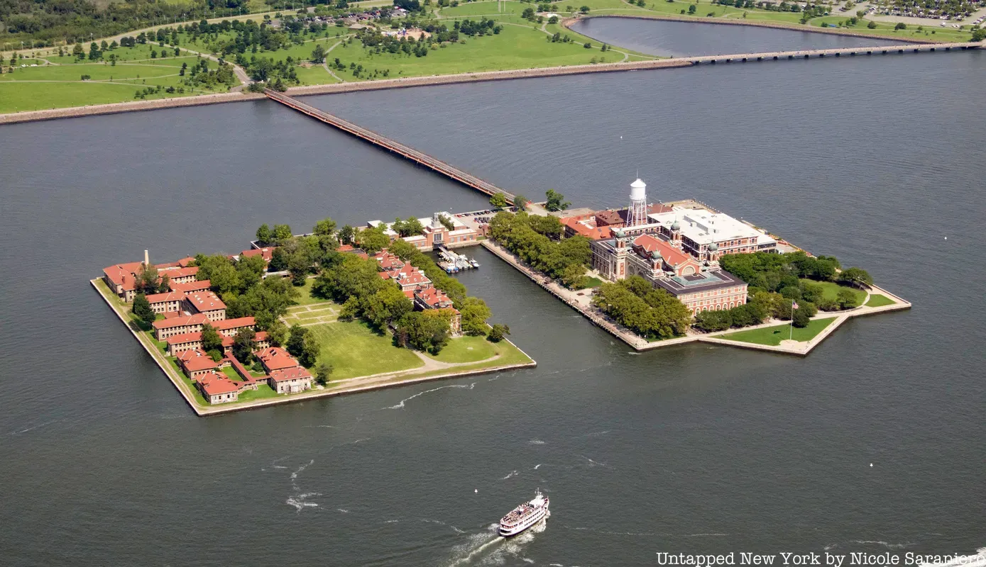
Ellis Island, which spans nearly twenty-eight acres today, started out measuring just over three acres. The first expansion of the island was completed in 1902 with infill from the excavation of the IRT subway tunnels in Manhattan. In 1911, according to the National Parks Service, the island was further expanded by five acres with infill from excavations of the BMT subway lines in Brooklyn. This dirt was used to create “Island 3” where the Ellis Island Immigrant Hospital was eventually constructed. The island grew to its final size in 1934.
The source of the infill became part of a court battle between the states of New York and New Jersey in the 1990s over the jurisdiction of the island. New Jersey conceded that the original, natural, 3.3 acres belonged to New York, but argued that the artificial areas of the island fell under New Jersey’s jurisdiction since they fell west of demarcated border between the two states which runs down the middle of the Hudson River.
Part of New York’s defense was that most of the fill used for the artificial parts of the island came from the New York City subway tunnels. In 1998 it was ruled that New Jersey had authority over the south side of Ellis Island, the landfill portion, and New York retained ownership of the original acreage where the immigration center stands. Though New York has jurisdiction over this part of the island, the small triangle in front of the immigration center, where the flagpole is, belongs to New Jersey.
To learn more about Ellis Island, join us on our Behind-The-Scenes Hard Hat Tour of the Abandoned Ellis Island Hospital Complex with Save Ellis Island!

Gain access to spaces usually off-limits to the public!

View from The Hills, the latest new park on Governors Island
The southern part of Governor’s Island, where you will find The Hills today, was made from landfill that came out of the excavation of the Lexington Avenue subway (4/5/6 lines) in the early 1900s. This addition added 103 acres to the island bringing its total size to 172 acres. At the time of the expansion the land was flat.
The Hills, the new park which opened in 2016, themselves are specially engineered and made up of demolition debris from the implosion of Building 877 and other structures on the island along with dirt and gravel from upstate.
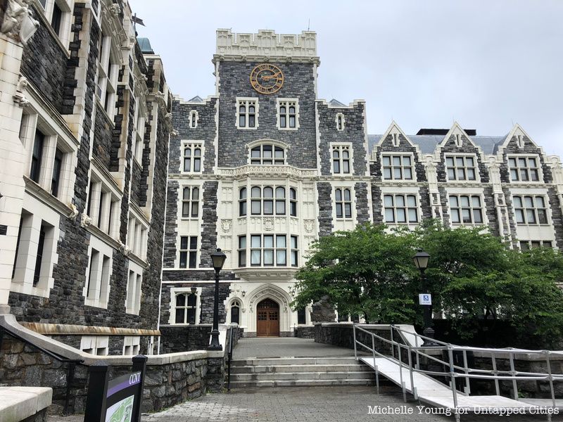
Rock from the subway tunnels isn’t always used as landfill. According to Kenneth Jackson’s Encyclopedia of New York City, Manhattan schist excavated from the first subway tunnels of Manhattan was used to build the impressive Neo-Gothic structures of the City College of New York, in upper Manhattan, completed in 1907 and designed by George B. Post. Post’s design was one of the first in America to make use of the Collegiate Gothic style. Post contrasted the dark Manhattan schist with white terra cotta trim and adorned the campus buildings with over 600 gargoyles and grotesques.

Construction of the Second Avenue Subway churned out 5,000 tons of rock a day. The rock that workers tunneled through to build the subway line was Manhattan schist, a rock that is twice as hard as concrete. Manhattan Schist can be found in many buildings in New York City like the campus of the City College of New York. After being bored through and ground up, schist is referred to as “mole rock,” a useful and inexpensive building material.
One of the locations that received “mole rock” from the Second Avenue Subway tunnels is Trump Golf Links at Ferry Point, a golf course in the Bronx which opened in 2013. The course, designed by Jack Nicklaus with views of the New York skyline, used nearly half of the mole rock from the Second Avenue Subway project.
St. Peter’s University in Jersey City was another recipient of the debris extracted during construction of the second avenue subway, receiving 70,000 tons of mole rock which was to be used to build a new dormitory. The new dormitories were part of a 21-story mixed-use tower designed by KPN architects, but construction on the project has yet to begin.
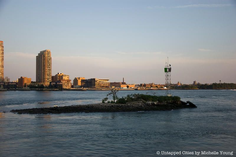
U Thant Island sits in the East River between Queens and Manhattan. In the 1890s, William Steinway, a businessman and lead developer of Astoria, Queens, set out to build two tunnels between the boroughs of Queens and Manhattan. Steinway died before his work was completed and the project was taken over by August Belmont Jr., who the island was originally (and is still legally) named after. Waste build up from the construction of the tunnel led to the formation of the island and the tunnels were eventually used by the 7 line.
The island was renamed U Thant by a group called the Peace Meditation at the United Nations who leased the island in the 1970s and renamed it for former UN Secretary General U Thant. August Belmont Jr., meanwhile, who financed the first subway line in New York City, had his own private subway car.
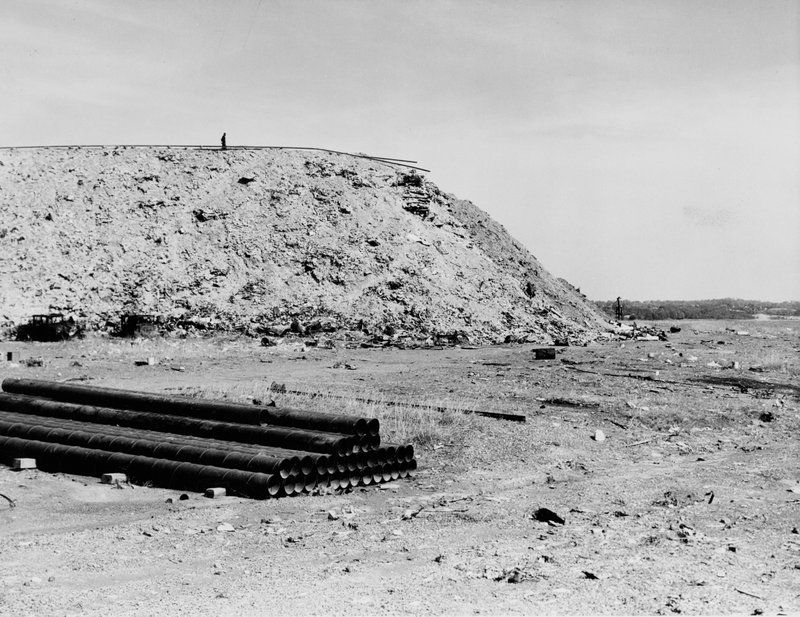
Before Flushing, Queens boasted Citi Field, the Arthur Ashe Tennis Stadium and Flushing Meadows-Corona Park, it was a dusty ash heap immortalized unfavorably in F. Scott Fitzgerald’s The Great Gatsby. In 1907, contractor Michael Degnon, who’s firmed worked on the Williamsburg Bridge and Steinway tunnels, had the idea to turn the land along Flushing Creek into a port at Flushing Bay.
To accomplish this, he started buying all kinds of refuse to fill in the wetlands. Chimney ashes, street sweepings, and dirt and rock from the expansion of Brooklyn’s subway system were brought to the area and dumped in the meadows. As the town of Corona started to build up by 1911, Degnon and the Brooklyn Ash Removal Company, had brought so much ash and debris to the area it became known as the Corona Ash Dump. In 1914 a mound of debris that accumulated into a 100-foot tall hill was dubbed “Mount Corona.”
The area would not be cleaned up until 1935 when Robert Moses and other powerful men took control of the meadows to turn it into a suitable site for the 1939 World’s Fair. The debris was redistributed and the 300-acres of the Corona Ash Dump were incorporated into what would become the nearly 900 acre Flushing Meadows-Corona Park.

Didn't make it to the 1939/40 or 1964/65 fairs? Here's your chance!
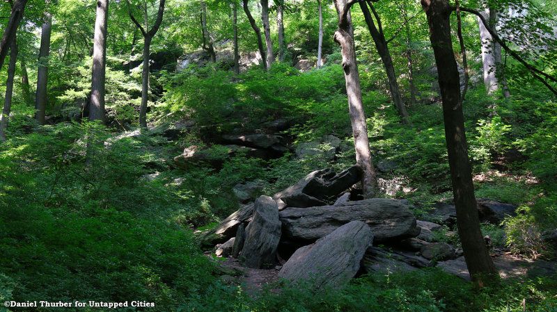
Besides the foot-trails and roads added by people, the natural landscape of Inwood Hill Park, with its caves, valleys, ridges and primordial forest, has remained largely as it was naturally formed by shifting glaciers. The park contains the last natural forest and salt marsh in Manhattan. However, there is part of Inwood Hill Park was artificially formed. The flat part of Inwood Hill Park, West of the Henry Hudson Parkway and the railroad, was filled in with rocks and dirt from the digging of the subway tunnels for the IND 8th avenue line.
Subscribe to our newsletter