Last Chance to Catch NYC's Holiday Notalgia Train
We met the voices of the NYC subway on our nostalgia ride this weekend!


Recently, Untapped Cities Insiders were treated to a star-studded tour of the new section of Hunter’s Point South Park that opened a little over a month ago. The tour was led by Jennifer Lantzas, Deputy Director of Public Art for NYC Parks, along with NYC Parks Monument Coordinator Colombina Valera; Jacob Glazer, Landscape Designer at SWA/Balsley and Lee Lim, Project Architect at Weiss/Manfredi, of the firms that co-designed both phases of the park; and Kyle Dancewicz, Director of Exhibitions and Programs at SculptureCenter.
The first phase of Hunter’s Point South Park opened in 2013, and was managed by the New York City Economic Development Corporation under Mayor Bloomberg’s administration. Taking cues from the industrial heritage of the site, including reusing an old gantry and railroad tracks, the first section of the park focuses on active recreation and gathering. Phase two of the park, is much more contemplative in nature and reflects an increased awareness of resilience and sustainability that has come to the forefront of waterfront design since Hurricane Sandy. The 5.5 acre addition flows seamlessly from the first phase, beginning at 54th Avenue and wrapping around the opening of Newtown Creek, creating a total of 11 acres of waterfront park surrounded by water on three sides.
Here are some of the fun facts we learned on our tour of the newest section of Hunter’s Point South Park:
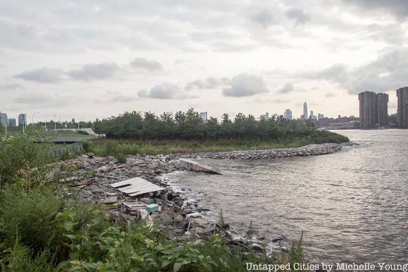
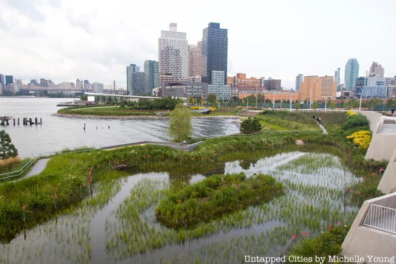
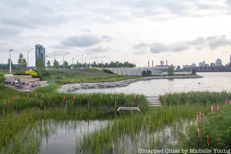
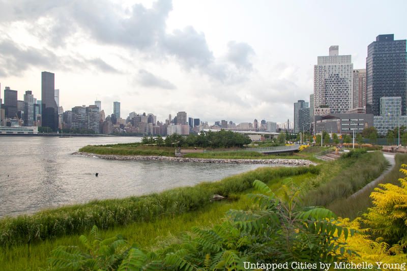
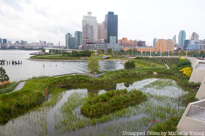
In the middle of Hunter’s Point South Park, a former peninsula has been transformed into “New York City’s newest island,” proclaimed Jacob Glazer, Landscape Designer at SWA/Balsley. Hundreds of years ago, this was a wetland, like the rest of New York City’s natural coastline. However, a man-made peninsula here has been a feature of the waterfront for many decades, built from landfill from the excavation of city tunnels atop former a sugar refinery and docks. Through the first half of the 20th century, this area was the heart of Queens’ economic engine: a 1911 Atlas of Long Island City as well as a 1924 aerial photograph depict a bustling waterfront with well-defined piers. But the city-wide industrial decline, driven by containerization and the move of the port to Newark, also had an impact here. Google Earth satellite images from 1994 show the peninsula with just a ring of vegetation. By the early 2000s, it is densely covered in brush. In 2015, the art project Chance Ecologies worked in this off-limits post-industrial space shortly before it was reclaimed again to be turned into this park.
The genius of the new design intervention is to separate the peninsula from the land and ringing it with new marshes and riprap that fill with water twice a day during high tide, returning this piece to the water in a very deliberate but visually discreet way.
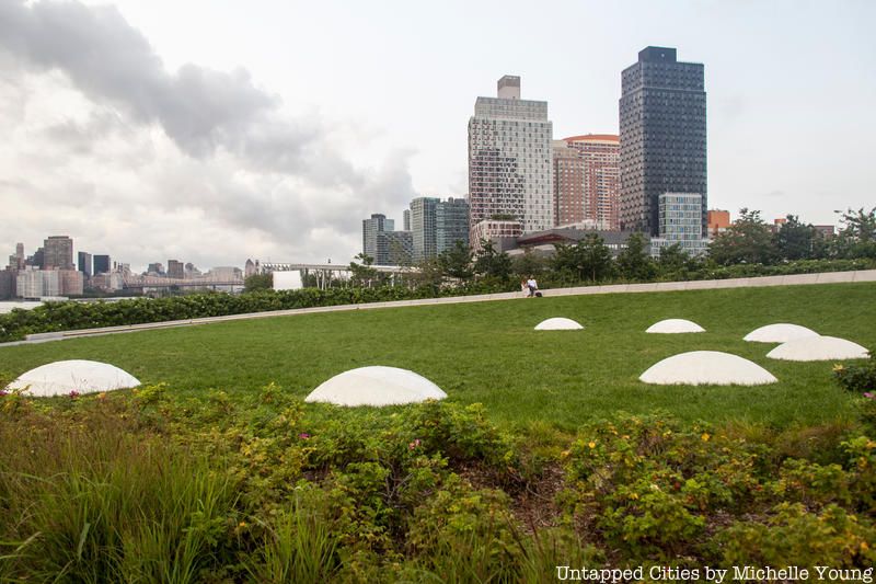
An elevated walkway wraps around the southern side of the new island, leading the visitor down to an oval lawn that features the artwork Luminescence by Nobuho Nagasawa, an internationally recognized sculptor who currently serves as Professor of the MFA Graduate Program Director Sculpture at Stony Brook University. The seven domed sculptures represent the seven phases of the moon and are made of Portland concrete. Each dome has a different coverage of a phosphorescent aggregate material that absorbs sunlight and illuminates the surface at night with a soft blue color, representing a specific moon phase. The artist used NASA topographic survey maps collected by the Lunar Reconnaissance Orbiter (LRO), so look closely as you’ll see craters and mountains on the surface of each dome.
Walking south, you won’t see Luminescence unless you take the elevated wraparound walkway, but you can see it looking north from the elevated lookout point. Another great way to see the art piece is actually from the water. If you’re on the upper level of NYC Ferry, you’ll catch it. Luminescence won a 2017 Excellence in Design award from the NYC Public Design Commission.
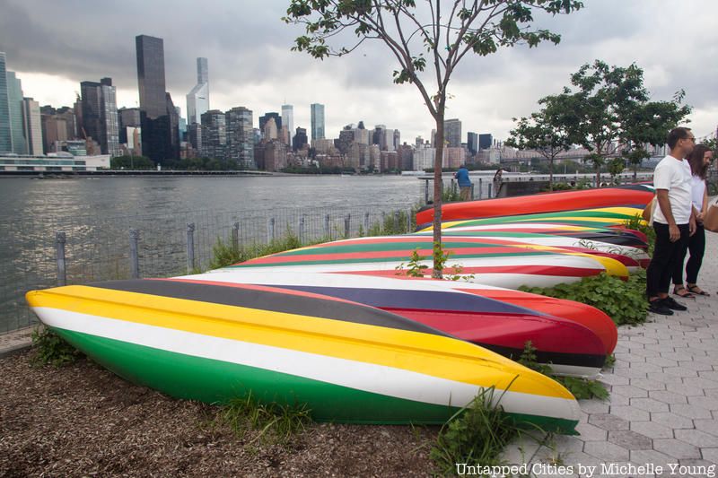
Artwork abounds in the first phase of the park as well, with a permanent sculpture called Tetherball in the basketball courts, maintained by Monuments Conservation Program at NYC Parks. Just closing (but still viewable for a short time) is a temporary public art installations called Convene, by Xaviera Simmons, featuring 27 brightly painted canoes that evoke the national flags of people who live in Astoria and Long Island City. The work was programmed by SculptureCenter, a non-collecting art institution in Long Island City located in a former trolley repair shop. High school students at SculptureCenter’s Public Process program selected the proposal for a temporary public artwork to be commissioned. Stay tuned for the next work!
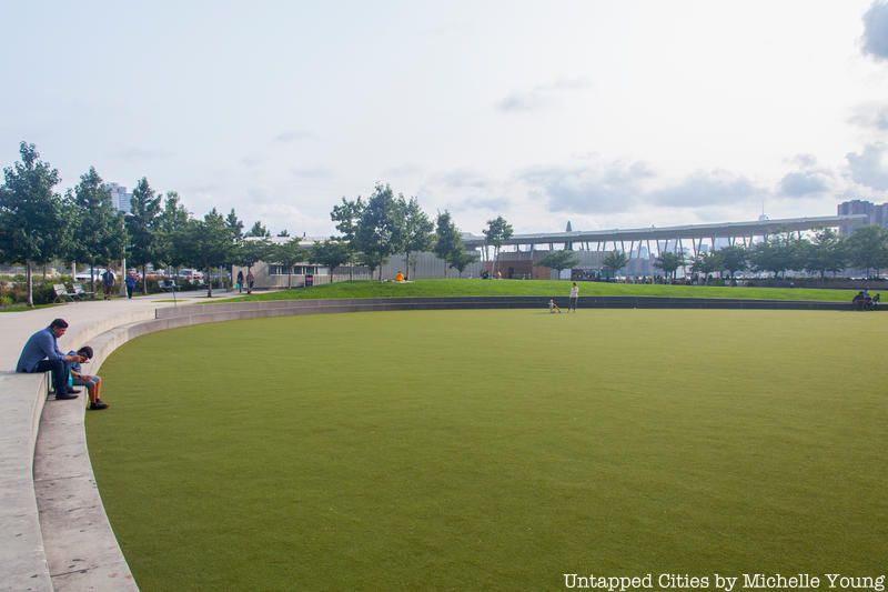
The first phase of Hunter’s Point South Park was in construction when Hurricane Sandy hit. The oval main lawn, which is made of artificial turf, is sunken, ringed by two concrete steps, with natural grass on the upper level. Sandy flooded the park, but the water was retained by the lawn and then receded with the tide causing no damage done to the park at all, and minimizing flooding in the streets.
All the streets leading to the park also have bioswales (landscaped tree beds and other plantings) so that stormwater is already being absorbed before it hits the park, and then the East River. New York City’s combined sewer system, that mixes both rainwater and sewage, gets quickly overwhelmed during heavy rains and storms, so any opportunity to catch water before it hits the system helps.
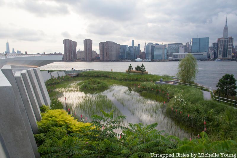
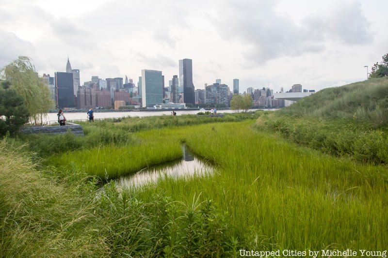
For the second phase of Hunter’s Point South Park, resiliency was taken in a more naturalistic direction, known as “soft” design in architecture terminology. New wetlands, including the ones around the new island, abound. Both low and high marshes have been planted, and according to a press release, these new wetlands “enable shoreline bank erosion control and sediment stabilization. With an expanded plant palette, the wetlands also enhance water quality and promote wildlife and fish habitation.” The pink flags are to keep away the geese but according to Jacob Glazer, Landscape Designer at SWA/Balsley, the wetlands are growing in well.
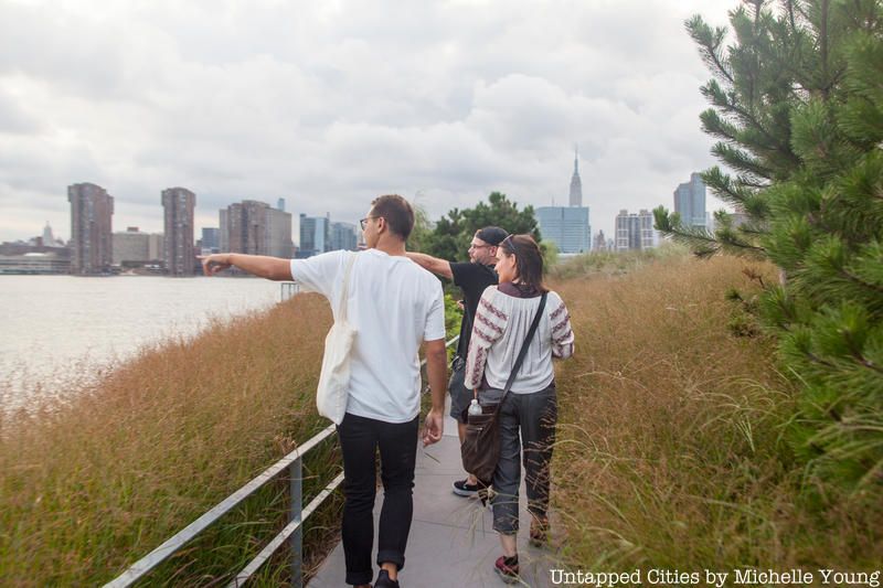
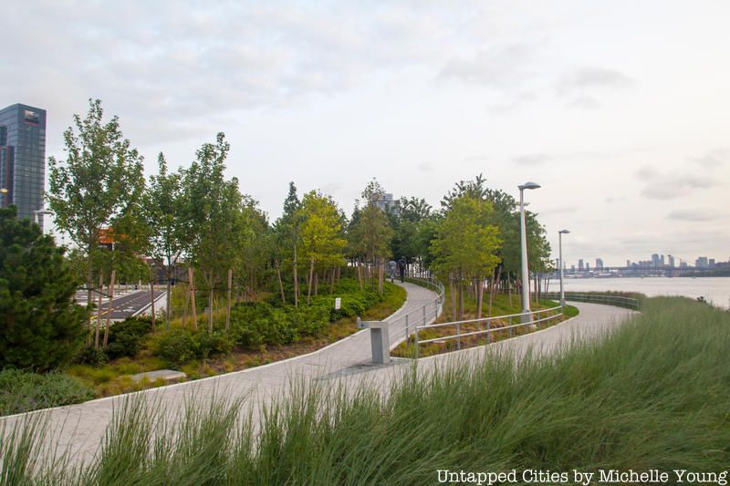
Lee Lim, Project Architect at Weiss/Manfredi, the firm that co-designed both phases of Hunter’s Point South Park, told us that from the beginning, the park concept was envisioned with a continuous walkway along the waterfront, one that would traverse both sections. The first section features a more straightforward path and bulkhead, but the second section’s waterfront walk is a meandering, multi-elevational delight.
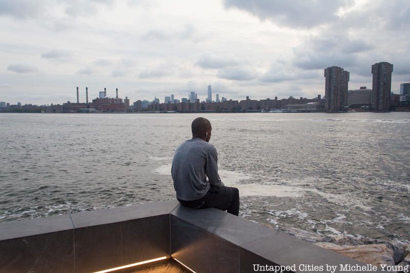
Along the walkways, you will have the East River on one side and wetlands on the other – quite a unique design that keeps the visitor viscerally connected to the water. These new edges replaced the concrete bulkheads that existed before, with new overlooks for visitors to take advantage of the stunning Manhattan skyline. Although these walkways might flood during a storm, it’s just part of the “soft” edge infrastructure throughout the park. Like the rest of the park design, the walkways are intended to bring the community to the waterfront, which Lim says is the main goal of the park’s design.
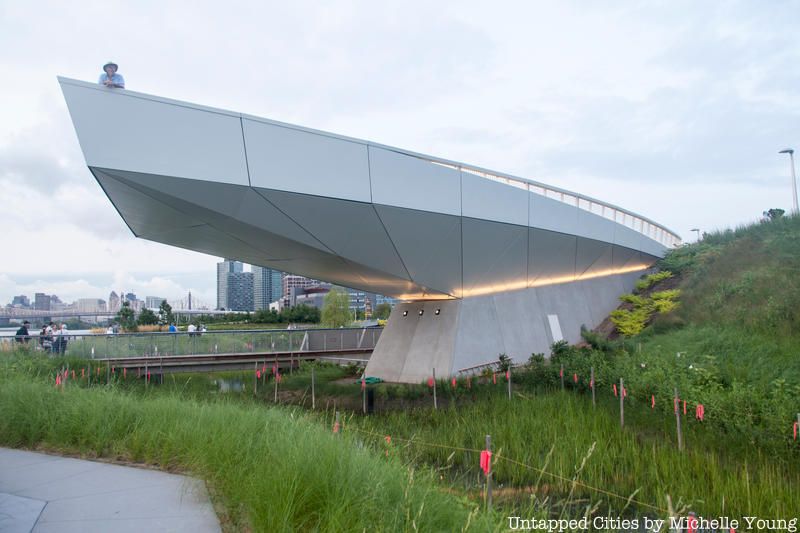
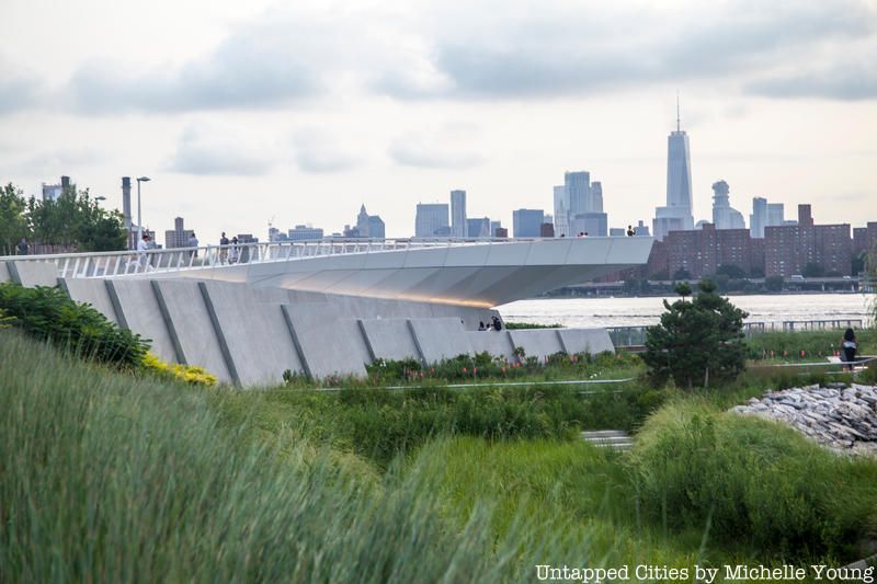
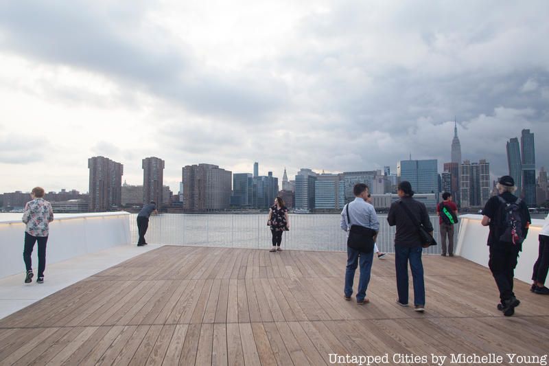
All paths in Hunter’s Point South Park lead to an elevated promenade, a lookout point, that rises 22 feet into the air and is cantilevered 50 feet over the land it’s built on (meaning it juts out). A wooden boardwalk opens up to a wide, panoramic view of the Manhattan skyline and East River. Lee Lim of Weiss/Manfredi tells us that the structure was intended as a “big gesture,” describing it as an “urban building plus ship-like land form.” It’s intended, he says, to give you the “illusion of floating over the water.” According to the park’s fact sheet, it aims to “brings the city to a precipice suspended over the new wetland water’s edge.”
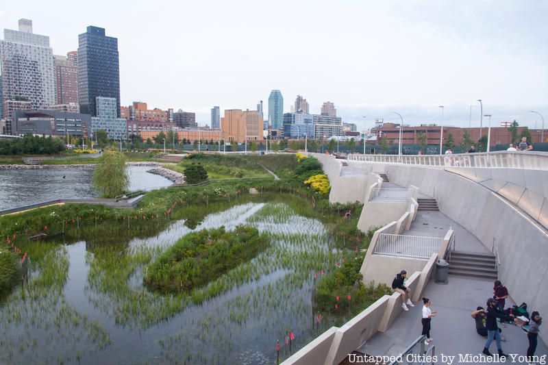
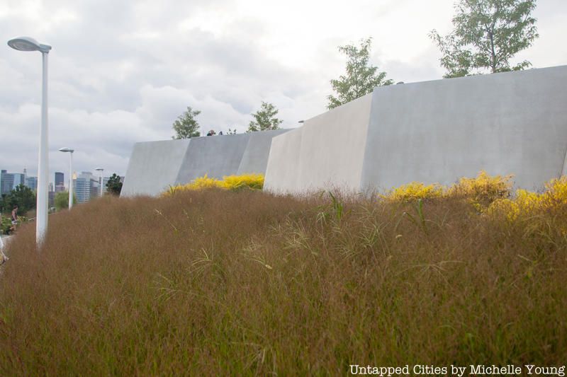
The sheer amount of landfill excavated from New York City tunnels created large piles of earth along this waterfront. In one section of Hunter’s Point South Park, leading up to the cantilevered overlook platform, large concrete retaining walls not only hold the earth back, but widen the amount of wetland space the architects and landscape architects could instill. The public spaces adjacent to the walls have already become a popular gathering spot – a photo shoot of a dance was happening during our visit. The stepped terraces at different elevations allow for separate groups to use appropriate the space for themselves, albeit temporarily.
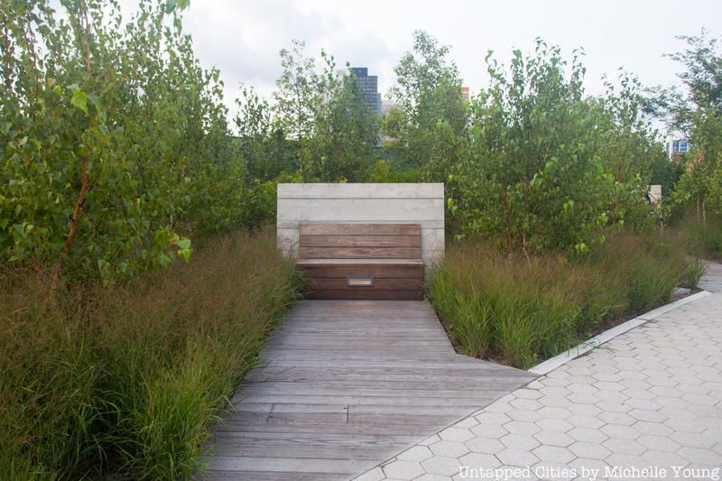
The most southern section of Hunter’s Point South Park, which leads to the kayak launch along Newtown Creek, is the most personal of the spaces. Little “rooms” come off the walkway to offer a place to read, contemplate, or have a conversation. The inviting alleyways feature a wooden bench with a small light surrounded by trees and tall grasses. But don’t stop here — at the kayak launch, an wooden amphitheater-like seating section connects the entrance at 2nd Street all the way down to the water’s edge.
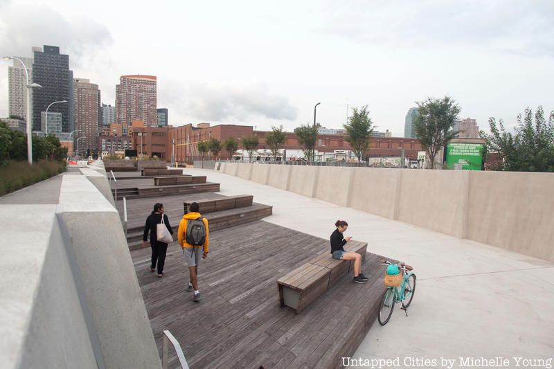
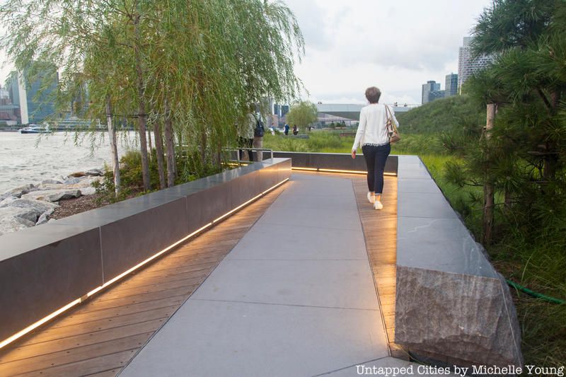
Just like the diversity of plantings in the landscape design, special attention has been paid here to vary the materials on the ground — from stone pavers, to wood beams, to concrete, sometimes laid side-by-side in juxtaposition. Even the edges of the walkways vary from place to place — white fencing, metal fencing, concrete slabs, polished granite blocks with an unfinished edge.
Eventually, the second phase of housing for Hunter’s Point Park South will rise along 2nd Avenue, constituting the largest affordable housing project in the city in over three decades. Designed by architecture firm ODA, the initial architectural plans feature stepped, terraces filled with greenery along with a central communal green space. The new buildings should have little impact on the experience of the park, designed as it is to feel detached, yet connected to the city through the juxtaposition of materials and architecture.
Here are a few more photographs of the park:
Next, check out what Hunter’s Point Park South looked like before it was turned into a park.
Subscribe to our newsletter