

Recently, Untapped Cities Insiders were treated to a star-studded tour of the new section of Hunter’s Point South Park that opened a little over a month ago. The tour was led by Jennifer Lantzas, Deputy Director of Public Art for NYC Parks, along with NYC Parks Monument Coordinator Colombina Valera; Jacob Glazer, Landscape Designer at SWA/Balsley and Lee Lim, Project Architect at Weiss/Manfredi, of the firms that co-designed both phases of the park; and Kyle Dancewicz, Director of Exhibitions and Programs at SculptureCenter.
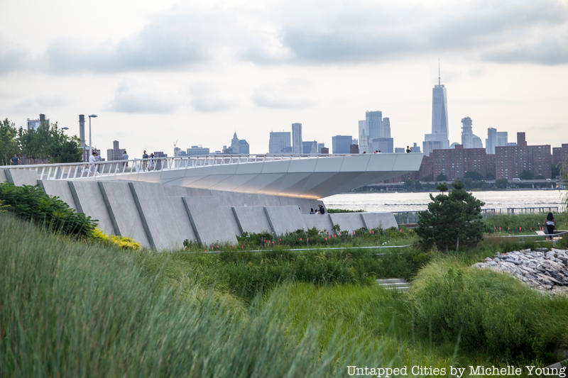
The first phase of Hunter’s Point South Park opened in 2013, and was managed by the New York City Economic Development Corporation under Mayor Bloomberg’s administration. Taking cues from the industrial heritage of the site, including reusing an old gantry and railroad tracks, the first section of the park focuses on active recreation and gathering. Phase two of the park, is much more contemplative in nature and reflects an increased awareness of resilience and sustainability that has come to the forefront of waterfront design since Hurricane Sandy. The 5.5 acre addition flows seamlessly from the first phase, beginning at 54th Avenue and wrapping around the opening of Newtown Creek, creating a total of 11 acres of waterfront park surrounded by water on three sides.
Here are some of the fun facts we learned on our tour of the newest section of Hunter’s Point South Park:
1. New York City’s Newest Island Was Created at Hunter’s Point South Park
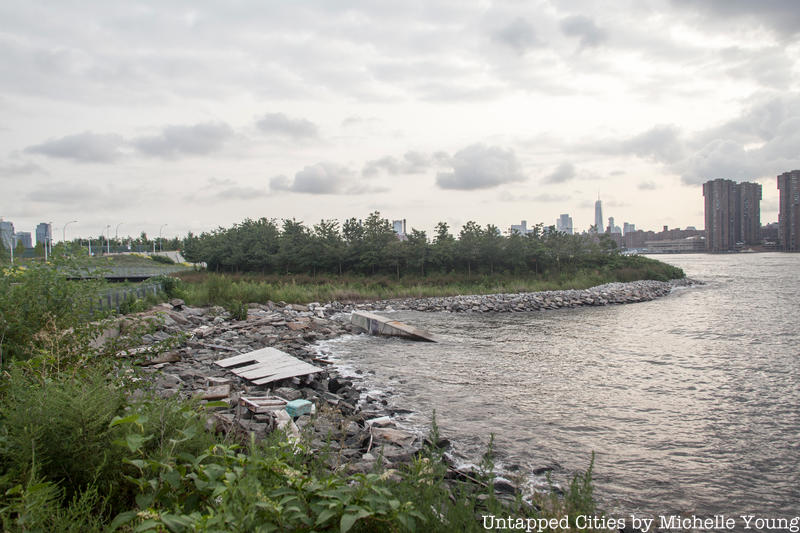
In the middle of Hunter’s Point South Park, a former peninsula has been transformed into “New York City’s newest island,” proclaimed Jacob Glazer, Landscape Designer at SWA/Balsley. Hundreds of years ago, this was a wetland, like the rest of New York City’s natural coastline. However, a man-made peninsula here has been a feature of the waterfront for many decades, built from landfill from the excavation of city tunnels atop former a sugar refinery and docks. Through the first half of the 20th century, this area was the heart of Queens’ economic engine: a 1911 Atlas of Long Island City as well as a 1924 aerial photograph depict a bustling waterfront with well-defined piers. But the city-wide industrial decline, driven by containerization and the move of the port to Newark, also had an impact here. Google Earth satellite images from 1994 show the peninsula with just a ring of vegetation. By the early 2000s, it is densely covered in brush. In 2015, the art project Chance Ecologies worked in this off-limits post-industrial space shortly before it was reclaimed again to be turned into this park.
The genius of the new design intervention is to separate the peninsula from the land and ringing it with new marshes and riprap that fill with water twice a day during high tide, returning this piece to the water in a very deliberate but visually discreet way.