


We’re back with the video series “A City Full of History,” delving into the lesser known aspects of New York City history produced by Untapped Cities contributor Dan Thurber, who runs the YouTube channel Bookworm History. Most recently, went in search of the last shot tower in Manhattan! This time we head to Midtown to visit the first and last shot tower in Manhattan, and dive into the unique process for manufacturing lead shot in Old New York!
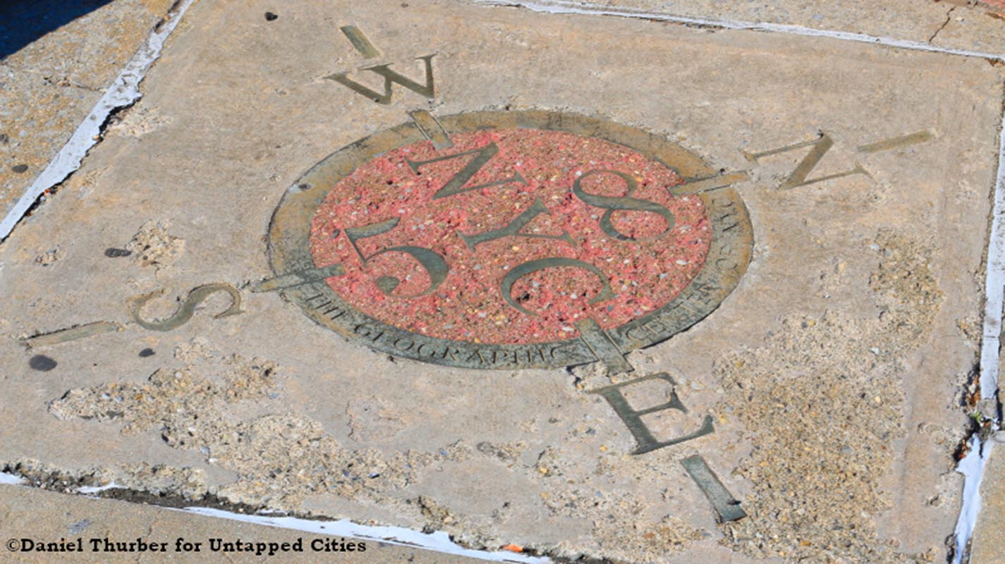
Embedded in the sidewalk at the intersection of Queens Boulevard and 58th Street in Woodside lies a curious marker denoting that spot as the geographical center of New York City. There’s only one small problem with this: it isn’t actually the geographical center of New York City.
Finding the center of something as large and unwieldy as a city or country is complicated, to put it mildly. The shape of the body of land is probably incredibly irregular, could contain lots of irregularly shaped islands, and may change depending on tides or the acquisition of new territory. All of which ignores the 3-dimensional, curved shape of the globe!
In 1912, and again in 1959, the United States Coast and Geodetic Survey used a large piece of cardboard in the shape of the United States to come up with an answer for the question “Where is the center of the United States?” but they would be the first to say this was hardly an accurate method. Today we can have computers do the heavy lifting, but even with them finding the center can prove difficult and inaccurate.
So where is the geographical center of New York City? Come along with us as we track down this elusive center point on “City Full of History”!
Meanwhile, official distances measured to and from New York City have traditionally been measured from Columbus Circle. Find out this and more in our article on the Top 10 Secrets of Columbus Circle.