
Secrets of NYC
Top 10 Hidden Beaches of NYC
From Great Kills, Staten Island to Soundview Park in the Bronx, discover secret beaches in NYC for a day in the sun!
From Great Kills, Staten Island to Soundview Park in the Bronx, discover secret beaches in NYC for a day in the sun!

Discover how vacant storefronts are being transformed with works of art!


In 1899, you couldn’t walk down Sixth Avenue without missing the steam powered trains hurdling over your head. Elevated lines ran along 2nd and 3rd Avenues and cable cars weaved through the streets like in New Orleans or San Fransisco. “It’s very much out of another world entirely,” says Jake Berman, a New York City based artist who takes long gone transit lines of New York and other cities and turns them into modern subway style maps.
Berman starts his map making process by combing through micro films of old engineering documents from public libraries. The construction plans hold detailed information about the proposed sites for stations as well as the exact positions of those transit hubs. The artist uses these historical plans as the foundation for his representations of both built and proposed train lines in cities across the country. He then adapts the historical information into hand drawn sketches before putting together the finished image in Adobe Illustrator. “Laying out these things is something that I have to visualize on paper before I put it on my laptop,” said Berman in an interview over the phone.
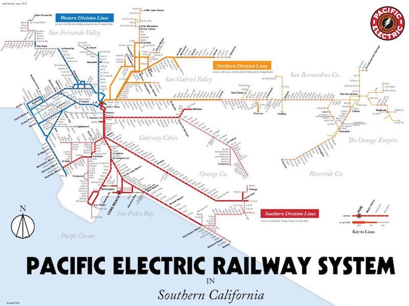
Los Angeles Pacific Electric Railway streetcar map print, 1926. Courtesy Jake Berman.
In the summer of 2010, Berman got the idea to make the maps after getting stuck in traffic on the 101 freeway in Los Angeles. While waiting for the cars to clear, he started to think that there must be a better way for locals to get around. So the artist went to the LA Public Library and discovered that in the 1920s the city had the largest electric railway in the world and a light rail system that was about 25 percent more track milage than the New York City subway.
The “1926 Pacific Electric Railway Streetcar Map” became his first historical illustration and the project “snowballed from there.” Berman went on to create historical and proposed transit maps of cities across the country like Detroit and San Fransisco. In the future, the artist hopes to design maps based on transit plans that never got made for every major US city. “It’s fun to think about what might have been as well as what was,” said Berman.
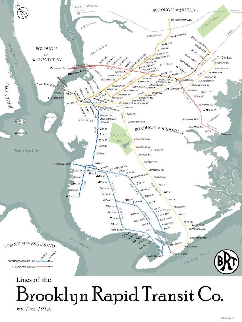
Brooklyn rapid transit map print 1912. Courtesy Jake Berman.
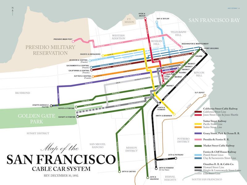
San Fransisco cable cars, 1892. Courtesy Jake Berman.
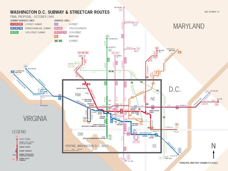
Washington, DC proposed subway system map, October 1944. Courtesy Jake Berman.
Next check out this map of the NYC subway drawn in concentric circles or 5 Subway Routes that Should be Brought Back.
Get in touch with our author @joshaaronsiegel

Subscribe to our free newsletters
Free Newsletters
Get the best stories and things to do sent straight to your inbox.
