


13. Manhattan Borough President’s Map Display
 Courtesy of credit Manhattan Borough Presidents Office via Open House New York
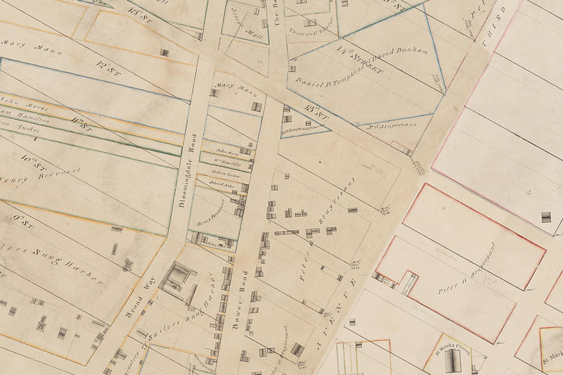
NYC Borough Presidents are responsible for maintaining the official maps of their borough. During OHNY Weekend, the Manhattan Borough President’s Topographical Bureau will display a historically-essential map in the development of Manhattan executed by John Randel in 1820. This map is the first that plotted the 1811 “Commissioner’s Plan” which established the Manhattan street grid from Houston Street to 155th Street.
The office is the sole repository for these 92 individually hand-drawn and hand-colored panels which will be assembled into a room-size display, roughly 16 feet by 60 feet, so that map geeks and Manhattanphiles may examine every part of these historic documents. In addition, Manhattan residents who live in each map’s quadrant will be able to register for a drawing for a digital print of the map!
The site will be open on Saturday, October 19th from 10:00AM to 4:00PM.