Koryo Books: Where K-Pop Fans and Book Lovers Converge in NYC
Established over 40 years ago, this Koreatown store has evolved from a community bookshop into a global cultural destination!


Last fall, I was invited to join the board of Brooklyn Greenway Initiative (BGI), the nearly twenty-year-old organization that has been the force of activism to connect the 26 mile waterfront in Brooklyn for pedestrians and bikers. Like all organizations, coronavirus put on pause some initiatives but galvanized others. It has been fascinating for me to see the data coming in during our virtual committee meetings about the increased usage of the Brooklyn Waterfront Greenway during this unprecedented time.
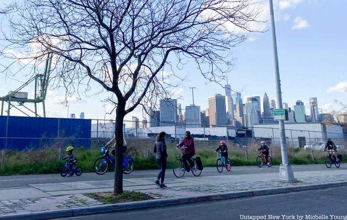
In fact, as BGI Executive Director Terri Carta wrote in an Op-Ed in amNY that was published earlier this week, this past Sunday, April 4th, “cyclist use was higher than any single day since we started collecting data last June. Right now the Greenway is providing critical safe passage for people commuting to essential jobs and a safe space for solo exercise and stress-relief during New York’s PAUSE period.” A visit I did yesterday to scope out the section between Red Hook and Brooklyn Heights showed very active use, with people running and biking. Many were wearing masks.
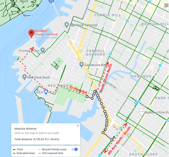
Proposal for temporary greenway connector in Brooklyn to provide safer and more efficient access to temporary hospital under construction in Red Hook Cruise Terminal
But there are still portions of the Brooklyn waterfront that are not connected and are highly unconducive and dangerous for walking, running or biking. Critically, as Carta explains in the Op-Ed, a few stretches of the future Greenway that could serve the temporary 750-bed hospital coming to the Brooklyn Cruise Terminal in Red Hook have not been built. She writes, “New York City Department of Transportation (DOT) needs to install a temporary protected bike corridor over the Gowanus Canal for essential workers from South and Central Brooklyn communities who are traveling by bicycle.”
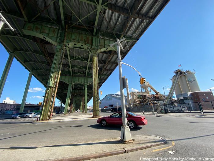
A stretch under the Gowanus Expressway with multiple lanes of traffic all of have dangerous crossings
Carta emphasizes that given the circumstances, there is no time for a two-year capital construction project to connect these areas. There are simpler measures to get temporary infrastructure that will make access to the temporary hospital safer and more efficient, which include “tapping alternative resources from the private sector who are eager to contribute to the relief effort and get back to work.”
Carta suggests using jersey barriers instead of plastic barrels to reduce maintenance needs and allow DOT to focus on other priorities. She writes, “BGI is the City’s partner in planning and operations of the Brooklyn Waterfront Greenway. We are ready, willing, and able to leverage private sector resources to coordinate this essential work. There are numerous industrial businesses within a 1-mile radius of the Gowanus Canal that are equipped to install the protected lane per DOT’s plans.”
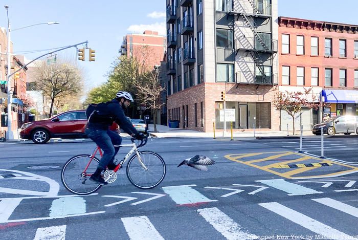
Biker in protected lane on 4th Avenue (with bird in flight!)
To better visualize the map, we went to take photographs along the proposed route. As you can see, currently bikers taking the protected bike lanes north and south on 4th Avenue who want to go west towards Red Hook do not have a viable east/west bike lane. If they do take a street going west sans bike lane, they hit the Gowanus Expressway, below, which is a daunting piece of elevated infrastructure that also has wide lanes of traffic on either side. There are no bike lanes here, but it is the only way to get to Red Hook from south of Prospect Highway.
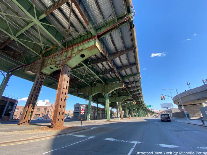
There are no bike lanes under this stretch that borders the Gowanus Canal and Gowanus Bay
From there to Red Hook, bikers would have to follow the car traffic and take one of the dangerous left turns going under the Gowanus Expressway and making an almost u-turn to go into the streets of Red Hook. From there, there are some bike-friendly roads but no major thoroughfares with bike lanes until you get to Columbia Street on the approach to IKEA.
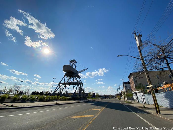
Bike lanes next to IKEA
The dedicated bike lane abruptly stops on Beard Street after the entrance to IKEA, after which it becomes a charming but hard-to-bike Belgian block surface. From here until two blocks south of the cruise terminal for about 7/10 of a mile, there are no bike lanes along the waterfront.
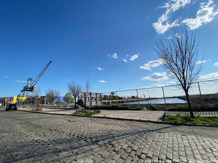
Where the bike lane ends
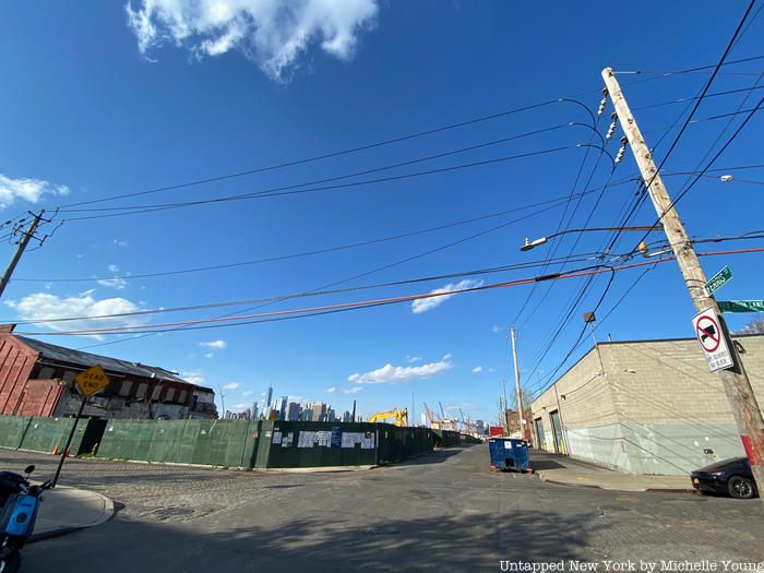
The approach from Valentino Park to the Brooklyn Cruise Terminal
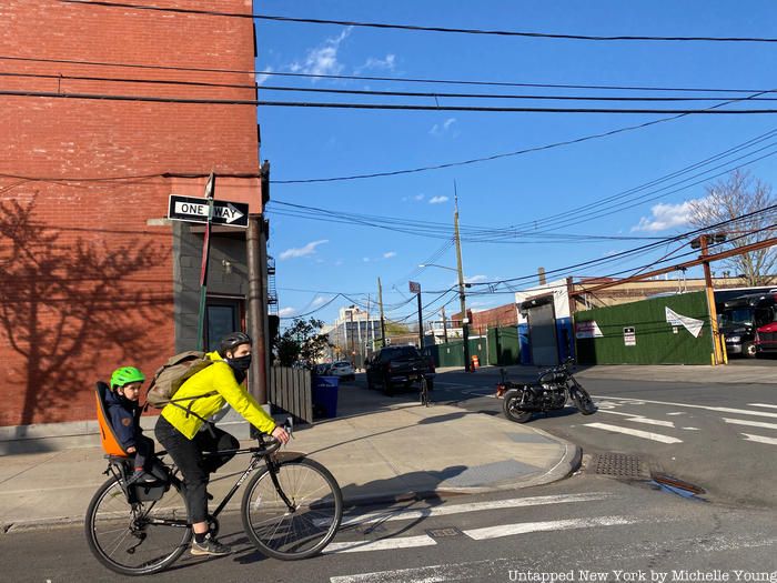
Bike lane resumes
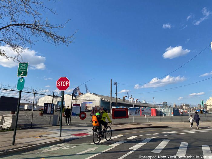
From the Brooklyn Cruise Terminal entrance area (above), the bike lane continues interrupted (mostly) to Brooklyn Heights
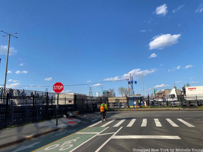
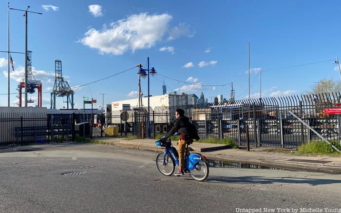
Some short portions of the Greenway do not have designated lanes
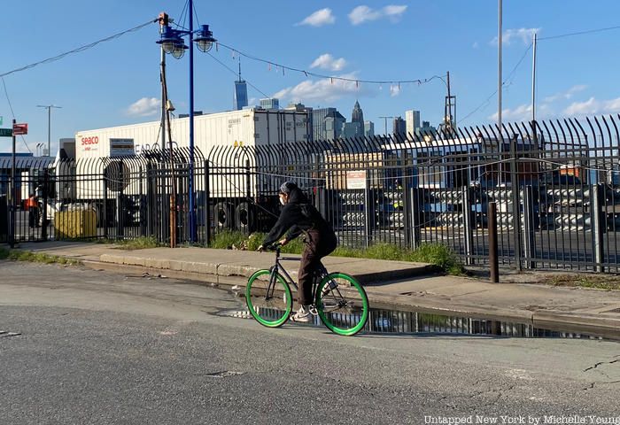
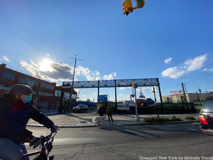
Entrance to Red Hook Terminal
If you would like to support the efforts of Brooklyn Greenway Initiative, find out more on its website here. Read more of Terri Carta’s Op-Ed on amNY here.
Subscribe to our newsletter