
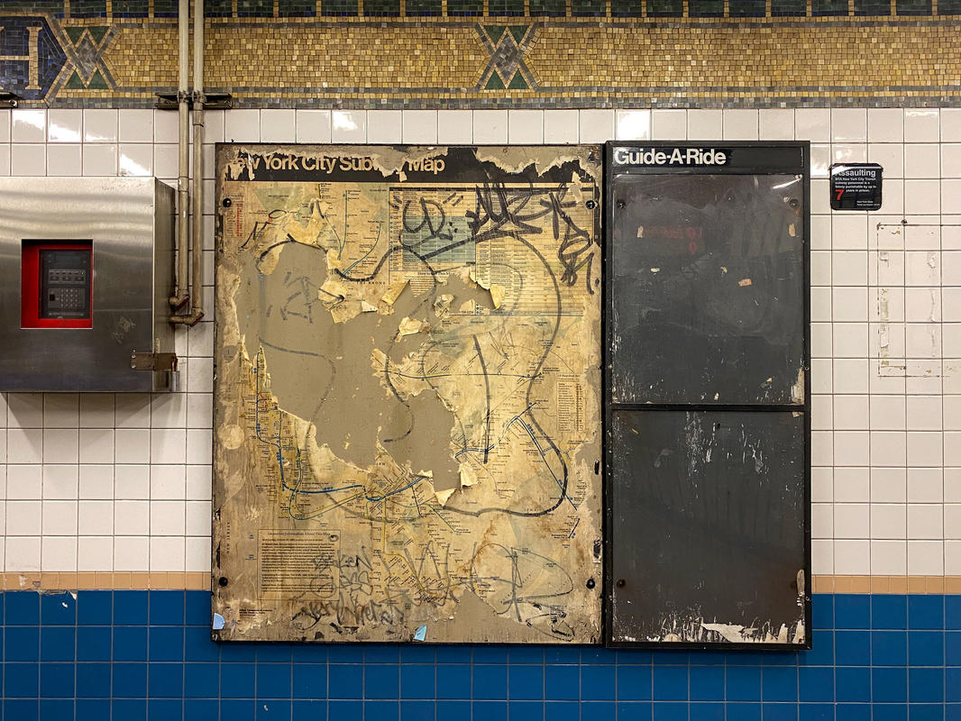
A vintage 1989 subway map has been unearthed and spotted at Manhattan’s Houston Street station on the 1 line. What makes this discovery even more fun is that the map contains a service note from this day, October 29th! The New York City subway map is an ever-evolving wayfinding tool and piece of graphic design, so it is exciting to compare today’s map to those of the past. The discovery of this 1989 subway map, which was spotted and photographed by photographer Ryan Lahiff, brings back the thrill of finding a 1970s Vignelli designed by that was uncovered a few years ago.
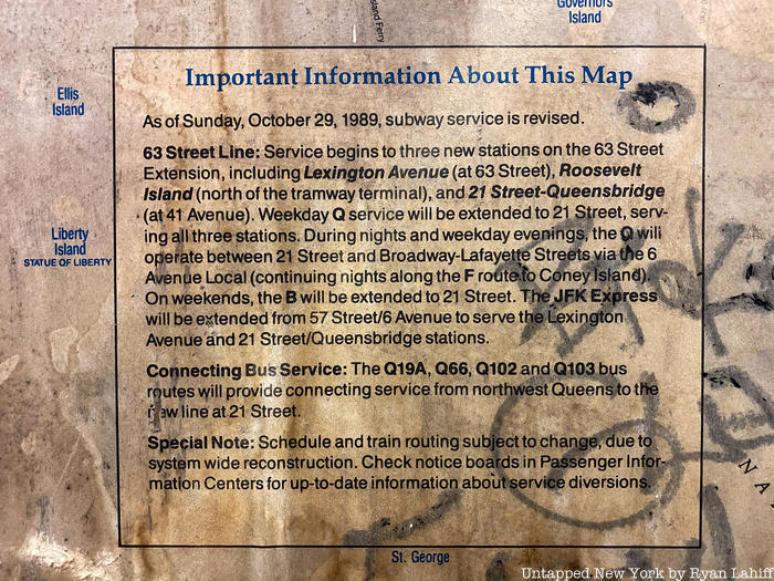
The notice on the map lets riders know that service has begun along the 63rd Street line (F) to three new stations including Lexington Avenue, Roosevelt Island and 21 Street-Queensbridge. The opening of the Roosevelt Island station actually led to a decline in tramway ridership, as commuters rerouted to the subway. The station was also serviced by the Q and B trains at the time. In close-ups of the map, you can see the similarities and differences in design, stops and routes compared to today’s maps.
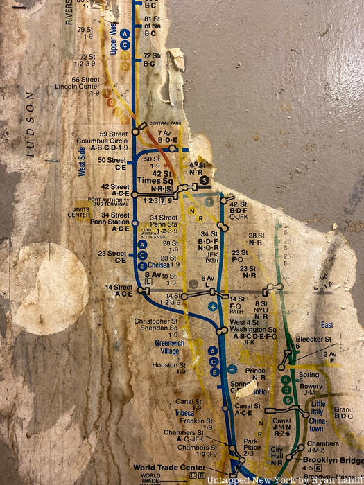
In the photo above, you can see little airplane symbols that denote the JFK Express, a train that took passengers from midtown Manhattan to JFK Airport. The “Train to the Plane” started at 57th Street and 6th Avenue and terminated at the Howard Beach-JFK Airport stop where an express bus would take passengers to their terminal. On the map, the route is light blue. Also in the photo above, you will see a number that we don’t use anymore, 9. The colors on the map have faded to yellow, but the 1-9 was the Broadway-7th Avenue local of today’s red 1,2,3 line. The 9 was suspended in 2005.
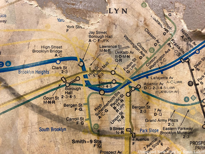
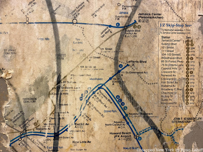
Moving on to Brooklyn, you will notice that today’s Jay Street Metro-Tech was called Jay Street Borough Hall, and the R did not connect as it does today. In Queens, you can see the terminus of the JFK Express, a predecessor of the AirTrain which opened in 2003. A letter that we no longer use also makes an appearance here on the map, H. The H connected with the A at Broad Channel to bring riders out to the western part of the Rockaway peninsula. This Rockaway Shuttle is now annotated with an S.
What other differences can you spot?
Next, check out The Hidden Meaning Behind the Colors of the NYC Subway and The Top 20 Secrets of the NYC Subway