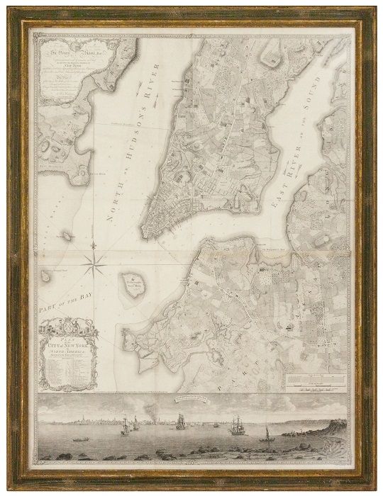
If you have ever wondered what New York City looked like in the 1760s, check out British cartographer Bernard Ratzer’s map “Plan of the City of New York, in North America: Surveyed in the Years 1766 & 1767.” Ratzer has been described in The New York Times as “something of a Da Vinci of New York cartography,” and his exceptionally detailed maps are prized possessions at cultural institutions like The New-York Historical Society and the Center for Brooklyn History. Now, another Ratzer map of New York is for sale at Robert Augustyn Rare Maps and Prints for $300,000.
Photo Courtesy of Robert Augustyn
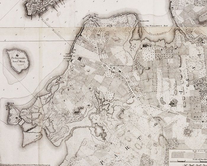
The 46 ¼ x 34 5/8 inches map is made up of three joined sheets and offers a rare glimpse into the outlook of the city during its early periods. The combination of fields, early settlements, landed estates, wetlands, and rivers would last only so long, before the march of development proceeded. The Ratzer map of New York also marks the first time that “significant portions” of Brooklyn and Queens were shown on a map (as predominantly farmland), along with New Jersey. It’s as if the potential of New York, beyond the main settlement in lower Manhattan, was being demonstrated via cartography to King George III.
Photo Courtesy of Robert Augustyn
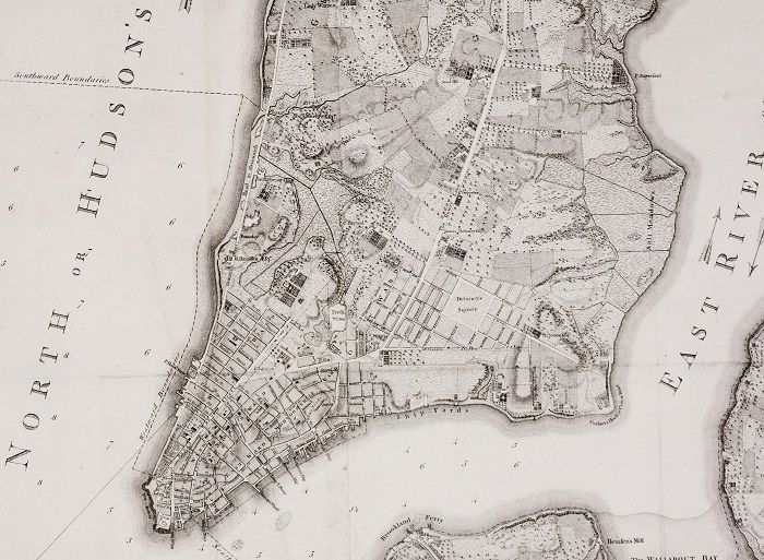
In the Ratzer map of New York, the settled part of the city was almost completely located below Canal Street. Above that demarcation line contained a combination of forest, farmland, salt meadows, and the sitings of bucolic estates for the wealthy within present-day Greenwich Village, Chelsea and Murray Hill. In fact, Manhattan looked completely different from the urban center we know of it the 21st century, and the map depicts the natural landscape that was beginning to be shaped by the British settlers at this time. According to the description on the Robert Augustyn website, there were “several, disparate micro eco systems,” along with “numerous streams and rivers and with several bodies of water,” including Collect Pond which used to supply water to the colony until it became too polluted. Collect Pond, along with the other streams and wetlands, were buried, filled in or leveled as Manhattan was settled.
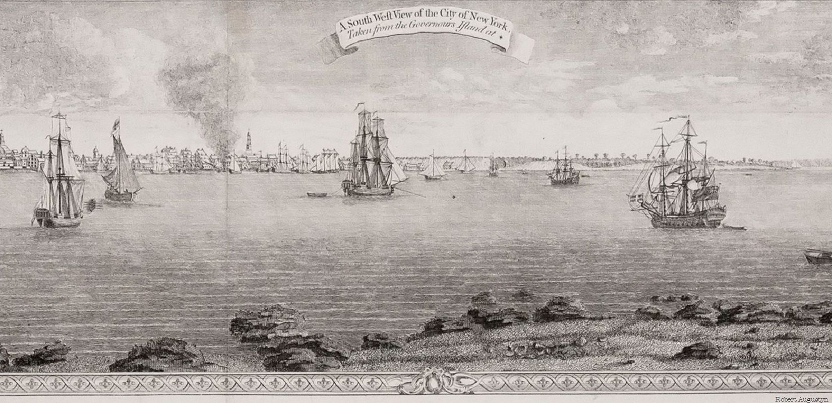
Underneath the map, the city itself was portrayed from a distance, and the view of Manhattan was illustrated as seen from Governors Island, with ships on the horizon. The scenery of the city is one of tranquility amidst a busy mercantile harbor, all of
which would soon be disrupted as the American colonists rose up against their British rulers. According to the description on the Robert Augustyn website, the map is modeled after 1766 and 1767 surveys made by Ratzer who served as a military engineer in America during the French and Indian War. The website notes that Ratzer surveyed New York City in an effort to continue the work begun by British military engineer and cartographer John Montrésor in 1765. He improved the map from his predecessors and added many new details including streets surrounding Delancey Square in modern-day Lower East Side.
Photo Courtesy of Robert Augustyn
Ratzer’s map was initially published by English engraver Thomas Kitchin in 1770, but the initial versions of the maps were incorrectly spelled as “Ratzen Plan.” The 1770 map is the most prized, and according to the New York Times, for many years it was believed that there were only three left in existence. According to the New York Times, one of the first copies was sent to King George III and it remains in the collection of the British Library to this day. Two copies are in the New-York Historical Society. One was discovered in the Center for Brooklyn History (previously known as the Brooklyn Historical Society) in 2011 and required extensive restoration.
The edition of the map that is currently for sale is from 1776 and was published by cartographers Thomas Jefferys and William Faden. It is almost exactly the same as the 1770 version, but contains a line just above the view of New York City from Governors Island at the bottom of the map. It reads, “London, Published according to Act of Parliament Jan 12, 1776 by Jeffrys & Faden, Corner of St. Martins Lane, Charring Cross.” The text contains the medial S, which looks a bit like an f letter, a form of the lower case s used in old English.