Last-Minute NYC Holiday Gift Guide 🎁
We’ve created a holiday gift guide with presents for the intrepid New Yorker that should arrive just in time—


In 1939, composer Billy Strayhorn created an instrumental piece for the Duke Ellington band that would become emblematic of New York City’s music history. “Take the A-Train,” is considered one of the most notable Duke Ellington hits, and there is much to be said for the subway line which inspired the song.
Opened in 1932, the A-train is the longest route in the New York City Subway System. At a whopping 31 miles, the A-train stretches all the way from Inwood in northern Manhattan to the Rockaways and Richmond Hill in southeastern Queens. Unlike other lines in the system, the A-train has four separate termini, with each acting as the gateway to four distinct neighborhoods. Welcome to our first installment of “End of the Line” where we will explore what’s at the end of each New York City subway line, a series our founder Michelle Young has been planning for many years. Finally, it’s here!
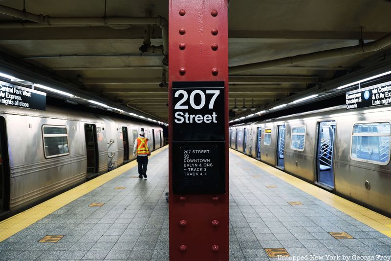
At its northernmost terminus, the A-train begins the 31-mile journey at the very tip of Manhattan in the neighborhood of Inwood. Bordered by the Harlem River to the north, the Bronx to the east, the Hudson River to the west, and Fort George to the south, Inwood is a neighborhood that sits high above all of Manhattan, not far from the island’s highest terrestrial point in Bennett Park.
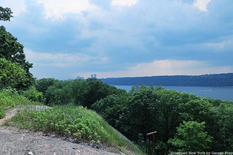
The area itself is home to the urban forest that is Inwood Hill Park, perched high above the Hudson River shoreline. Less than a five-minute walk from the 207th Street Station, the park contains the last natural forest on Manhattan Island, serving as a portal to a time when the borough was still home to the Lenape people (whose caves you can still see in the park). If you stroll the paths of the park up toward the Inwood Hill lookout, you will be rewarded with a spectacular view of both the George Washington Bridge and Fort Lee to the south. Look across the Hudson River toward New Jersey for a stunning view of the vast swath of heavily forested cliffside land known as the Palisades.
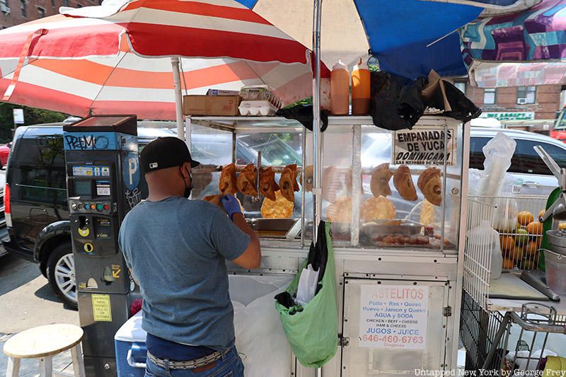
As you hike back down toward Broadway, you will see the Shorakkopoch Rock, where Peter Minuit of the Dutch East India Company supposedly bought the island of Manhattan for $24. Arriving back on Broadway, the main thoroughfare of the neighborhood you come across a variety of small businesses and empanada stands where merchants squeeze fresh juice.
Like nearby Washington Heights, Inwood is one of the many epicenters for Latin American culture in New York City. From the Dominican Republic to Puerto Rico, a variety of nationalities are represented here, their flags flying high outside apartment windows. Many Latin American cuisines can be found here: Cachapas y Mas, a Venezuelan restaurant devoted to serving street food favorites, is just one of the many cultural establishments in this small nook in Northern Manhattan. Others include the newly opened Mexican eatery Serrano Salsa and Dyckman Express, a hotspot for Dominican street food.
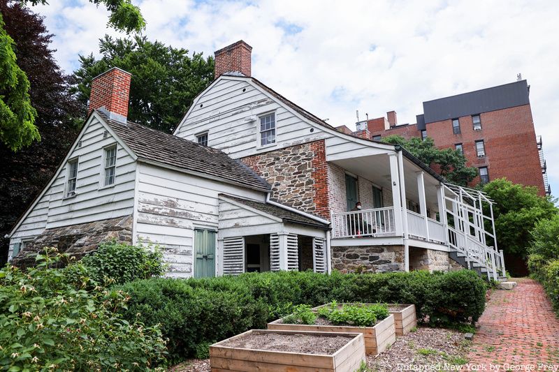
At the intersection of 204th Street and Broadway sits the Dyckman Farmhouse, the oldest remaining house on Manhattan island. Once belonging to the Dyckman farming clan, the home was originally located around 210th Street. With the onset of the Revolutionary War, the family fled Manhattan for Upstate New York, and the home and orchards were burned down in the ensuing conflict. It was only after the war that they returned to construct the current dwelling at 204th Street, recultivating the surrounding land to farm crops as well as apple and cherry trees. Today, the house, much like King Manor in Jamaica, Queens serves as both a museum and part-time art gallery. You can learn more about the Dyckman family, including how they freed their servants, on one of their many tours.
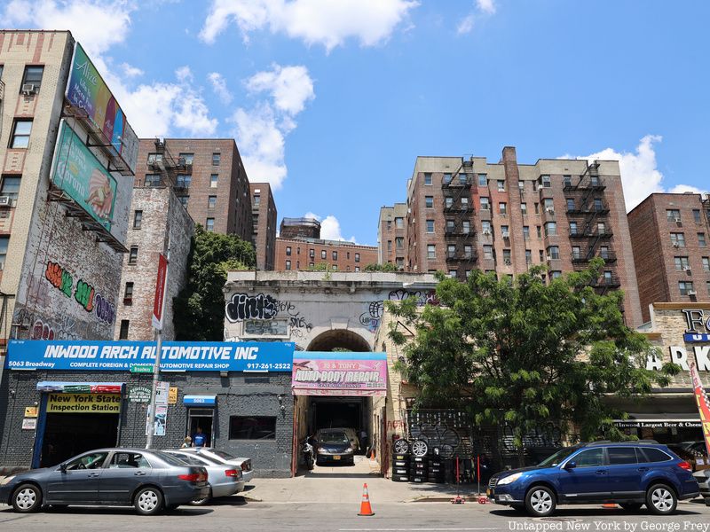
Just north of the Dyckman estate on Broadway is a smaller, more hidden landmark of another notable Inwood family. The Seaman-Drake Arch is the only remaining portion of what was once the sprawling grounds of the Seaman-Drake Estate once located on the side of Inwood Hill. The central mansion, constructed in 1855, was given the nickname “Mount Olympus” by its owners John and Ann Seaman, but after a series of financial misdeeds, the Seaman family left the mansion.
The majority of the estate was demolished in 1938 and replaced with a five-story apartment building known as Park Terrace Gardens. The arch continued to stand undisturbed along Broadway until 1970 when a fire destroyed the interior components along with the roof. As of 2021, the arch is a graffiti-covered reminder of the once palatial complex.
Looking north, Broadway continues across the Harlem River into the Bronx, eventually merging with Route 9. To get to the opposite end of the A-train, however, you have to turn south and sit on the A-train for nearly two-and-a-half hours to get to the sandy white beaches of the Rockaway Peninsula.
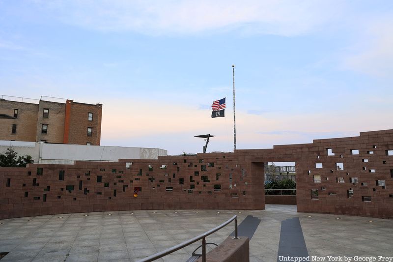
Once on the Far Rockaway-bound A-train, you travel down Central Park West and 8th Avenue, eventually diving under the East River into Downtown Brooklyn. Racing along Fulton Street, the A-train reaches the Brooklyn-Queens border emerging from the subway tunnel onto elevated train tracks as the train makes a sharp turn to the south. Passing over Jamaica Bay, you arrive at Broad Channel Station transferring to the Rockaway Park Shuttle, eventually arriving at Beach 116th Street roughly two hours after departing Inwood. Walking south to the end of Beach 116th Street, you will find Flight 587 Memorial Park.
Shortly after the September 11 attacks, on November 12, 2001, American Airlines flight 587 lifted off from JFK Airport en route to the Dominican Republic. Soon after takeoff, the Airbus A300 aircraft plummeted downwards and eventually crashed into the ground at the intersection of Newport Avenue and Beach 131st Street killing all aboard as well as five below.
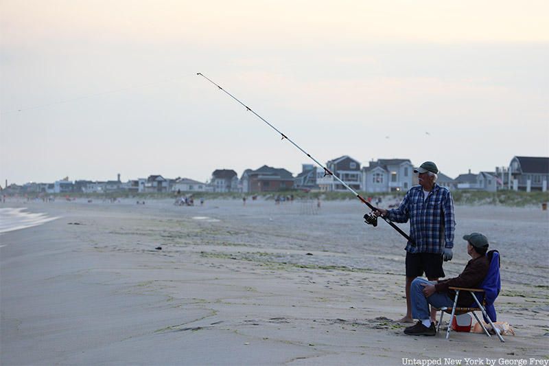
Passing the memorial to Flight 587, Rockaway Beach emerges in front of you. The ever-present scent of saltwater fills your nostrils as children play in the water and seniors stand with their fishing poles.
In a vacant space surrounded by barbed wire are the ruins of the Neponsit Hospital, a former tuberculosis ward that operated from 1915 into the 1950s. The hospital shut down permanently in 1955. In the years since its closure, the long-abandoned structure was left to rot, yet it has become adorned with colorful LGBTQ-themed graffiti and murals.
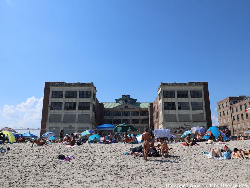
Half a mile down the boardwalk is an abandoned former bathhouse, once a hub for beachside entertainment but now stands as a lonely yet impressive brick structure. Constructed in 1932, the building was designed in the Art Deco style. Much like its namesake Jacob Riis, a Danish-American journalist who wrote How the Other Half Lives, the bathhouse was an egalitarian establishment, allowing for a wide variety of patrons to enter and enjoy its impressive amenities.
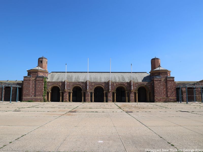
Despite its vacancy, the Art Deco grounds of the bathhouse provide a home to the Riis Beach Bazaar, a marketplace filled with various local pop-up vendors, artists, and occasional concerts. Another gathering place much closer to the central part of the Rockaway peninsula is the Rockaway Beach Surf Club, a bar, restaurant, and gathering place for many in the community. Uma’s Restaurant, not far from the Rockaway Beach Surf Club, is the only establishment serving Uzbek and other Central Asian cuisines on the peninsula.
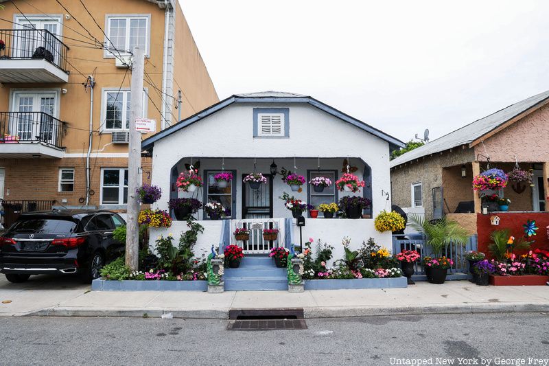
At the other terminus of the A train in the Rockaways, you can find the Beach Bungalow Historic District, listed on The National Register of Historic Places . It’s a small stretch of colorful one-story houses from Beach 24th to 26th Street. Originally constructed in 1921 to cater to Manhattan beach-goers, the bungalows each follow the same uniform design. Some residents chose to have their home remain closer to their 1920s design, while others have taken the liberty of hanging flower baskets, putting up a variety of signs and statues along with other trinkets to create a unique curb appeal. At the same time, some of the bungalows remain abandoned, having been heavily damaged by the destructive power of Hurricane Sandy.
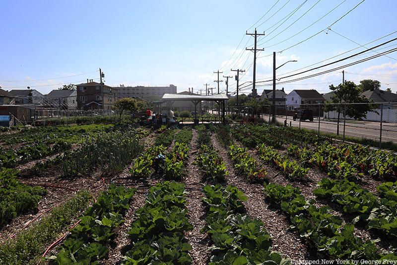
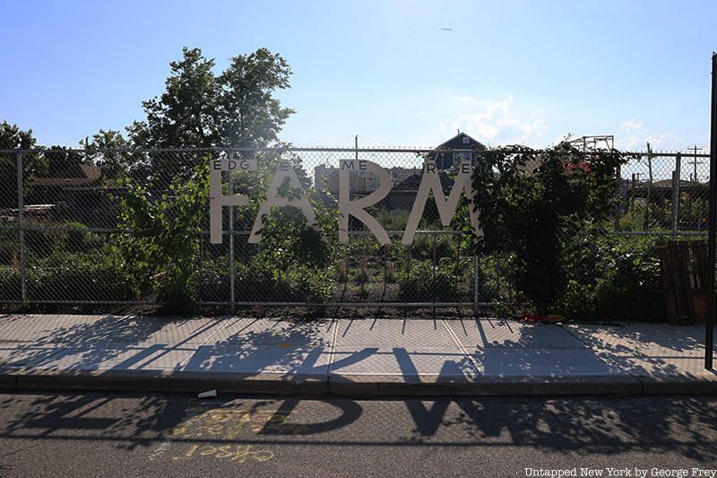
In the adjacent Edgemere district, the Edgemere Farm stands as a beacon in this post-Hurricane Sandy neighborhood. Functioning as both a community garden and working farm, with both chickens and bees on the premises, the farm hosts occasional dinners where patrons can sample some of the finest organic, farm-to-table dishes the city has to offer.
Several blocks south of Edgemere Farm, just off Beach 148th Street is an overgrown patch of nature alongside the beach boardwalk. It was on this plot of land that the luxurious Marine Pavilion Hotel once stood. Originally completed in 1834, the establishment is credited with first luring in Manhattanites to bathe in the cold waters of the Atlantic. Quickly, the building caused Far Rockaway to become a magnet for wealthy, prominent Manhattan families, including the Vanderbilts and Astors, who were frequent guests at the fabled establishment.
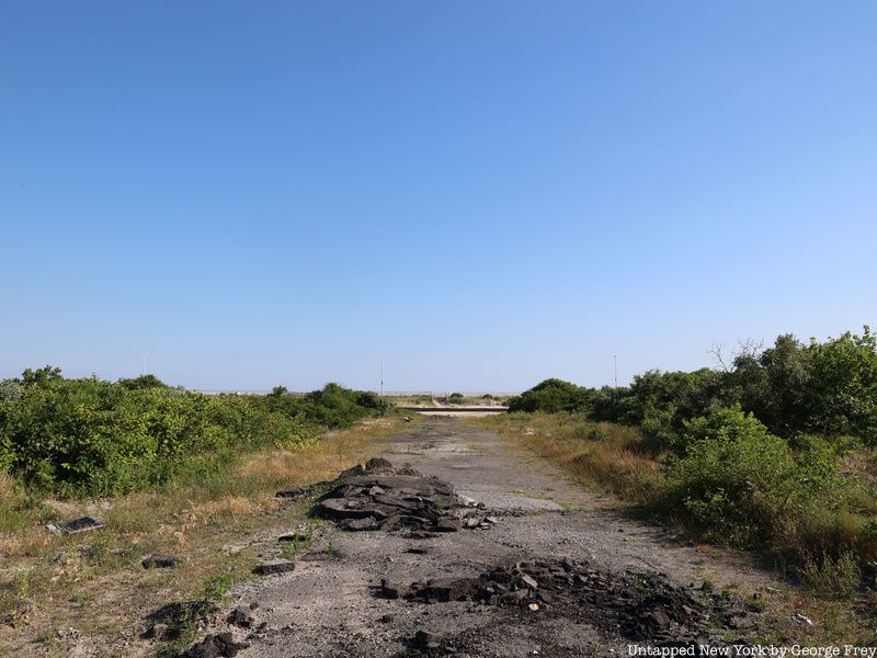
The Marine Pavilion Hotel burned to the ground in 1864, yet the success of the hotel along with the completion of a Long Island Rail Road line to Far Rockaway facilitated the construction of even more hotels along the eastern half of Rockaway Beach. In this construction boom, the inception of the Beach Bungalow Historic District occurred which allowed for more development on the whole of the peninsula, in effect creating the many beachside communities seen in the Rockaways today.
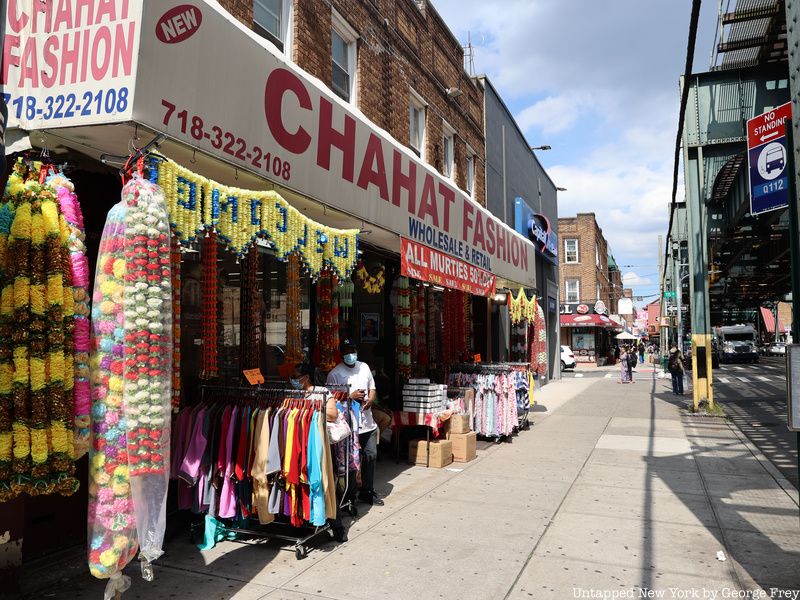
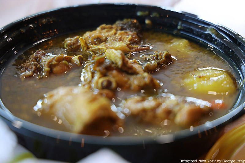
Branching away from the Rockaway-bound A-trains are elevated tracks that take you above Liberty Avenue into a neighborhood known as Richmond Hill, with a sub-micro neighborhood known as Little Guyana. Little Guyana is an area steeped in both Caribbean and South Asian cultures, with roti and curry shops sitting side by side restaurants serving pepper pot, an Indo-Caribbean delicacy and one of Guyana’s national dishes.
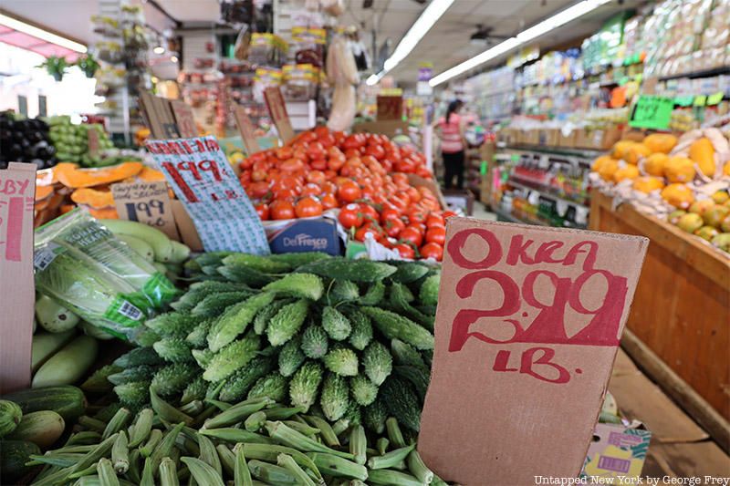
Guyana is populated by both descendants of African slaves and Indian laborers who were brought to the nation by the British to harvest sugarcane. As a result, Little Guyana is a unique mixture of two vastly different cultures half a world away from one another. Other groups of immigrants in the neighborhood include Trinidadians and Surinamese.
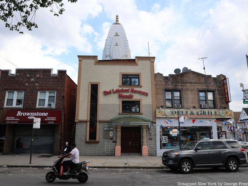
Walking along Liberty Avenue, recently renamed Little Guyana Avenue, there are multiple grocery stores selling everything from fish to sarees. The various businesses along the street extend out onto the sidewalk, creating small outdoor marketplaces. Further down the street sits the Narayan Mandir Temple, which features the beautiful altar to the goddess Shri Lakshmi, who represents life and beauty.
There are even more nuances to the A-train and the New York City subway as a whole, and secrets that are just waiting to be discovered.
To uncover more, you can join us on one of our upcoming subway tours. Visit our website for more details on how to join our Insiders program that grants you unparalleled access to some of the most secretive places in the city of New York.
Next, check out The Hidden Meaning Behind The Colors of the NYC Subway!
Subscribe to our newsletter