


3. Commissioner’s map and survey of Manhattan Island
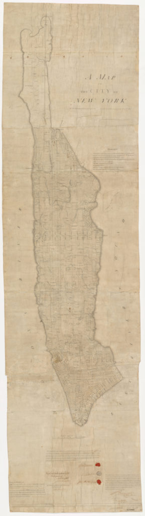
During the early 1800s, much of lower Manhattan featured a conglomeration of disjointed, winding, and uneven streets built around private land and natural barriers. However, following a mass population boom in New York City from 1790 to 1810, three commissioners set out to create a plan to better regulate the anticipated northward growth in Manhattan. As one of the three original manuscript versions of the 1811 plan, this map is a reminder of what New York City might have looked like.
While examining the map, there are key similarities and differences in comparison to the layout of Manhattan we have today. Interestingly, the 1811 version features an early version of the grid system found throughout much of modern Manhattan. However, key differences that firmly separate this map include the absence of Central Park and the absence of any grid north of 155th Street. While the map’s proposed plan was not well received by everyone, this map highlights the coming urbanization set for the future of New York City. This Commissioner’s Map is different than the version you can view at the Library of Congress.