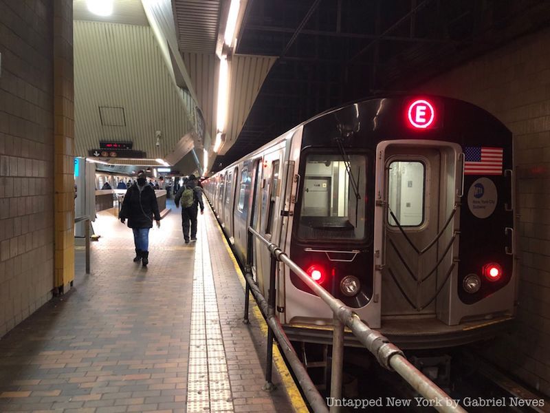
It has been a little over six months since our first installment of the “End of the Line” series on the A train, but now it has finally returned! Welcome to our second piece looking into the neighborhoods traversed by New York City’s many subway lines. Along with the endpoints, each piece will now take a look at some of the neighborhoods and historical sites that each route passes through along its trip. This particular article will be discussing the E train, which connects Jamaica, Queens to the World Trade Center in Lower Manhattan.
With service beginning in 1933 along the newly constructed Independent Subway System’s (IND) Queens Boulevard Line, the E train provided city access to commuters from deeper parts of Queens. Not only is it one of the busiest lines in the entire system, but it also offers one of the fastest ways to travel to and from Manhattan with express service along Queens Boulevard. The line runs along the local track later at night after evening rush hour to accommodate for the reduced train service. The E provides connections to some of the busiest stations in the subway system, such as Jackson Heights-Roosevelt Avenue, Port Authority Bus Terminal with access to Times Square-42nd Street, 34th Street-Penn Station, West 4th Street, and the World Trade Center.
The endpoints of the line are at Jamaica Center-Parsons/Archer and the World Trade Center, but the E did not always run this particular route. In its earlier days, trains would be connected to some segments of the IND Sixth Avenue line in SoHo and even stretch into some sections of Brooklyn. Up until 1976, E train service terminated at stations such as Church Avenue, Euclid Avenue, Lefferts Boulevard, and even Rockaway Park-Beach 116th Street in Queens. It was decided after some time that Chambers Street near the World Trade Center would be the final stop due to the addition of new bus routes and modified train service in Brooklyn.
The line has some significant issues when it comes to overcrowding and homelessness. The E along with the F trains are historically the lines with the highest ridership, and the MTA has taken certain measures to ease the pressure this causes. One such measure was implemented in 2017 by removing seats at the ends of its R-160 subway cars to allow more standing room for passengers. According to some follow-up studies, this modification has allowed for the steadier flow of passengers and has reduced overcrowding at certain stops.
Now, let’s take a look at the starting point for the E train in Jamaica!
Jamaica Center-Parsons/Archer
The intersection of Parsons Boulevard and Jamaica Avenue
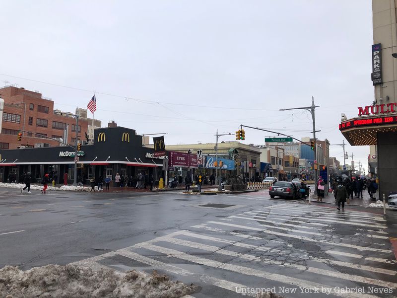
Jamaica Center leaves commuters a block away from the neighborhood’s commercial strip along Jamaica Avenue just north of the station. Connections to the J and Z lines are available at the terminal, as well as a number of buses traveling to different parts of Queens. Dollar vans are also present just outside the station where you can hear drivers screaming out destinations and route stops.
The Jamaica area was inhabited by the Lenape Native Americans before the first European settlers arrived in the mid-1650s. The name of the neighborhood comes from the word “yamecah” which translates to “beaver.” After the British began to gain control of the land settled by the Dutch, the name “Jamaica” stuck with the locals.
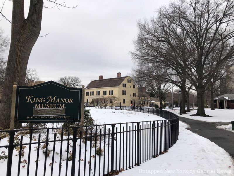
The area served as a trading post for farmers, producers, and other Native American tribes coming from as far as Ohio. The land was used for these purposes quite heavily during the Revolutionary War and gradually became more developed at the start of the 19th century. King Manor, located in a park named after the U.S. Constitution signee Rufus King, was owned by the former New York State Governor and his family for decades. The home in which he and his descendants lived until 1896 still stands in the park and has been converted into a museum in their memory.
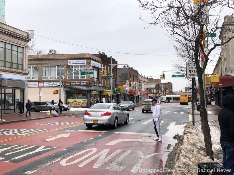
The neighborhood itself is one of the most ethnically diverse in the entire borough. People of African American, Caribbean, Hispanic, and Asian descent call the neighborhood home. Jamaica was predominantly white in the mid-1950s but the population has been reduced to a mere fraction. A large percentage of West Indian immigrants began moving to the area in the late 1960s and early 70s, who were then followed by people from El Salvador, Colombia, and the Dominican Republic. The area has become a popular shopping location for many Bangladeshis, especially on Hillside Avenue where a number of families own businesses and grocery stores that sell goods from their homeland.
Intersection along Jamaica Avenue
As we hop on the E train, get ready to ride the line!
Riding the Line: Queens
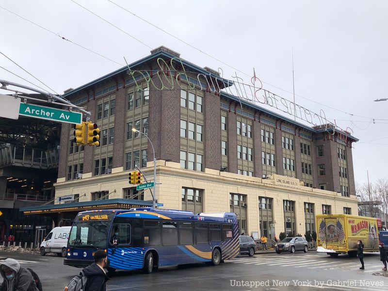
Long Island Rail Road office on Sutphin Boulevard and Archer Avenue
After departing Jamaica Center, the E makes another 21 stops before arriving at its destination in the Financial District. Despite running over 20 miles of track, the train manages to link the two terminals in just a little over an hour. The route passes through a number of neighborhoods in Queens with a high population of working-class citizens, such as Jackson Heights, Jamaica, Rego Park, and Elmhurst. The E also offers a connection to JFK Airport’s AirTrain system and is a popular choice of travel for commuters coming from the city.
The first stop right after Jamaica Center-Parsons Archer is the Sutphin-Boulevard-JFK Airport station, which does offer that connection to the international airport. The route then makes a turn heading alongside the above-ground Van Wyck Expressway, making stops on the outskirts of Richmond Hill and Briarwood, Both the Jamaica-Van Wyck and Briarwood stops feature the least ridership on the entire line because they don’t directly pass through each of these neighborhoods. Richmond Hill is home to a large percentage of Caribbean Americans and South Asian Americans, while Briarwood is a diverse middle-class community that features some colonial and old-English style residences.
Kew Gardens-Union Turnpike, 75th Avenue, and Forest Hills-71st Avenue are the next trio of stops along the line. The neighborhood of Kew Gardens is one of the seven planned garden communities built in the borough of Queens before the 1950s. The area features a range of social classes and is well regarded for its commercial center along Lefferts Boulevard, where businesses such as Austin’s Ale House, the Village Diner, and Dani’s Pizzeria have been serving residents for years.
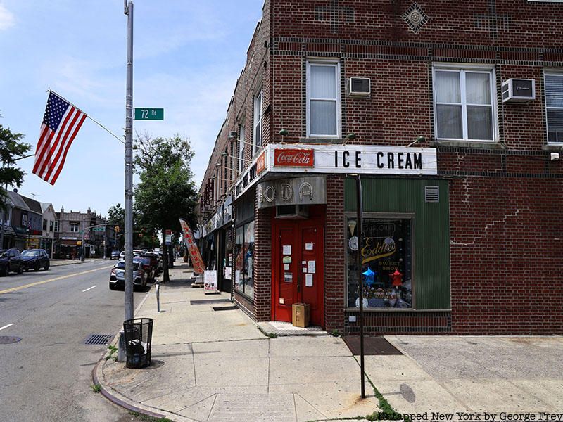
Forest Hills is home to Eddie’s Sweet Shop, one of the oldest ice cream parlors in NYC
Forest Hills and its subway hub on 71st Avenue rank as one of the most important stops along the E line. The station offers transfers to the F, M, and R trains, with the M and R terminating at that station. The neighborhood itself features plenty of historical sites, including some pre-war churches, a Long Island Rail Road station that is one of the oldest commuter rail terminals in New York, and some beautiful neighborhood architecture along Austin Street. Forest Hills used to be the original site of the U.S. Open Tennis competition before it was moved to the Billie Jean King National Tennis Center in Flushing Meadows-Corona Park.
On its local schedule, the next stops on the E train pass through Rego Park and Elmhurst before reaching its next express stop on Roosevelt Avenue in Jackson Heights. Both Rego Park and Elmhurst feature a high Asian and Hispanic/Latino population, as well as a notable Bukharan Jewish community. The rapidly developing markets in these neighborhoods, particularly in Elmhurst, have attracted plenty of business and have made them centers for Chinese culture in the city.
Jackson Heights is where a bulk of the working-class commuters who take the E train come from, boasting an incredibly diverse mixture of cultures (and some amazing restaurants!). The Jackson Heights-Roosevelt Avenue station is a major transportation hub along the line due to its connections with the M, F, R, and 7 trains. It is also an important bus terminal for routes that shuttle passengers to different parts of Queens and the Q72 bus for passengers heading to LaGuardia Airport.
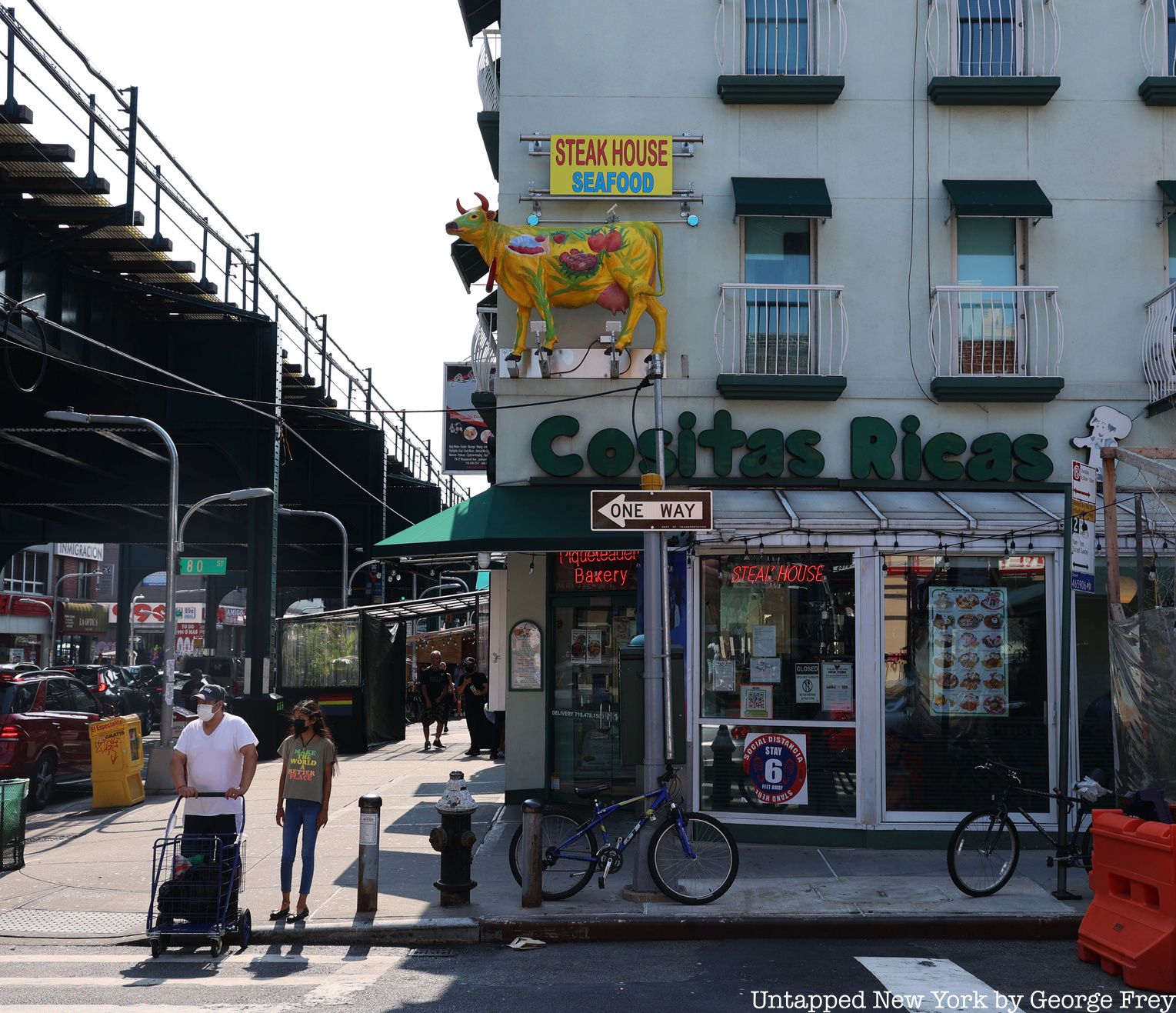
Jackson Heights is a diverse neighborhood with lots of great places to eat
The next several stations have lower ridership and pass through the edges of main neighborhoods and industrial areas. The 65th Street, Northern Boulevard, and 46th Street stops pass through a section of Woodside that has a high concentration of Asian residents, especially those of Nepalese and Tibetan descent. Steinway Street connects E train riders to the lower section of Astoria, which is one of the most ethnically diverse neighborhoods in the entire city. The following station, 36th Street, is nestled alongside a number of old commercial buildings that are now used as office space or for small businesses.
The express stop at Queens Plaza and the station after it at Court Square are the last stops on the Queens side of the E line. The intense commercialization, gentrification, and increase in resident populations in Long Island City have boosted the usage of these two stations dramatically. The community used to be an entirely separate city, featuring its own community board and even holding elections to vote for their mayor.
For years after rejoining with the rest of New York, Long Island City was utilized mainly for industry and production. Factories, rail yards, and scrap yards were scattered all over until the early 2000s, when the city decided to rezone the land. With demand for real estate growing by the year and space in Manhattan becoming less available, large apartment buildings and residential communities began popping up. Sites such as the Pepsi-Cola sign, Gantry State Park, and the Long Island City Court House Complex offer an interesting blend of history and renovation.
Riding the Line: Manhattan
The E train heads down into the tunnel after departing Court Square, rushes under the East River, and makes its next three stops along 53rd Street in Manhattan. The route runs through Midtown East, the Diamond District, and the eastern portion of Hell’s Kitchen. It’s primarily high-income and consists mostly of places tourists would be expected to visit while in New York. Department stores, luxury brand stores, and Rockefeller Center highlight the area’s importance as one of the world’s leading commercial centers.
The route then makes a turn off 7th Avenue and merges onto the original IND Eighth Avenue Line. 50th Street, 42nd Street-Port Authority Bus Terminal, and 34th Street-Penn Station are arguably the most important segment of stops on this ride. Over 200,000 riders utilize the 42nd Street station on an average weekday and it’s the stop with the highest ridership in the entire subway system. The iconic Times Square, coupled with the major bus terminal, makes this station extremely popular. Not to mention the vital transportation hub just down the avenue in Penn Station where Amtrak, New Jersey Transit, and LIRR can switch to the E train. The famous Madison Square Garden, which sits above the terminal, also means the E train sees plenty of sports fans at certain points during the week.
As the line heads down the avenue and begins to approach Lower Manhattan, the E makes two stops at 23rd Street and 14th Street. The train passes directly through Chelsea and borders the Meatpacking District. Chelsea used to consist almost entirely of coal and gas plants up until around the late 1860s, when theaters started to sprout up. The Art Deco-style buildings such as the London Terrace rise up from the streets to add a rustic, throwback vibe to a neighborhood that has seen significant modernization in the past decade. The Meatpacking District was just as industrialized as Chelsea, but got its name from all the slaughterhouses and packing plants located there.
Cobblestone street in SoHo
West 4th Street-Washington Square, Spring Street, and Canal Street make stops in Greenwich Village and SoHo just before reaching the last stop. The area is well recognized for its artistic and inclusive vibe, with lots of NYU students and creative professionals. Washington Square Park is a popular location where people gather throughout the day and night and socialize. After SoHo underwent some serious rezoning in 2005, the number of artists who had moved in since the 1970s became more recognized for their works. Today, the neighborhood is a popular tourist site for people interested in architecture, art, and modern fashion.
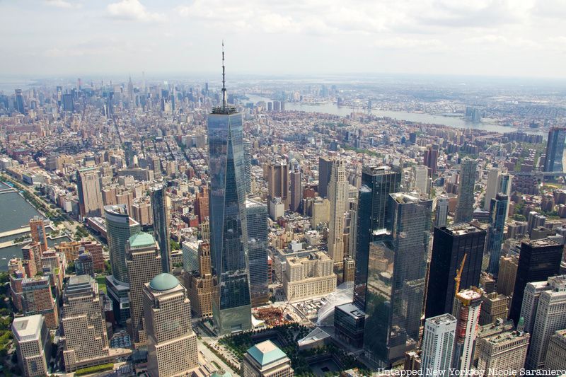
The last stop on the E train ends up at one of the world’s most crucial financial centers. The city that we know today grew rapidly from when the Dutch first arrived in New York in the early 1600s, naming it New Amsterdam. The streets that are now completely drowned out by skyscrapers and office buildings were once the core of the New York City everyone knows today. The sheer amount of historical landmarks make it a popular attraction for tourists wanting a reminder of the way New Yorkers lived in the past.
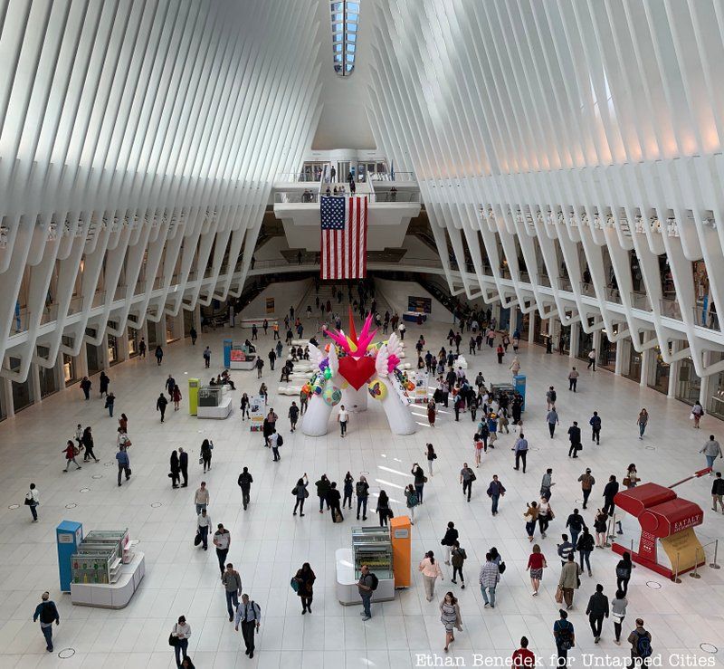
Passengers coming out of the labyrinth of underground walkways and connection tunnels can take the main exit out to the Oculus Center. The large terminal structure serves as both a transportation hub for commuters looking to take the subway or PATH trains and as a shopping center. The roof of the complex was specially designed to let in as much natural light as possible, specifically in autumn as a tribute to those killed in the September 11th attacks. The structure was opened in 2015 and has attracted quite a few visitors since then.
Transportation hub in the Oculus
The Oculus’s western exit opens visitors up to the site of the former World Trade Center complex that has been transformed into the 9/11 Memorial and Museum. The foundations of the former towers were transformed into reflecting pools with each victim’s name etched into the stone around the perimeter of each foundation. The museum features a number of artifacts found in the rubble on September 11th, including an entire firetruck, steel beams, equipment, and a staircase recovered from one of the towers. Over 45 million people have visited both the memorial and museum since its opening in 2014, with the sites honoring all the people who suffered on that day.
Coming out on the east side of the Oculus leaves you within walking distance of some significant historical sites in Lower Manhattan. Trinity Church located on Broadway and Pine Street is over 200 years old and was the tallest structure in the United States until 1869. The Federal Reserve Bank Building, the House of Morgan, and the New York Stock Exchange are also popular symbols of the Financial District. Along the harbor in Battery Park, Castle Clinton and the James Watson House display remnants of New York’s intricate history in coastal and harbor defense. Many of the piers located along the harbor also provide access to different locations in the city via the Staten Island Ferry, the seasonal Governors’ Island ferry, and the NYC ferry system.