
Free
Storefront Art Tour with Pratt Institute + The Village West
Discover how vacant storefronts are being transformed with works of art!
Discover how vacant storefronts are being transformed with works of art!
Untapped New York's founder and author of Secret Brooklyn, Michelle Young, shares her favorite things to do!
Discover how the criminal justice system has impacted music history throughout the 20th century!


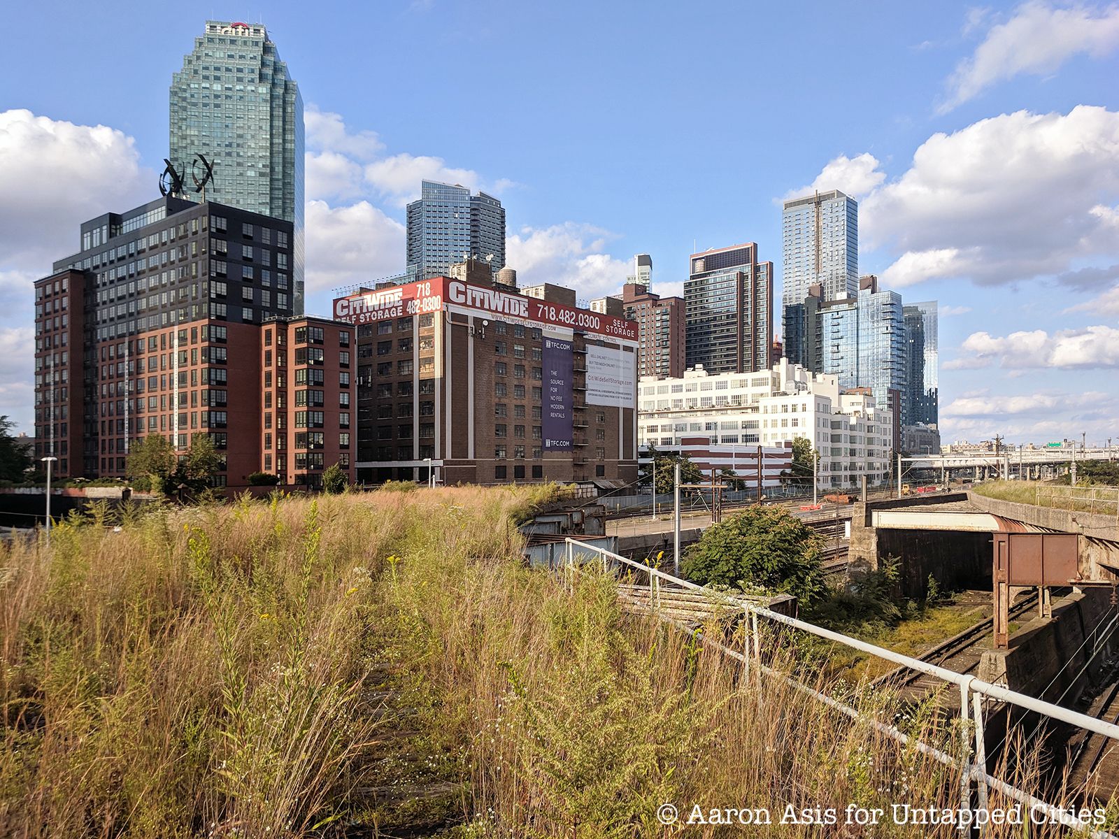
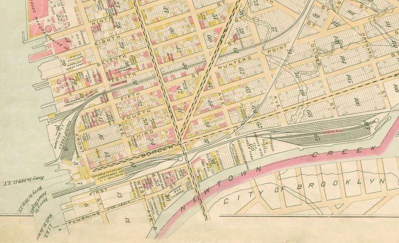
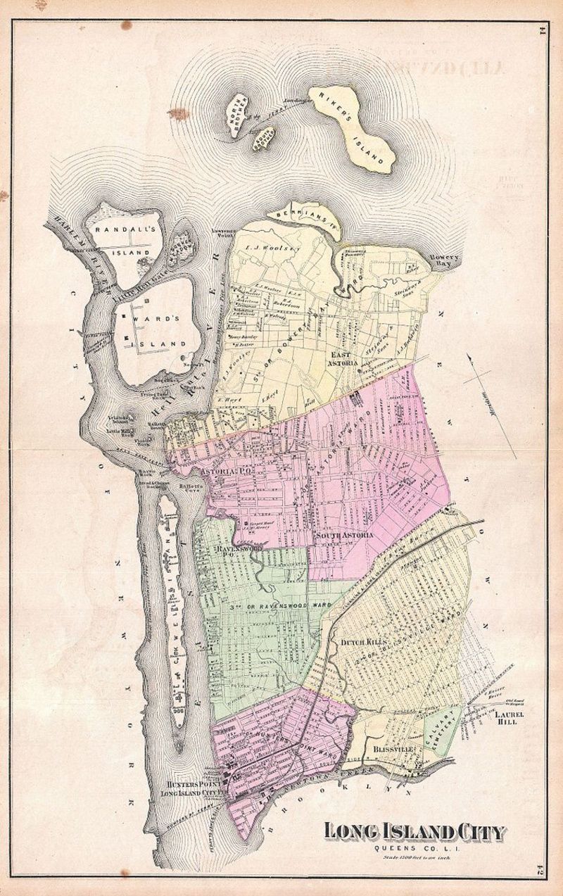
Overlooking the East River on the extreme western tip of Queens is Long Island City, one of New York’s fastest-growing neighborhoods. On May 4, 1870, Long Island City was created through a merger between the Village of Astoria and the hamlets of Ravenswood, Hunters Point, Blissville, Sunnyside, Dutch Kills, Steinway, Bowery Bay, and Middletown in the Town of Newton. At the time, the city had between 12,000 and 15,000 residents and was split into five wards, each receiving two representatives to serve on the Board of Alderman along with an elected mayor. During the 1880s, Mayor De Bevoise was convicted of embezzlement, nearly bankrupting Long Island City’s government in the process. As a result, in 1884 many residents living in the former Astoria area petitioned the state legislature to allow it to secede from Long Island City and reincorporate again as an independent village, though the petition was eventually dropped. Long Island City remained an incorporated city until 1898, when Queens was annexed to New York City.
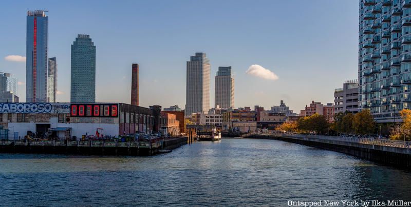
Once known for being an epicenter of the manufacturing industry, Long Island City was rezoned as a residential neighborhood in 2001 — causing the area to undergo significant gentrification as new developments such as Hunter’s Point South were erected. Today, Long Island City is known for its stunning waterfront and thriving arts community, with must-visit places like MOMA PS1, the Isamu Noguchi Foundation and Museum, and Culture Lab LIC, a nonprofit organization dedicated to supporting the development of art in Western Queens.
On the south side of Long Island City along Newtown Creek is Hunters Point, a subsection of the neighborhood known today for its East River waterfront and stunning views of the Manhattan skyline. The area gained its name in 1825 from British sea captain George Hunter, whose family operated the site as a 210-acre farm. The area is also home to the Hunters Point Historic District, a national historic district created in 1968. The district is made of a row of 47 townhouses built between 1871 and 1890 in the Italianate, French Second Empire, and Neo-Grec styles along 45th Avenue between 21st and 23rd Streets.
Visitors can also stroll through Hunter’s Point South Park, an expansive green space featuring a waterside promenade, a 30-foot-tall cantilevered platform for viewing the skyline, and a 13,000 square-foot pavilion. The park was erected on a peninsula built from landfill extracted during the excavation of the city’s tunnels, resulting in steep piles of earth with a wildly curved perimeter. During the 1990s, the area was designated a park by Governor Mario Cuomo, with construction overseen by the engineering firm ARUP and design firms SWA/Balsley and Weiss/Manfredi. Hunter’s Point South Park’s design involved separating the peninsula from the mainland, ringing it with new marshes and riprap that fill with water twice a day during high tide — discretely returning the piece to the water. In addition, all the streets leading to the park have bioswales with landscaped tree beds and other plants designed to absorb stormwater before it reaches the park.
Before its burial, Sunswick Creek’s source was located close to 21st Street north of what is now the Queensboro Bridge and Queens Plaza. The creek’s name may have originated from the Algonquin word “Sunkisq,” which translated to “Woman Chief” or “Sachem’s Wife.” In 1664, the land on the northern shore of the creek was purchased by British settler William Hallet from two native chiefs named Shawestcont and Erramorhar, and the peninsula was renamed Hallets Cove. Due to increased industrialization, the lack of a proper sewage system, and the high population density of Long Island City and nearby Astoria, Sunswick Creek became heavily polluted by the 1860s and 1870s. After the outbreak of diseases in 1871 and 1875, the marshes surrounding the creek were drained in 1879. By 1893, the creek had been diverted into one of the new sewage system’s brick tunnels.
In 1915, protest arose among the residents of Ravenswood over the infestation of the creek’s tide gates by mosquitos, arguing to the New York City Board of Health that the tide gates should be opened as they were actually making the water stagnant and trapping the mosquitoes inside the creek. One year later in April 1916, residents broke down the tide gates themselves using axes, which prompted the New York City health commissioner to remark that the residents preferred “to live like hogs.” By the end of 1916, New York City’s government proposed closing the creek and mandated households to divert their sewage elsewhere. Today, the creek exists underground as part of a sewage tunnel, with Socrates Sculpture Park occupying what was once the creek’s mouth.
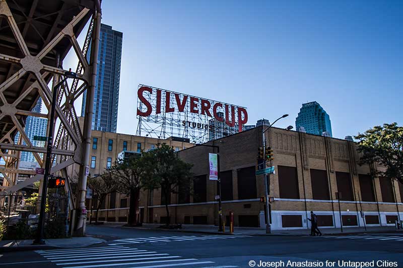
From the 1920s to the 1970s, “Silvercup,” the brand name for bread produced by the Gordon Baking Company, was a household name. Beginning in Detroit on May 11, 1927, the Gordon Baking Company quickly expanded to New York City just two years later, commissioning Pollmar & Ropes to design a 500,000 square-foot-baking plant at 42-25 21st Street equipped with four flour silos. Silvercup went on to become so famous that businesses named Silvercup Meats and Silvercup Fruit opened in Long Island City, though they held no relation to the bakery. Silvercup bread was known for sponsoring radio and television programming from the 1930s to the 1960s.
The nail in the coffin for Silvercup came on Christmas Day in 1974, when members of the Teamsters demanded a 10% commission on bread delivered to non-union stores and supermarkets in 1975. However, given that the company already had an exclusive three-year contract with the New York City Board of Education prohibiting it from raising its contracted price (after the cost of bread had more than doubled following the sale of $750 million of American wheat, corn, and other grains to the Soviet Union), the worker’s demands could not be met.
Instead, the company countered with an offer of 2% to the union. Unwilling to accept this offer, the union went on strike, forcing the bakery to close permanently. The abandoned bakery was eventually bought by Harry Suna, owner of a sheet metal factory on 46th Street, for $2 million in 1981. Suna went on to remodel the bakery, turning it into Silvercup Studios, which opened in 1983. During its early years, the studio was overseen by Norman Leigh, a New York-based filmmaker known for his electrical and gaffing work on the 1969 film Midnight Cowboy.
Today, Silvercup Studios is one of the largest film and television production studios in New York City, having served as the primary shooting facility for ABC’s Hope & Faith and HBO’s Sex and the City and The Sopranos. Scenes from over 50 film and television shows have been shot in the studio, including Gossip Girl, 30 Rock, and Mad Men. The original Silvercup logo can still be viewed from the 7, N, and W trains going in and out of Queensboro Plaza.
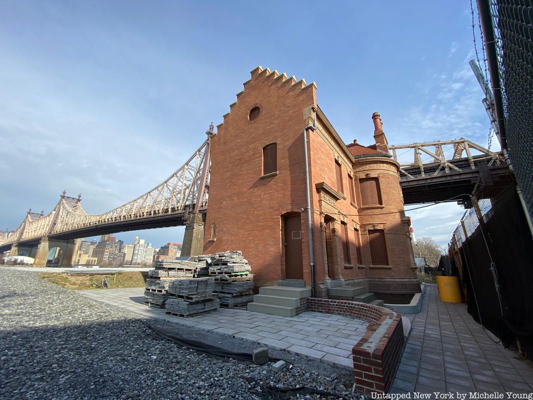
Sitting underneath the Queensboro Bridge is an office building that stands as the last vestige of the New York Architectural Terra-Cotta Company, once responsible for supplying material for some of the city’s most notable buildings such as Carnegie Hall, the Ansonia Hotel, and the Plaza Hotel. The New York Architectural Terra-Cotta Company began operations in 1886, mining the clay for its terra-cotta production from northern and central New Jersey. As the company began to expand, an office building was constructed in 1892. It was designed in the Renaissance and Tudor Revival styles by architect Francis Kimball, who employed material from the company for commissions such as the Corbin Building and Montauk Club in Park Slope.
After the company’s closing in 1932, its property passed through various owners. Until the 1940s, the property remained in use for the production of terra cotta by the Eastern Terra Cotta Company. In 1974, it was purchased by Citicorp, who swiftly moved to demolish the entire property save for the office building, which was spared due to landmarking efforts spearheaded by local residents and historians. The building received official landmark status in 1982.
While the High Line may no longer be abandoned, one major disused railroad lying fallow in New York City is the Montauk Cutoff. Likely built in 1908 among the construction of a wave of overpasses in industrial Queens, it is called a “cutoff” as it bypassed the city below it. Measuring only a third of a mile long, the railroad was primarily used to get trains in and out of Sunnyside Yard.
The Montauk Cutoff remained popular until the 1970s, when freight train traffic in Long Island City began to decrease. Abandoned completely in the 1990s, the site was used by the now-defunct Sextantworks (Wanderlust Projects) for a speakeasy and urban exploration mixed event. In 2011, Smiling Hogshead Ranch, an urban farm collective created by a group of Long Island City neighbors, formed a guerrilla garden on the abandoned tracks of Montauk Cutoff — later securing a lease from the MTA to become an official nonprofit organization. By day, Smiling Hogshead Ranch is an agricultural farm and community garden and by night a social club and cultural venue.
As New York City’s largest borough, Queens is home to more than 36 skyscrapers. Over the years, Long Island City has housed some of Queens’ tallest buildings — beginning in 1927 with the Chase Manhattan Bank Building, a 14-story clock tower and office building that stood as the borough’s first skyscraper. It remained the tallest commercial building in Queens until the opening of One Court Square in 1990. Designed by Skidmore, Owings, and Merrill, One Court Square is a 50-story 673-foot-tall office tower. The building has a green-tinted wrapped facade, 27 passenger elevators, six escalators, and more than 1,400,000 square feet of rentable space. One Court Square remained the tallest building in New York State outside of Manhattan for 29 years until the completion of the nearby Skyline Tower in October 2019.
Measuring 778 feet tall, the Skyline Tower is a 68-story residential skyscraper with 802 condos intended to target buyers looking for more space at a lower price point. Units at the Skyline Tower cost an average of $500,000 to $4 million, significantly less than their Manhattan counterparts. Original plans for the skyscraper envisioned the structure as 79 stories tall with a height of 963 feet. However, due to its close proximity to LaGuardia Airport, the Federal Aviation Administration ruled that the building could rise no higher than 752 feet without posing a risk to landing airplanes, forcing developers to modify the structure to its current height. Long Island City also contains Queens Plaza Park, the second tallest building in Queens — measuring in at 755 feet. Topped out in June 2020, Queens Plaza Park incorporated the Chase Manhattan Bank Building, which was designated an official city landmark in 2015, into its design to serve as the building’s commercial base.

To most, the World War II-era bombers that sit at the intersection of Queens Boulevard and 36th Street represent a bygone era. For students at the Aviation Career & Technical Education High School, they serve as an integral part of their daily routine. Formerly known as the Manhattan School of Aviation Trades, Aviation High School began operations in 1925 as part of the Central Building Trades School in Manhattan. At the time, only three teachers taught four-hour blocks of building trades, such as woodworking and plumbing.
During the 1930s, a four-year aviation curriculum was developed, including airplane mechanics, engine mechanics, aerodynamics, navigation, and radio theory. In 1949, the school received a Civil Aeronautics Association (now the Federal Aviation Administration) certification and officially became the largest all-aviation high school in the country. A few years later in 1958, Aviation High School moved to its current location, created at a cost of $9 million. The school’s design features a 10,000-square-foot hangar and 15,000-square-foot apron used by senior students to perform maintenance work on retired aircraft, a test cell for Powerplant students, and a seven-story building equipped with academic classrooms and specialized aviation maintenance labs.
Though Aviation High School’s city location might seem unusual, both Queens and Long Island have a rich history with aviation. Following World War II, aviation became a booming business for the area. Serving an average of 2,000 students, Aviation High School remains one of the nation’s most prestigious aviation schools, having earned seven straight “A” ratings from the New York City Department of Education as of 2011. Today, the school focuses on preparing students for careers in aviation maintenance and the aerospace industry. Notable alumni include Greg Boyer, former men’s national water polo team member and 1998 Summer Olympics silver medalist, baseball pitcher Whitey Ford, and Frank Gustave Zarb, chairman of the NASDAQ stock exchange during the dot-com boom of the late 1990s.
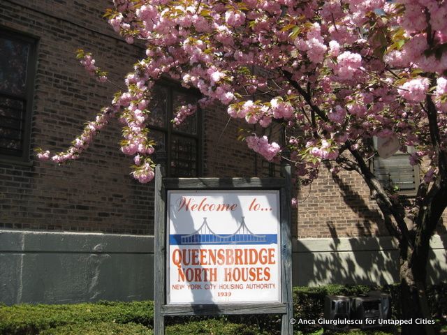
Located between Vernon Boulevard and 21st Street south of the Ravenswood Power Plant are the Queensbridge Houses. With 96 buildings and 3,142 units serving 7,000 people in two separate complexes, Queensbridge Houses is the largest public housing complex in North America. Opened in 1939, the structure’s original plan included basic amenities such as a central shopping center, a nursery, and six inner courtyards for recreational use. To provide residents with more privacy and access to sunlight, architects for Queensbridge designed each six-story building in the shape of two Y’s connecting at the base. In addition, as a cost-effective measure, the building used elevators that only stopped on the 1st, 3rd, and 5th floors.
Queensbridge is also known for its contributions to hip hop and rap music. One such example is Marlon Williams, known better as Marley Marl. An American DJ, record producer, rapper, and record label founder, Marley Marl performed in local talent shows during the early days of rap music and helped produce LL Cool J’s critically acclaimed 1990 album “Mama Said Knock You Out.” Marl is also credited with having influenced the hip hop icons RZA, DJ Premier, and Pete Rock.
In addition, the 1980’s hip-hop collective The Juice Crew featured many Queensbridge rappers, including MC Shan, Roxanne Shante, and Craig G. Later rappers such as Nas Mobb Deep also made frequent references to the Queensbridge Houses in their music, painting it as a dystopian vision of crime and poverty at the height of New York City’s crack cocaine epidemic.
One of Long Island City’s most prominent art venues is Socrates Sculpture Park, named after the Greek philosopher Socrates. The park’s name also serves as a nod to the people of nearby Astoria, which holds New York City’s largest Greek community. The site where Socrates Sculpture Park resides today was once a port for offloading stone and sand, which eventually transformed into a dumping area and landfill. In 1985, local sculptor Mark di Suvero spearheaded the area’s restoration, opening the 4-acre park one year later. For 14 years, Socrates Sculpture Park operated as a temporary city park, only being granted official status by then-Mayor Rudolph Guiliani in 1998 after a developer attempted to build luxury hotels and a marina on the site after the park’s lease had expired.
Unknown to most, Socrates Sculpture Park is surrounded by stone fencing built in part from boulders recycled from old grave markers. Unfortunately, nobody knows which graveyard the stones were pulled from. Hidden within the park is a beach at Hallets Cove, whose sandy shore is often concealed from view during high tide. On select weekends in July and August, visitors can participate in free kayaking and canoeing sessions through the LIC Community Boathouse.
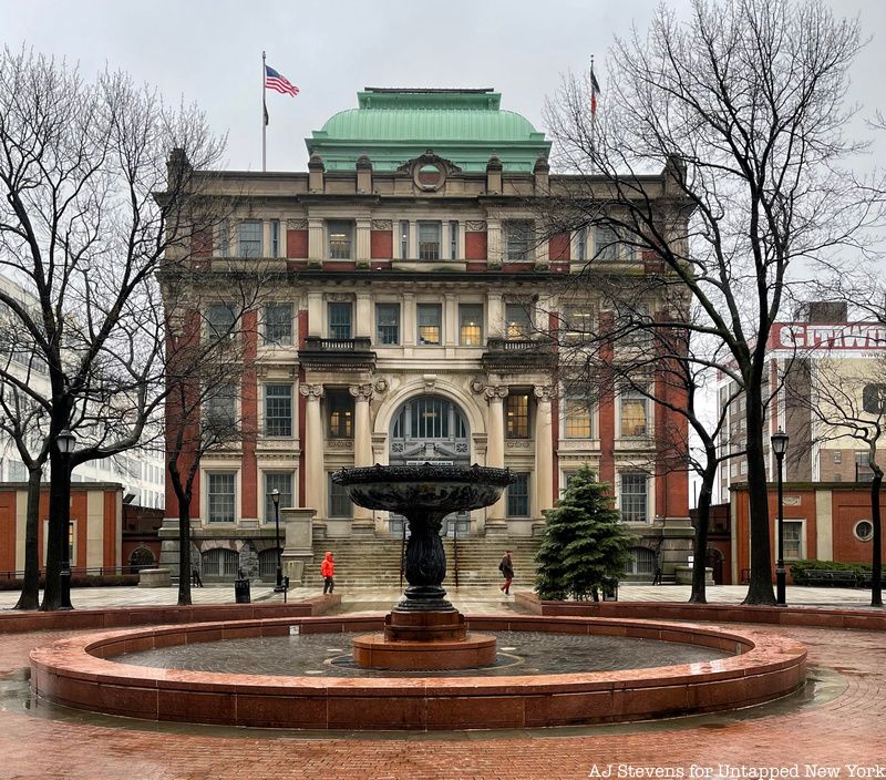
Constructed in 1874, the Long Island City Courthouse was designed by architect George Hathorne in the Beaux-Arts style. The decision for the courthouse’s location at 25-10 Court Street was decided as the Queens County seat was being moved from Jamaica to Long Island City. After a portion of the courthouse was destroyed by a fire in 1904, the building was remodeled and enlarged by Peter M. Coco. Though two jails were once part of the complex, they were replaced by a parking garage in 1988. Formerly housing Criminal Court, County Court, the District Attorney staff, and the county sheriff’s office, the courthouse is home to the Civil Term of the Supreme Court for Queens County, which also sits in Jamaica.
The Long Island City courthouse has also been featured on the screen. During season 2 of the hit Marvel series Jessica Jones, Trish and Griffin meet Jessica at the courthouse after her arraignment for the assault of Pryce. On Person of Interest, the courthouse is featured in the pilot episode and once more in season 4 during a meeting between Reese and Fusco as they investigate the murders of several Brotherhood members.
Next, check out 10 Must-Visit Spots In Long Island City: An Untapped Cities Guide!

Subscribe to our free newsletters
Free Newsletters
Get the best stories and things to do sent straight to your inbox.