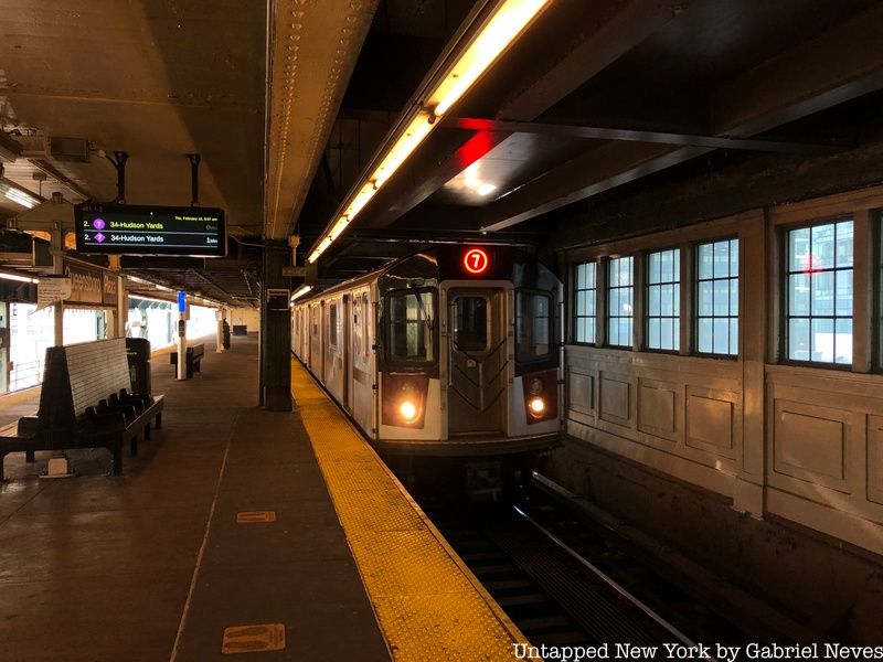
Operating along the original IRT Flushing Line, the 7 train provides commuters with one of the most important subway connections between the boroughs of Queens and Manhattan. The line services over 250,000 commuters on an average weekday and provides express service in either direction depending on the rush hour time (towards Manhattan in the morning and Queens in the evening). It passes through some of the busiest subway stations in the entire system, such as Times Square-42nd Street, Grand Central-42nd Street, and 74th Street-Broadway in Queens. Many commuters who take the 7 rely heavily on the route’s daily operation.
The line stretches from the Flushing neighborhood of Queens all the way to the far west side of Manhattan in Hudson Yards, with service terminating at Flushing-Main Street and 34th Street-Hudson Yards. The Interborough Rapid Transit Company opened the line in 1915 and has been running the same route since 1927, except for the new terminus at Hudson Yards, which opened in 2015.
The line operated locally on its route until about 1939, when the IRT decided to operate express service because of the upcoming World’s Fair in Flushing Meadows Park, which called for a much faster connection to Manhattan. In 1953, the company experimented with super express service, which saw trains skip every station between Willets Point and Queensboro Plaza before heading into the tunnel and through to Grand Central and Times Square.
The rolling stock on the 7 line consists primarily of the Kawasaki Heavy Industries’ R142A and R188 models. Since the MTA began implementing CBTC technology onto the line in 2018, the original R62A models had to be replaced because they were too old to be incorporated into the automated system. In the 1980s and early ’90s, the line consisted entirely of the R33S and R36 types, which were nicknamed the “Redbirds” for their distinct red color. In Kew Gardens, there is a single R33 car on display alongside the Queens Borough Hall building as a reminder of the historical model.
Now, let’s take a look at the first terminal on the 7 line, beginning in Hudson Yards!
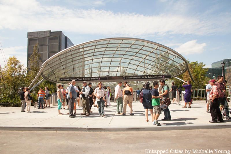
34th Street-Hudson Yards
The IRT Flushing Line begins its journey at its westernmost terminal on the route in the newly developed neighborhood of Hudson Yards. The main entrance to the station sends riders down an incredibly steep escalator ride 125 feet below street level. The station opened in 2015, but was postponed a number of times because of complications with assembling and constructing the elevator and escalator systems in the station.
The initial goal of the whole project at 34th Street-Hudson Yards was to create a state-of-the-art station for passengers traveling to the previously planned West Side Stadium. New York City placed a bid to host the 2012 Summer Olympics, but the games ended up in London. The proposed 85,000-seat arena never actually broke ground, as major companies and collaborators involved in the deal believed it wouldn’t be logical to place such a stadium so close to Madison Square Garden. What came about after these disagreements would end up being one of the most extensive rezoning projects in the entire city,
The name of the mega-development project comes from the actual rail yard used by the MTA for storing Long Island Rail Road train cars. The West Side Yard was originally used as a depot for trains that ran down the Eleventh Avenue line back in the 1970s. The yard was renovated in 1987 to serve nearby Penn Station and increase its rush-hour capacity. Train operators previously would be required to move trains to yards located on Long Island, which proved time-consuming and illogical.
The area between 30th and 41st Streets, and between 8th and 12th Avenues, has seen a multitude of high-rise apartment buildings, shopping centers, tourist sites, and parks built in the past few years. Related Companies, the company responsible for the development of Hudson Yards, built a segment of the neighborhood on a large platform placed over the West Side Yard. This installation allowed the MTA to continue using the rail yard underground while facilities such as the Shed, the Vessel, the Shops at Hudson Yards, and 30 Hudson Yards (home to the Edge observation deck) were constructed above it.
The Vessel at Hudson Yards
Most of the sites located on this platform serve as the primary attraction for shoppers and tourists who come to visit the newly constructed neighborhood. Many elect to visit the Edge, the tallest outdoor observation deck in the entire Western Hemisphere. The High Line can also be accessed via Hudson Yards by walking toward 8th Avenue.
The architects and engineers of Hudson Yards developed a variety of methods to ensure that the neighborhood would be environmentally sustainable. For instance, the city installed a 60,000-gallon tank underneath the streets designed to collect and redistribute rainwater throughout the neighborhood. The addition limits the need to consume more water and focuses on reusing what is available to irrigate parks and cool the mechanical equipment in nearby buildings. The area also utilizes a temperature control system that reduces the emission of carbon dioxide into the atmosphere at an amount equivalent to removing 5,100 cars from the streets.
-Gabriel Neves
Riding the Line – Part 1
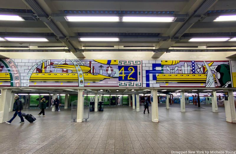
Artwork inside the Times Square-42nd Street station
As the train departs 34th Street, the tunnel makes a gradual turn to the right and heads straight down 42nd Street toward its first stop at Times Square. The ride on that first segment is notably quieter due to how relatively new the track segments and tunnels are in comparison to the rest of the line. The Times Square-42nd Street Station is generally where the most passengers board and quickly fill up the cars, as the station has the highest ridership in the entire subway system. The hustle and bustle of Times Square, along with its connections to major transportation hubs like the Port Authority Bus Terminal and Grand Central, are the reasons why it is such a heavily used station.
The next stop on the route is at the 5th Avenue station with connection to the 42nd Street-Bryant Park stop on the B, D, F, and M lines. Bryant Park itself has a unique history and is a common location for people to gather. In the 17th century, the land was used as a cemetery for the city’s poor up until 1823 when it was converted into a distribution reservoir for the city’s drinking water supply. There are plenty of spots to sit and socialize in the park, as well as some restaurants and small coffee shops to check out.
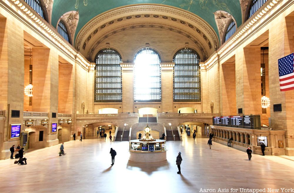
Grand Central is the last stop in Manhattan before the 7 makes its way under the East River into Queens. The terminal is one of the most recognized Beaux-Arts landmarks in New York City, famous for its architecture and history as one of the busiest train stations in America. Thousands of commuters from upstate New York and Connecticut pass through the station via the Metro-North Railroad every day to get to and from work. Along with the 4, 5, 6, and 42nd Street Shuttle lines, the 7 train will also be providing passengers access to the LIRR in the near future. The East Side Access Project is nearing its completion, which means that LIRR service will soon be making its way to Grand Central for the first time, alleviating the pressure on Penn Station as its primary terminal in the city.
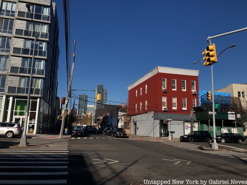
Vernon Boulevard-Jackson Avenue is where the 7 finally enters Queens. The portion of Long Island City along Vernon Boulevard has undergone an extensive rezoning project that began in the early 2000s. Most of the property along the river used to be land strictly used for industrial or commercial purposes. Now the neighborhood thrives as a high-income neighborhood and an alternative for New Yorkers looking to own a home or apartment away from the city center. Gantry State Park is just about a five-minute walk from the subway station, as well as Hunters Point South Park and a ferry port.
Intersection in Long Island City a few blocks from the Vernon Boulevard-Jackson Avenue station
Hunters Point Avenue is the next underground stop and is one of the stations with the lowest ridership on the route. The station offers a connection to the Hunters Point stop on the LIRR, which is also one of the lesser-used stations on the commuter rail line. This eastern portion of the neighborhood is made up mostly of commercial and textile factory buildings.
Coming out from underground, the 7 pulls its way into a sharp left turn as it passes over the Hunters Point rail yard and LIRR maintenance station. The elevated tracks lead the train into Court Square, the third busiest stop on the Queens section of the route. The stop offers transfers to the E, M, and G trains, as well as a few bus connections. A number of historical buildings and art centers can be found near the Court Square station, most notably MoMA PS1 and the now-demolished 5 Pointz. The area has seen a revamp in the amount of art and architecture up for display, especially along Jackson Avenue, where statues and sculptures are lined up along the center of the boulevard.
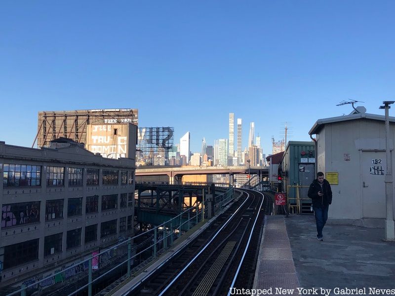
As the train pulls out of Court Square, it continues along the elevated track before making a sharp turn into the Queensboro Plaza station. This stop connects riders to the N and W trains, which head north towards Astoria-Ditmars. Although the Queens Plaza station is just underneath the elevated stop, there is not a direct transfer connection between the two. The track runs over a busy section of roadway connected to the Queensboro Bridge, linking Long Island City with 59th Street in Manhattan. The route proceeds by extending back over the Hunters Point rail yard, but this time pointing out towards the east before pulling into the 33rd Street Station, the last stop in Long Island City.
View of Manhattan from the Flushing-Bound platform at Queensboro Plaza
The 33rd Street-Rawson Street stop edges on the border between Sunnyside and Long Island City just along with the final extent of Queens Boulevard. The boulevard itself mostly consists of shops and restaurants, while other portions of the area feature some office buildings and schools like LaGuardia Community College and Aviation High School.
-Gabriel Neves
Riding the Line – Part 2
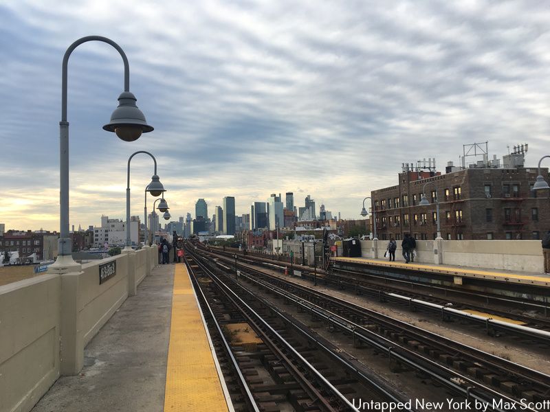
View of Long Island City from 46 Street-Bliss Street station
Continuing along Queens Boulevard, the 7 train makes stops at 40th and 46th Streets before curving onto Roosevelt Avenue to stop at 52nd street.
Sunnyside is a quiet community just outside the busy commercial cores of Long Island City and Midtown Manhattan. It is home to Sunnyside Gardens, built between 1924 and 1928 as the first planned garden community in the United States. Today Sunnyside is much larger than just the Gardens, but the original historic homes and mews remain as part of the Sunnyside Gardens Historic District. The main commercial streets of Sunnyside are Queens Boulevard and Greenpoint Avenue, but cafes, laundromats, and supermarkets line both Skillman and 43rd Avenues as well.
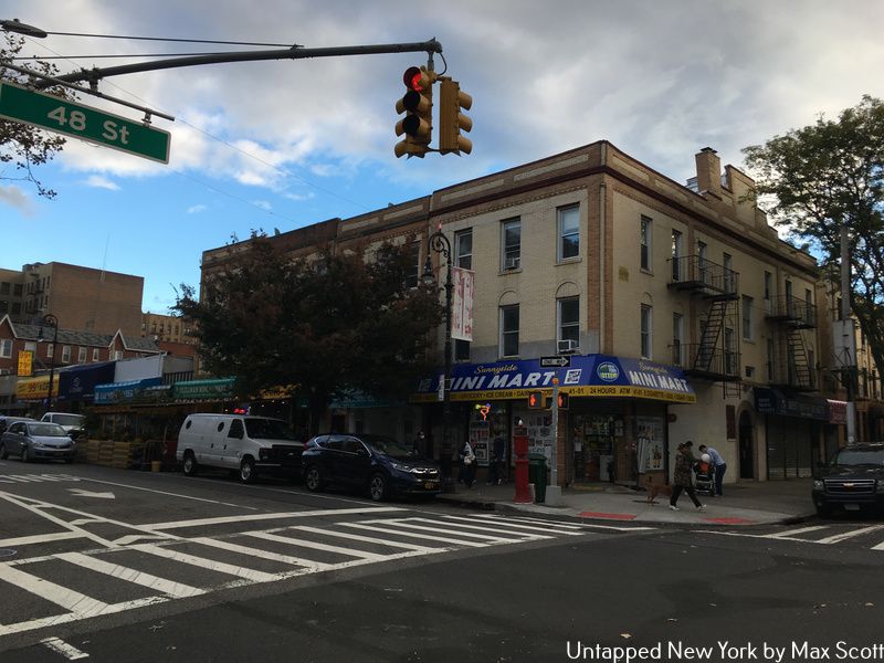
Small businesses along Skillman Avenue and 48th Street
As with most of Queens, Sunnyside is home to a mix of people from different ethnic and economic backgrounds. The southern portion of the neighborhood has a sizable South Asian and Latin American population, while the northern side of the neighborhood, which includes Sunnyside Gardens, is generally wealthier and whiter. The northern part of Sunnyside is also home to a significant Turkish community, who make their presence felt through restaurants and grocery stores like Turkiyem Market or the Turkish Grill, as well as the Turkish Cultural Center Queens.
Woodside is the next Queens neighborhood served by the 7 train. Rumbling along on its elevated steel trackbed, the 7 train stops at 61st Street and 69th Street. Home to Doughboy Park, the Long Island Rail Road, Little Manila, and old Irish pubs, Woodside is quintessentially Queens.
A neighborhood grocery store with the elevated 7 train above and the Long Island Rail Road in the upper left.
Doughboy Park is named after the Woodside Doughboy, which was the name given to the young men in the neighborhood who returned home after serving in World War I. The park is also built directly into a hill, giving it a more natural feel than most New York City parks. From the basketball courts at the top of the hill, you can get glimpses of the Manhattan skyline and the planes landing at LaGuardia Airport.
Woodside is also a great neighborhood for transit. The 61st Street-Woodside 7 train stop is both local and express, making Midtown Manhattan only a 15-minute ride away during morning or evening peak hours. The Long Island Rail Road also stops in Woodside and arrives in Penn Station just 10 minutes later. Many different Queens bus routes descend on Woodside as well, with the Q70 Select Bus Service providing express service to LaGuardia.
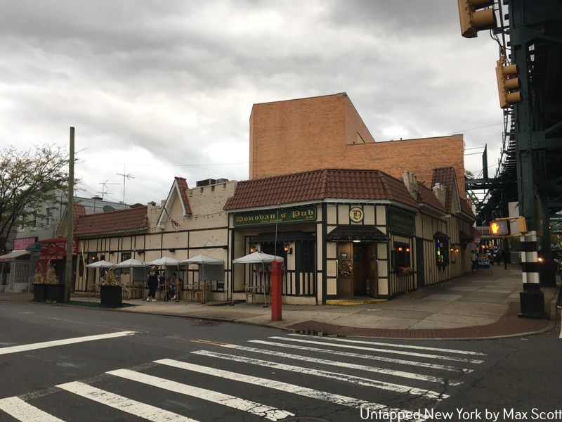
Donovan’s Pub in Woodside
The area around 69th Street and Roosevelt Avenue is the center of Queens’s Filipino community, with restaurants and grocery stores like the Phil-Am Food Mart and Kabayan serving the surrounding neighborhood. Woodside also used to be home to a large Irish community after a number of immigration waves from Ireland in the late 19th and early 20th centuries. While most of the original residents have moved out, a few Irish pubs like Sean Og’s and Donovan’s Pub can still be seen flying the Irish flag near 61st Street. Directly adjacent to many of these pubs are Chinese grocery stores that serve the wave of immigrants that moved to the area in the 1990s and early 2000s.
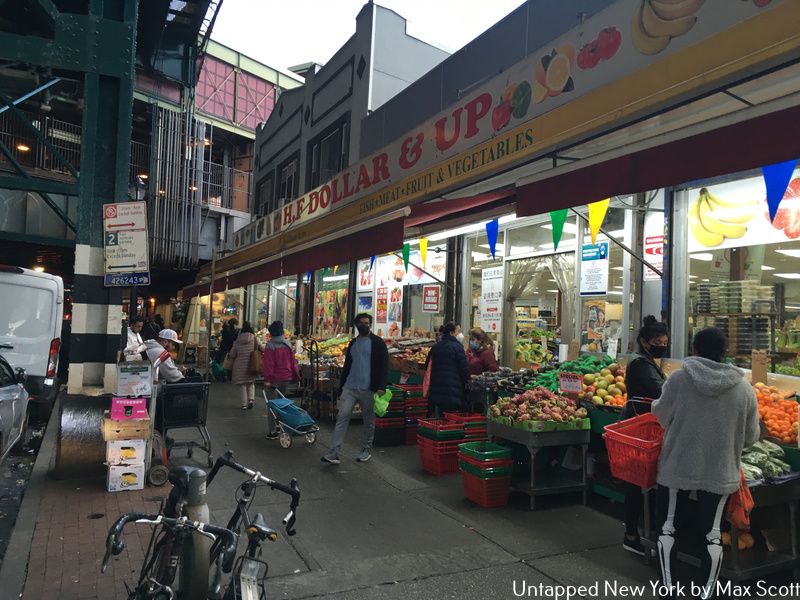
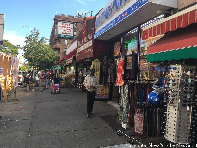
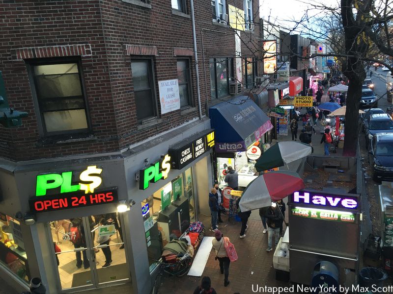
The 7 train’s next few stops are 74th, 82nd, and 90th Streets. These three stops pass through the neighborhoods of Elmhurst and Jackson Heights. Roosevelt Avenue is the dividing line between these two neighborhoods, with Jackson Heights north of the avenue and Elmhurst south. The majority of the area’s transit is centered on the 74th Street station, which is a hub for the E, F, M, R, and 7 trains, but the 82nd Street and 90th Street stations are also well used. It’s only a 30-minute ride on the 7 into Midtown or a 20-minute ride on the E or F express.
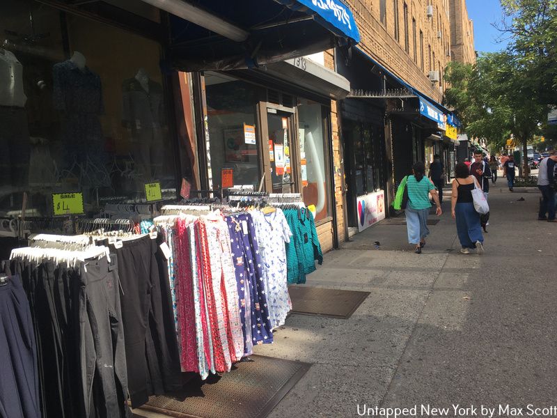
Jackson Heights, and to a lesser extent Elmhurst, is probably best known for its cultural and ethnic diversity. It is estimated that 167 different languages are spoken in this dense section of northwestern Queens. The area is largely working-class, with dozens of immigrant communities that created distinct enclaves. About half the area identifies as Latino, with people hailing from Colombia, Ecuador, Peru, Bolivia, and Uruguay. Another 20% identifies as South Asian, with Bangladeshi, Pakistani, Indian, and Nepali heritage people predominating. There are also older white residents, as well as some newer, wealthier residents who are mainly clustered in the spacious pre-war garden apartments around 80th Street and 34th Avenue.
The section of 74th Street between Roosevelt Avenue and 37th Avenue is the heart of Jackson Heights’s South Asian community. Large grocery stores like Patel Brothers and Apna Bazar serve the community’s diverse culinary needs. In addition to food, there are Indian saree clothing shops, a handful of jewelry and electronics stores, as well as banks along 74th street.
37th Avenue between 77th Street and Junction Boulevard is the main commercial corridor for the Latin American immigrant population. Colombian restaurants like Seba Seba and Arepa Lady line the street. La Gran Uruguaya is an important restaurant and hub for the small but tightly-knit Uruguayan community in Jackson Heights.
Lastly, a ten-block stretch of Broadway in Elmhurst is home to a diverse East Asian community. Here you can find Chinese, Vietnamese, Malaysian, and Thai restaurants surrounding Moore Homestead park and the long-dismantled Long Island Rail Road Elmhurst station.
-Max Scott
Riding the Line – Part 3
The second major express stop for the 7 train is Junction Boulevard in the neighborhood of Corona. The 7 train’s express service makes Junction Boulevard only two stops from Long Island City and five stops from Midtown. For those getting on at 103rd Street or 111th Street, the ride is a bit longer but will take no more than 40 minutes.
Junction Boulevard as viewed from the staircase leading up to the 7 train platform.
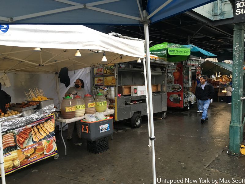
Corona is mainly home to immigrants from Mexico, Guatemala, and El Salvador, among many other countries. The two main thoroughfares of the Spanish-speaking part of Corona are JunctionBoulevard and Corona Plaza. Junction Boulevard is a major shopping street, akin to that of Jamaica Avenue in Jamaica, Queens. Corona Plaza is quite unique in New York because it’s a pedestrian plaza that has morphed during the pandemic into a fully-fledged open-air market. Dozens of street vendors flock to Corona Plaza to sell their wares. Everything from street food like empanadas and tacos to fresh fruits and vegetables to items of clothing and trinkets can be found at the Plaza.
Street vendors in Corona Plaza.
While Corona’s population is predominantly Latin American today, in the past Corona also had a large African American and Italian population. The Louis Armstrong House Museum is both the birthplace of the famous jazz trumpet player Louis Armstrong and an archive full of history about his life and jazz. The Lemon Ice King of Corona, notably featured in the early 2000s sitcom “The King of Queens,” is one of the last remaining small businesses of Corona’s mid-20th century Italian community.
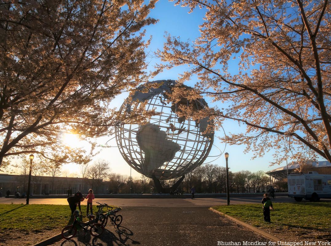
Flushing Meadows-Corona Park, which is easily accessible via the 111th Street stop on the 7 train, was once the site of the 1939 and 1964 World’s Fairs. Today, it is full of soccer fields, an abandoned observation tower, the Unisphere, and the Queens Museum. On Saturday afternoons the park is packed with games of soccer and volleyball.
After the 7 train leaves 111th Street, it only has one more stop before reaching its final destination at Flushing-Main Street. The penultimate stop on the 7 line is called Mets-Willets Point. This station sits at the intersection of the massive Citi Field, the Willets Point industrial zone, and the northern end of Flushing Meadows-Corona Park.
Citi Field is the home of New York City’s less famous baseball team, the New York Mets. The current stadium was built in 2009 as a replacement for the dated original 1964 Shea Stadium. Directly adjacent to Citi Field is Willets Point. Colloquially known as the Iron Triangle because of the large number of auto body repair shops, Willets Point has long been one of New York’s dumping grounds for heavy industry.
In 2018, the de Blasio administration and the New York City Economic Development Corporation proposed a plan to redevelop Willets Point into a mixed-use residential community. The first phase of that redevelopment, which will bring 1,100 new units of housing and a school to a current brownfield site in the area, was recently approved by the Queens Borough Board. While the development only includes a small chunk of the whole Iron Triangle, it will radically change the face of Willets Point if it proceeds as planned.
-Max Scott
Flushing-Main Street
Intersection of Main Street and Roosevelt Avenue in Flushing
The final stop on the 7 line is Flushing-Main Street. As the 7 train makes its way into Downtown Flushing, the elevated structure crosses the Flushing Creek and then descends into a tunnel where it terminates under Roosevelt Avenue and Main Street. After passing through the residential communities of Sunnyside, Woodside, Jackson Heights, and Corona, bustling Downtown Flushing caps off the extensive variety of cultures and ethnic communities along the way.
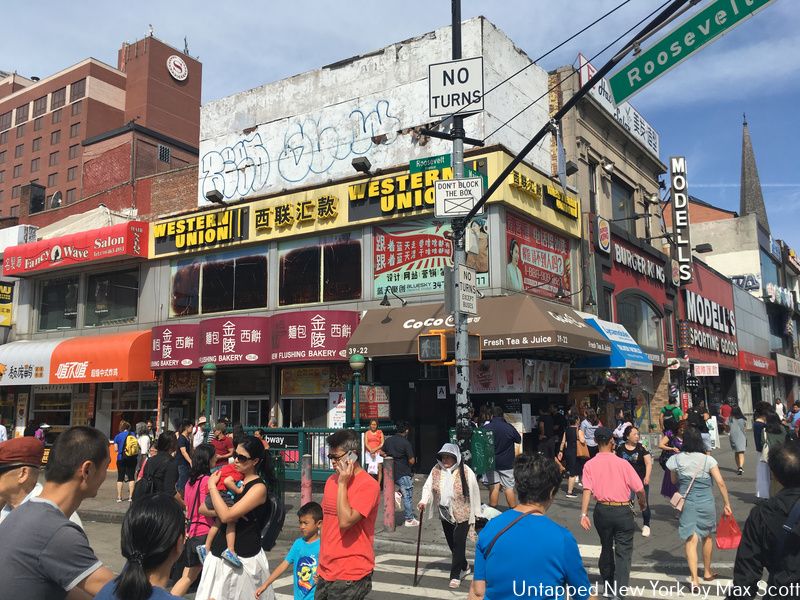
Flushing is a major cultural, transportation, and commercial hub. In fact, the intersection of Main Street and Roosevelt Avenue is the third busiest in the city, after only Times Square and Herald Square. In addition to a subway and Long Island Rail Road connection, 18 different local bus routes serve Downtown Flushing. Located in north-central Queens, Flushing is a 45-minute subway ride or-20 minute Long Island Rail Road ride from Midtown Manhattan. Heading east, Flushing is only a short Long Island Rail Road ride away from the quiet neighborhoods of eastern Queens and important Long Island business centers like Great Neck and Port Washington. Fort Totten, an old civil-war era battlement that was converted into a park, is also only a 30-minute bus ride away.
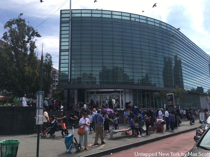
Main Street is the heart of Flushing’s Chinese and Korean communities. Just as Canal Streetis the lifeblood of Manhattan’s Chinatown, Main Street is the center of commercial and cultural life for the community. The street is always packed with pedestrians, food vendors, and commuters who shop at the hundreds of small businesses that line the street. The neighborhood’s post office, library, and at least a dozen local grocery stores can be found on Main Street. Some landmarks of the Chinese community in Flushing are the New World Mall and Taipan Bakery.
The Queens Public Library’s Flushing branch on Main Street.
Throughout the last decade, Flushing has seen an increasing amount of investment from abroad as many firms and wealthier individuals based in eastern China, Taiwan, and Hong Kong turn to New York City as a good place to invest in real estate. New luxury developments, such as the SkyView Center, have sprung up along Main Street, Prince Street, and College Point Boulevard surrounding the 7 train’s terminus. The turn towards luxury housing in this overwhelmingly working-class and immigrant neighborhood culminated in the recent Flushing Rezoning. The project will redevelop a swath of industrial waterfront land along the Flushing Creek and convert the area into high-rise housing and commercial space.
-Max Scott
Next, check out the previous “End of the Line” pieces on the A and E trains!