Last-Minute NYC Holiday Gift Guide 🎁
We’ve created a holiday gift guide with presents for the intrepid New Yorker that should arrive just in time—


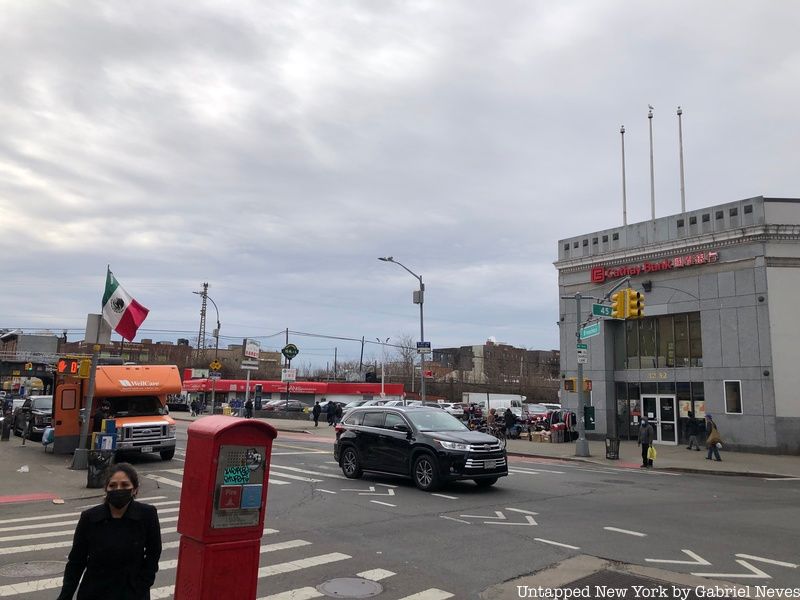
Established in 1652 by Dutch settlers, Elmhurst is an ethnically diverse neighborhood in Queens that consists mostly of multi-family homes, co-ops, and apartment buildings. It sits south of Jackson Heights, west of Corona, north of Rego Park, and east of Sunnyside and Woodside. Originally, the area was called Middleburgh, but in 1662 it became known as New Towne (and then just Newtown) until 1898 when it became part of New York City. Development in the area occurred mostly throughout the 20th century when business owners and immigrant families moved in from different parts of the city.
The Cord Meyer Development Company contributed directly to the influx of new residents with the construction of “high-class” housing units over the original farmland. The new buildings, coupled with the Independent Railway System’s construction of the Queens Boulevard line, would be the foundation for Elmhurst’s economic development over the course of the next several decades. From where it got its name to some surprising landmarks, here are 10 secrets of Elmhurst.
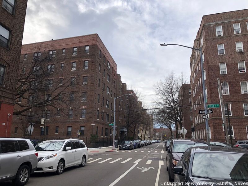
The land that became Elmhurst was first recognized as Middleburgh when the Dutch first settled there. The land they originally inhabited was in the area known today as Maspeth, but after a dispute with a group of Native Americans, the colonists had to move elsewhere. The land they found just east of Maspeth was filled with abundant natural resources, fertile land, and space with development potential.
Elm groves were scattered between the Maspeth and Newtown Creeks before settlement began, which is what inspired the name “Elmhurst.” Developer Cord Meyer came up with the new name as a promotional attempt in the 1890s to dissociate the neighborhood from the pollution and stench of Newtown Creek.
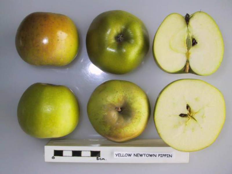
The Newtown Pippin originated by chance on the Gershom Moore estate sometime between the late 17th and early 18th centuries. The source tree popped up on the grounds located on what is now Broadway and 45th Avenue and became widespread since then. It was commonly used in dessert recipes during Colonial times and was eventually grown in the Castle Hill region of Virginia by former presidents George Washington and Thomas Jefferson.
The apple species adopted the alternate name “Albermarle Pippin” after Albermarle County in Virginia where it became heavily cultivated. It even became a vital export to the United Kingdom for a long period just before the start of World War II.
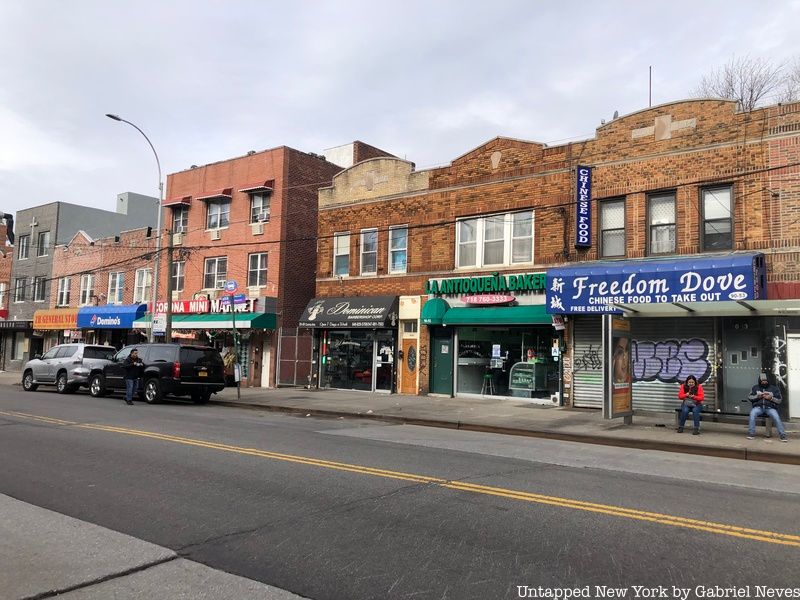
Elmhurst is one of the most ethnically diverse urban areas in New York City, with a majority of residents originating from Latin America and throughout Asia. According to the Census Reporter, as of the 2019 census, 65.1% of the neighborhood’s population is foreign-born, with 55% coming from Latin America and 40% from Asia. Streets in the neighborhood such as Corona Avenue and Broadway demonstrate how these cultures have blended together through cuisine, fashion, and retail.
Most of the Latinos that live in Elmhurst originate from Mexico, Ecuador, and Colombia. Dominicans and Puerto Ricans are also prominent in the area, as well as Peruvians, Argentinians, and Salvadoreans. Asians in the community are in large part from China, but smaller numbers are of Indian, Indonesian, Malaysian, Tibetan, and Nepali descent as well.
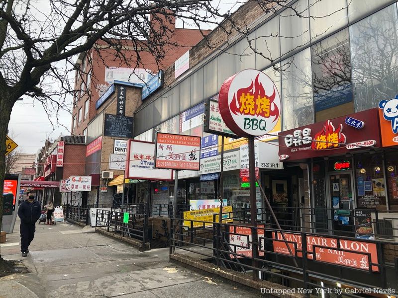
Along the winding avenue of Broadway, there is a multitude of shops, restaurants, and parks that make up one of the many “Chinatowns” in New York City. Large numbers of Chinese immigrants and second-generation Chinese-Americans began settling throughout the city by the 1960s, many of which were a part of the growing populations in Elmhurst and more recently in Corona.
Most of the store awnings and some street signs are written in Mandarin, while others gather in neighborhood parks such as Moore Homestead Playground to take part in folk dancing or Tai Chi groups. In addition to the high population of Chinese Americans, Elmhurst also has one of the highest concentrations of Southeast Asians in all of Queens. Malaysian Chinese, Singaporean Chinese, Vietnamese, Thai, and Indonesian residents make up the bulk of the community found along Broadway, Whitney Avenue, and 45th Avenue.
Following the American Revolution, a number of slaves in New York City were released by their owners or had escaped to different parts of the United States. The free Black community that developed in Newtown around the late 1830s began establishing their own community in that part of Queens. People came together to construct one of the first Black churches in the United States and used it not only as a place for religious gatherings but also for community bonding and strengthening.
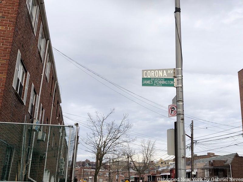
One of the more prominent figures of the community was a formerly enslaved blacksmith named James Pennington. He was a leading abolitionist in America at the time and even has a street sign in his name on Corona Avenue and 90th Street. Once slavery was federally abolished in 1865, the population of Blacks in Newtown dissipated as they moved to other parts of the city or country. Remnants of such history still remain in the area, such as the St. Mark’s African Methodist Episcopal Church and a former burial ground located on the same intersection as the James Pennington sign.
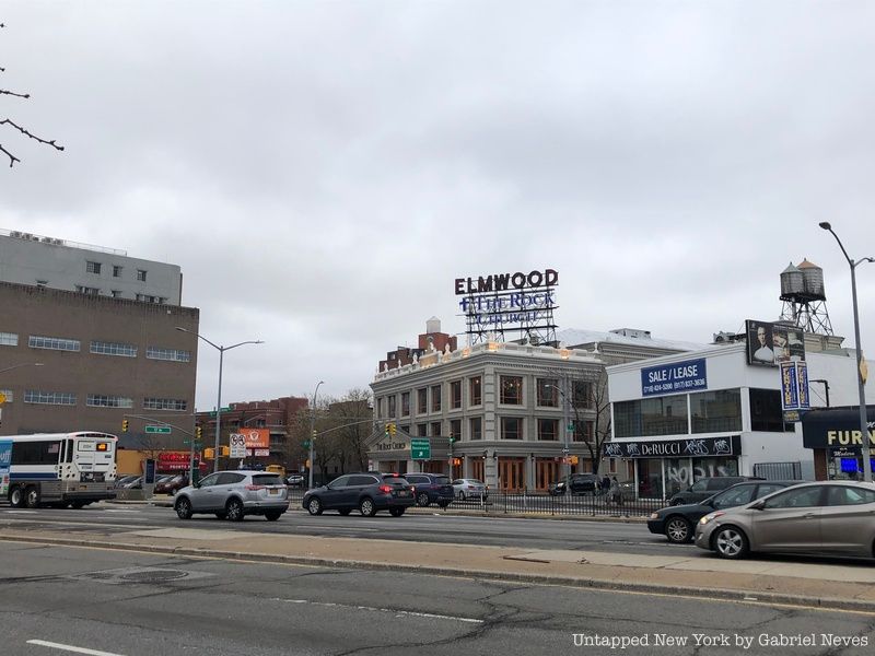
The Elmwood Theatre was supposed to be demolished and replaced with a larger cinema complex, but that plan was never actually carried out. The theater opened in 1928 and was the very first “Atmospheric” style movie theater to be constructed in Queens. It was originally named the Queensboro Theatre until naming rights were bought over by Interboro Circuit Inc. in 1946. Major media company Sony later bought the cinema from Interboro and kept it open until 2002, when the 18-screen multiplex was proposed.
There were expectations in the community that the renovation project would go ahead after a Sony-owned cinema near Elmwood on Queens Boulevard was shut down for the very same reason. The Elmwood Theatre has instead been modified into a church and auditorium, replacing the previous four-screen theater. Its façade has undergone extensive alterations, including discarding or covering with stucco some of the ornate 1920s glazed terra-cotta. The facility has been used throughout the pandemic to store food, water, and supplies for organizations such as City Harvest.
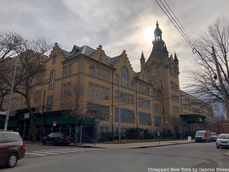
Newtown High School, located between 48th and 50th Avenues and 90th and 91st Streets, was designed by architect C. B. J. Snyder in the early 1900s. A larger building replaced the small wooden schoolhouse that existed on the property until 1897. The building was made with materials such as terra cotta and limestone and features an array of corbelled cornices, a 169-foot tower with turrets and a cupola, beige bricks for its outer facade, multi-shoulder flat arch lintels, and many other distinct features.
Snyder’s intentions were to replicate the building style from the neighborhood’s time as a Dutch colony in the 17th century. A few other additions were put in place to accommodate the growing school population while maintaining the architectural style that Snyder had in mind. The architect served as the Superintendent of School Buildings for the Department of Education from 1891 to 1923, contributing to the structural development of over 400 different schools across the city.
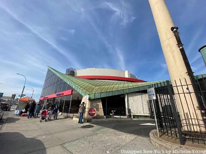
Architectural firms were looking to promote the borough of Queens to tourists who were visiting the World’s Fair in 1964 by designing buildings with a distinct format. The Modernist-style Jamaica Savings Bank is a “relic of jet-age design” and is constructed with sharp, wing-like structures on its copper roof.
It was built between 1966 and 1968 and was designed by architect William Cann. Despite it being a recognized landmark by the Landmarks Preservation Commission, the New York City Council voted to overturn its designation in 2005. The building now houses one of the Elmhurst branches of Capital One Bank.
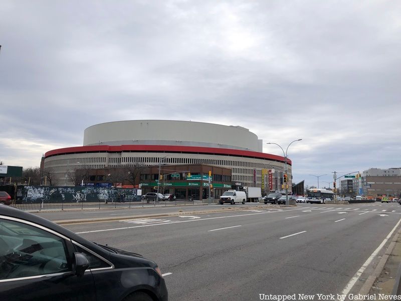
The coliseum-shaped shopping center on Queens Boulevard opened to the public in 1965 and was originally owned by Macy’s. When creating a plan for the mall’s construction in the late 1950s, the company concluded that 10 properties located along 55th Avenue would need to be demolished to accommodate the mall’s modernist design.
One of those property owners was Mary Sendek, who had lived with her husband Joseph in that very same house since 1925. Macy’s made numerous offers to purchase the property, but Mary wouldn’t budge. The company instead decided on sacrificing the mall’s intended circular design to prevent it from overlapping the Sendek property. This is the reason why there’s a seemingly uncharacteristic indent along the outside of the mall. The property was eventually demolished sometime after Mary Sendek’s death in 1980 and was converted into a small office building.
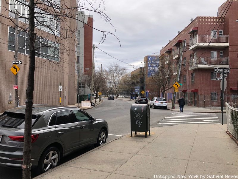
The express throughway of Queens Boulevard was designed to provide commuters from as far as Suffolk County on Long Island with express access to Manhattan via the Queensboro Bridge. During the construction of the IND Queens Boulevard Line, the Department of Transportation opted to widen the boulevard and install grade separation along certain intersections to create a highway-like design. The boulevard was just a dirt road up until the late 1800s and was comprised of both Hoffman Boulevard and Thompson Avenue.
Next, read about the top 10 secrets of Corona, Astoria, and Long Island City!
Subscribe to our newsletter