Last-Minute NYC Holiday Gift Guide 🎁
We’ve created a holiday gift guide with presents for the intrepid New Yorker that should arrive just in time—
We’ve created a holiday gift guide with presents for the intrepid New Yorker that should arrive just in time—

From lobster traps to origami animals, discover how quirky trees are decorated across the five boroughs!


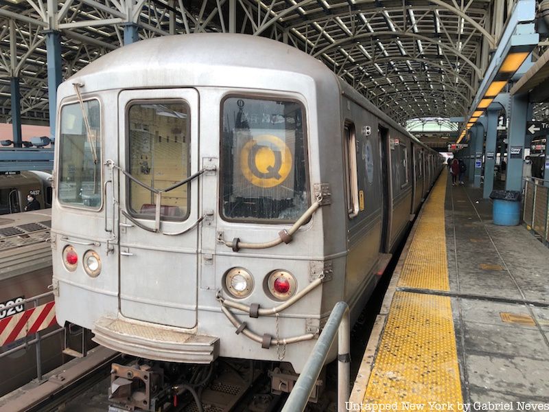
Welcome to another installment of Untapped New York’s “End of the Line” series, this time on the Q train, which runs from 96th Street on the Upper East Side down to Coney Island-Stillwell Avenue in Brooklyn. The Q has been in operation since 1920, when it was operated by the Brooklyn-Manhattan Transit Corporation (BMT). The segment of tracks running from Prospect Park to Coney Island was originally part of the Brooklyn, Flatbush, and Coney Island Railways that utilized steam-powered locomotives. Service on the railway began in 1878 and was modified a few decades later with electrified third rails to accommodate the introduction of subway car units to the system.
Even though the Q train has provided subway riders with service on the Brighton Line and on Broadway in Manhattan throughout its existence, it also ended up on a few other sectors of the system in Queens. The “1 Brighton Local”, as it was labeled in its early days, ran from Coney Island-Stillwell Avenue and terminated at 57th Street-7th Avenue station in Midtown. In 1949, the designated 57th Street terminal was moved to the Astoria-Ditmars Boulevard station on the newly constructed IRT Astoria Line. Throughout the 1950s and ’60s, the Q train was expanded to serve passengers as far as Jamaica along the IND Queens Boulevard Line, terminating at the Jamaica-179th Street station that now serves the F, and in some cases the E. The Q train had returned to serve along the Astoria branch by the early 2000s until the MTA decided to reinstate the W line. This subsequently led to the Q’s northern terminal being moved back to the original setup from the early 1920s at 57th Street-7th Avenue.
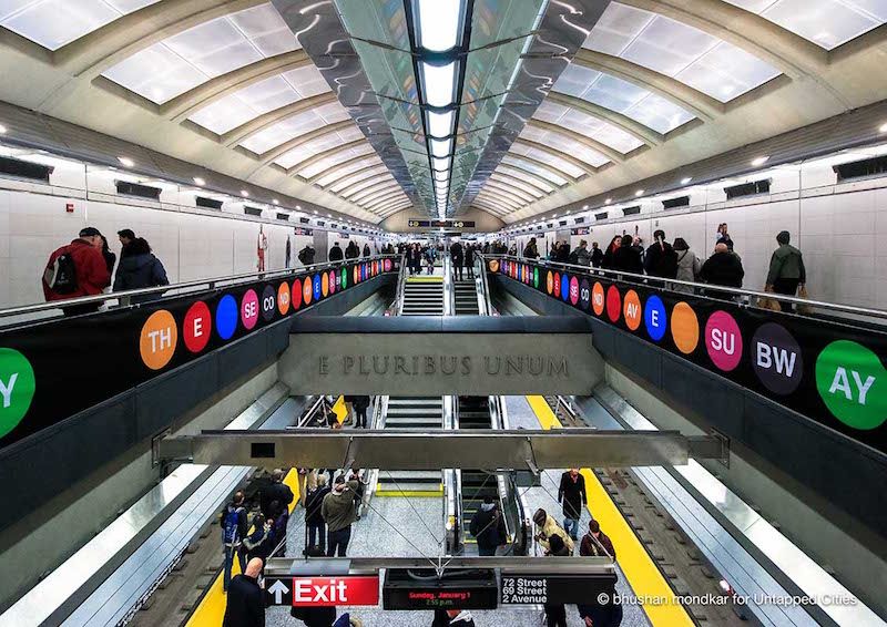
The line was finally extended to its current terminal at 96th Street back in 2017 as part of the MTA’s Second Avenue Subway project. The additional stations along the route were crucial in reducing both congestion along the Lexington Avenue Line and the dependency on buses for commuters in the Upper East Side. Construction along Second Avenue had started a few decades ago, but remained incomplete when the city fell into an economic crisis in the early 1970s. The first phase of the project cost around $4.5 billion and added new stations at 72nd Street, 86th Street, and 96th Street. Work was also done on the Lexington Avenue-63rd Street station to offer riders a connection to the F line. The remaining phases of the Second Avenue Subway project will look to extend the line further uptown to 125th Street in Harlem, and downtown to Hanover Square in the Financial District.
The rolling stock on the Q train consists primarily of R46 subway cars (168 units, 21 complete trains) and one complete train of R68 units. The R46 was built by the Pullman Standard Company and first went into service in 1975. Each subway car is 75 feet long and is the joint longest individual unit out of the NYC Subway’s entire rolling stock. These units can be found on other lines in the system like the A, C, N, and W trains. They are expected to be decommissioned in the next few years by the MTA to make way for the new R211A units that were recently purchased from Kawasaki Heavy Industries.
Now, let us take a look at the first terminal on the Q train: 96th Street!
The northernmost terminal for the Q train heading to Coney Island is located in a section of the Upper East Side called Yorkville. The area is known historically as an important camping ground for George Washington’s Continental Army during the American Revolution. The forces in Yorkville were positioned along the East River to protect Manhattan from British invasion and to support troops on Long Island if a retreat was ordered. That retreat did in fact happen, which prompted the division to regroup and fight successfully in a battle at Harlem Heights in 1776.
Yorkville has been home to a mixture of middle and working-class families since the 1850s. The largest populations consisted primarily of German and Irish immigrants, with Slovak, Czech, Hungarian, Polish, and Lebanese people also present in the area. The neighborhood saw a major increase in its German population after the General Slocum disaster that occurred just off the shore of Yorkville in 1905. A majority of the passengers were from a German church that congregated on the Lower East Side, which inspired them to move uptown as a way to unite and display solidarity for the victims of the accident. German culture is prevalent in the neighborhood to this day with restaurants, bakeries, and an annual Steuben Parade displaying the heavy influence on Yorkville’s current demographic.
Yorkville has seen a steady decline in its ethnic diversity ever since the end of the 1920s. Central European residents had been trickling away from the neighborhood ever since the end of the First World War due to heightened tension around their nationalities. This social predicament was also coupled with the demolition of the elevated subway line on 3rd Avenue in 1955. Mansions and businesses located near the El were destroyed during the demolition process and were replaced with high-rise buildings to accommodate newer residents to the neighborhood.
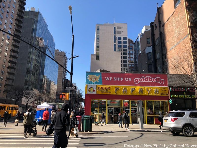
One notable landmark is the Papaya King located on the corner of 86th Street and 3rd Avenue. It was the first-ever Papaya King location in New York City and has been in operation since 1932. It was known primarily for its tropical fruit drinks for the first several years it was open, but then it began selling fast food options like hot dogs, which was a popular fast food choice for German-Americans in Yorkville.
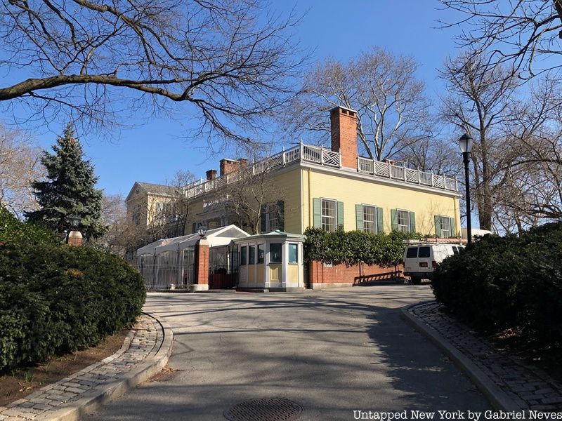
The Gracie Mansion, located on 88th Street and East End Avenue, has been the official residence for city mayors since the 1930s and is currently the home of Mayor Eric Adams and his family. The two-story, Federal-style wooden mansion was completed in 1799 on the site of the Belview Mansion, which served as a strategic lookout point during the Continental Army’s encampment. The mansion is also used as a museum, offering visitors guided tours of the property and the building itself.
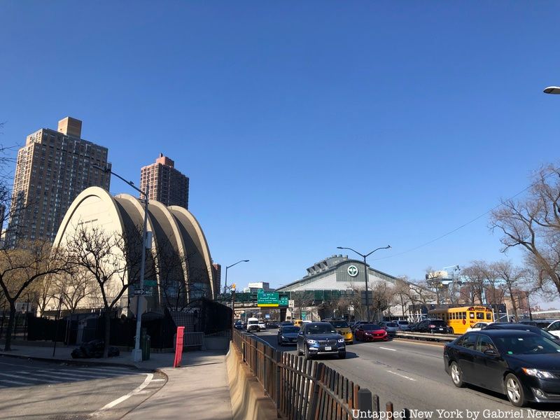
The Asphalt Green recreation center on 91st Street and York Avenue got its name from the Municipal Asphalt Plant that was built there in the 1940s. The same building is used today by the recreation center and is characterized by its arched shape made of reinforced concrete. The building is also close to one of the Department of Sanitation’s (DOS) main waste transfer facilities sitting on the other side of the F.D.R. Drive. Yorkville residents have made numerous complaints about the noise of trucks driving in and out of the facility, as well as the stench from the 5,000 tons of waste processed there each day. The location is strategic to the DOS because it reduces truck emissions and eases pressure on certain neighborhoods in the city that have limited means to transport the waste collected from their streets.
Now that we had the opportunity to venture around the neighborhood, let’s ride the line!
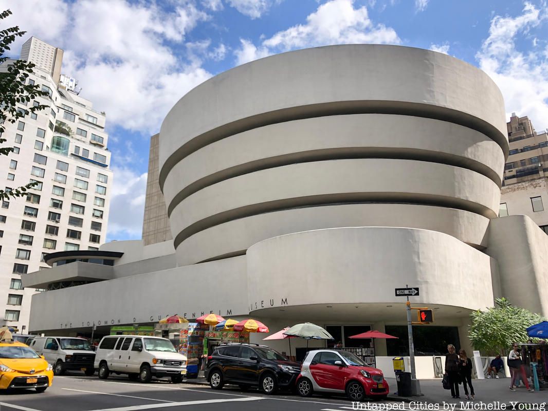
The Q train begins its journey heading down the newest portion of its route on Second Avenue, stopping at 86th Street and 72nd Street before making a turn onto 63rd Street. It departs Yorkville and passes through subsections of the Upper East Side known as Carnegie Hill and Lenox Hill. The area contains the greatest concentration of wealth in the entire city and is known for its above-average living costs. A number of famous museums and landmarks such as the Solomon R. Guggenheim Museum, the Metropolitan Museum of Art, the Park Avenue Armory, and the Gilded Age Fifth Avenue mansion of Andrew Carnegie (now home to the Cooper Hewitt Smithsonian Design Museum) are all located in these neighborhoods.
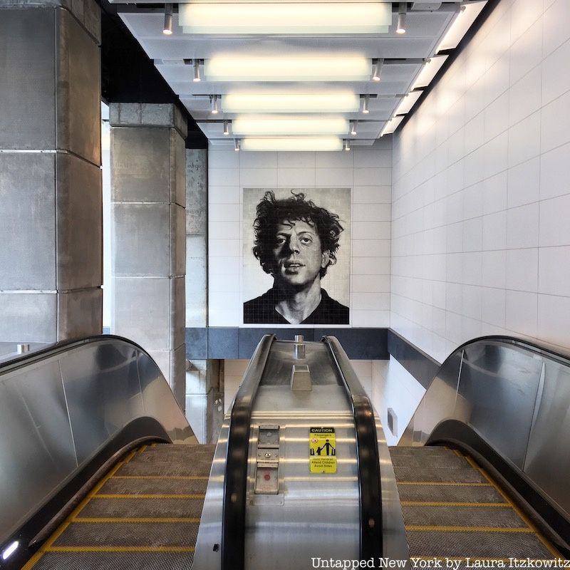
The Lexington Avenue-63rd Street station is the first stop that allows passengers to transfer over to a different line in the system. The F train stops on the opposite side of the platform and provides service between Jamaica-179th Street in Queens and Coney Island-Stillwell Avenue. Passengers also have access to a free, out-of-station transfer if they walk a few blocks down to 59th Street where service to the N, R. W. 4, 5, and 6 trains is available. The station was renovated in 2017 as part of the Second Avenue Subway project and was modernized with sound-absorbing wall panels and a number of mosaics and lighting features.
The Q then pulls out of the station and passes under the lower section of Central Park before it makes a turn onto Seventh Avenue. Now heading south, the train merges onto the same line as the N, R, and W trains before it enters the 57th Street-7th Avenue station. The original Q train terminal leaves passengers in the heart of Manhattan with major attractions within walking distance from the station. Carnegie Hall is just across the street from the main exit, while the Museum of Modern Art, the SPYSCAPE Museum, and Central Park are also close by.
The Q train proceeds to make its first express stop on the route as it bypasses 49th Street and heads straight into the subway’s central hub at Times Square-42nd Street. Trains make local stops in Manhattan during late-night service, but offer one of the quickest options for commuters to travel down Broadway during the daytime. Stopping at the busiest station in the entire system provides connections to 11 different subway lines and the Port Authority Bus Terminal.
The next stop on the line is at 34th Street-Herald Square. The major commercial center at Herald Square was named after the former headquarters of the New York Herald. The building used to be located on the square itself, which is now a green space with a monument and seating area. Greeley Square, located just a few hundred feet from Herald Square, was named after the publisher of the New York Tribune, which was the Herald’s rival newspaper in the late 19th century. The spot on 34th Street is now widely recognized as a popular commercial center and is usually bustling with shoppers and tourists from around the city.
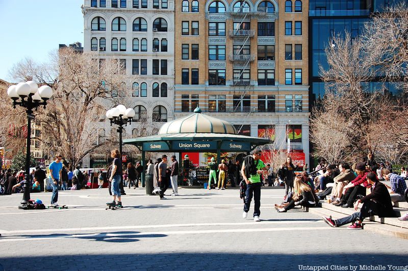
The Q train then proceeds to ride past 28th and 23rd Streets before stopping at 14th Street-Union Square. Construction of the square was completed in 1882, but it had been laid out as a public space as early as 1832. It features a number of statues and monuments dedicated to figures like George Washington, Mahatma Gandhi, and Abraham Lincoln. The area was home to the Rialto, one of the very first theater districts in New York City. This was a time when most of the theaters on Broadway were located around the Bowery and 14th Street before they eventually migrated up north to the current Theater District. The area developed in the early 1900s as a prominent space for the development of offices, businesses, and tenements. It later became a common space for farmers’ markets, social activism rallies, and street chess.
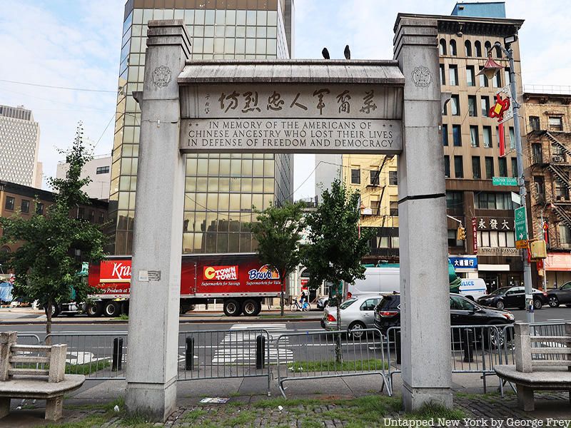
The next and final stop in Manhattan is Canal Street in Chinatown. Transfers at the station are available for the Queens-bound J and Z trains, as well as the R, W, 4, and 6 trains. As one of the stations with the highest ridership in the entire system, it demonstrates the sheer density that exists in a neighborhood with the highest population of Cantonese speakers in the Western Hemisphere. The streets of Chinatown are filled with vendors selling all kinds of goods ranging from jewelry and handbags to fruits and vegetables. Little Italy nearby also contributes to the high number of tourists that visit the historic neighborhoods in this portion of Lower Manhattan.
As the train leaves Canal Street, it first passes over the Manhattan Bridge and offers riders a view of New York Harbor. Now, on to Brooklyn!
After crossing the bridge and heading down into the tunnels below, the Q train travels a bit further into the borough before making its first stop at DeKalb Avenue, where transfers to the B, D, and R trains are available. The station is nestled on the corner of both Downtown Brooklyn and Fort Greene and is a commonly used station for students commuting to and from Long Island University and Brooklyn Technical High School. The neighborhood of Fort Greene was named after Nathanael Greene, who supervised the construction of a Revolutionary War-era fortress that was built in the area in 1776. Downtown Brooklyn, on the other hand, has undergone an extensive amount of rezoning since the start of the 21st century.
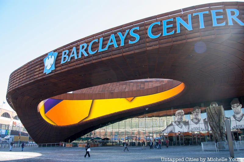
The next stop in Brooklyn is Atlantic Avenue-Barclays Center. The station is a key commercial and transportation hub for commuters traveling around the borough and for those coming from Long Island. Connections are available to the 2, 3, 4, 5, B, D, N, and R trains, as well as the Long Island Rail Road. The commuter rail station opened up in the early 1900s, but was renovated in 2010 to accompany the building of the Barclays Center, which was completed in 2012. The arena is used for concerts and conventions, but it serves primarily as the home venue for both the Brooklyn Nets and New York Liberty basketball teams. The roof of the Barclays Center is covered in a flowering plant called sedum, which engineers put in place to help reduce the amount of noise that emanates from the stadium during games and concerts.
The next station at 7th Avenue sits midway down the borderline of Prospect Heights. The interior section of the neighborhood is regarded for its brownstones built as far back as the 1890s. This is why most of the neighborhood is designated as the fifth-largest historic district in the entire city. The neighborhood’s layout and grid design is also uncharacteristic because of the Native American trails and farm boundaries that existed on the land prior to its development. For instance, the section of land between Underhill and Washington Avenues contains certain streets which angle in ways that counter the traditional grid system used by city planners.
Riding under Grand Army Plaza down Flatbush Avenue, the Q veers slightly to the right to make stops at the Prospect Park and Parkside Avenue stations. These are the first stations below street level, but still in open-air. The first of the two stops offers transfers to the B and Shuttle train, linking riders with the A and C line further north at Franklin Avenue. Both stations offer passengers access to Prospect Park, which opened to the public in 1859 and is the second-largest park in the entire borough behind Marine Park. The park’s construction focused on natural aesthetics and was intended to replicate the kind of ideals that were expressed in contemporary paintings. More than eight million people visit the urban park every year and come to paddle on the pond, ice skate at the LeFrak Center at Lakeside, or take in the many monuments, boathouses, footbridges, and flower gardens.
The next five stations on the Q train initiate the rest of the line’s trip above ground as it runs through the Flatbush section of Brooklyn. The Church Avenue and Newkirk Avenue stops provide a transfer to the B train that runs on the express track alongside the local Q. Beverley Road and Cortelyou Road are the stops in between while Avenue H comes after Newkirk Plaza.
Flatbush got its name from the Dutch translation for “flat woodland” or “wooded plain” and consists of multiple subsections such as Kensington and Midwood. Housing, along with the culture, varies distinctly from street to street. For instance, buildings along Avenue H are made up of townhouses and Victorian homes until the intersections at Ocean Avenue and Ocean Parkway, where pre-war co-ops and apartment buildings are more common. Almost 50% of the population living in Flatbush are Black, many of whom are immigrants or second-generation descendants from the Caribbean. Despite this, subsections of the neighborhood are quite evenly distributed demographically and aren’t necessarily sectionalized. Mexicans, Kenyans, Guyanese, Pakistani, Italian, and Irish residents make up a small portion of the many different ethnicities found throughout the neighborhood.
The following stations at Avenue J, Avenue M, and Kings Highway are situated in the Midwood neighborhood of Brooklyn. A large percentage of the people that live here are immigrants or descendants of immigrants who came from the former Soviet Union in the 1970s and ’80s. Midwood was going through a revamp at that time after many of its original residents chose to move out of the city and into suburban neighborhoods on Long Island or in New Jersey. Kings Highway, one of the express stops for the B, was close to a family-owned restaurant chain called Dubrow’s Cafeteria. The owners were of Belarusian descent and were popular enough that John F. Kennedy came out to the location on Kings Highway to host a rally for his presidential campaign.
Avenue U, Neck Road, and Sheepshead Bay are the next three stops along the Q train route before it crosses over the Belt Parkway and makes a turn onto Brighton Beach Avenue. Sheepshead Bay was named after a common species of fish called “sheepshead” found in the nearby bay. It was originally a fishing and farming community before it started to transition into a getaway beach destination for New Yorkers in the 1840s. Farmland was divvied up to make way for resorts, hotels, and restaurants while the construction of the Sheepshead Bay Race Track led to a peak in tourist visitation. After the establishment of amusement parks in nearby Coney Island, the area lost its appeal and eventually became the residential neighborhood that it is today. Much like Midwood, Sheepshead Bay saw a high population of Russian, Central Asian, and Jewish immigrants in the latter part of the 20th century.
Brighton Beach and Ocean Parkway are the next stops on the Q train in the Brighton Beach section of the line. Views of the beach and the Atlantic Ocean are now clearly visible to passengers on the train as it winds closer towards the last stop in Coney Island. The neighborhood is a popular summer destination for city residents and is separated from the more crowded portion of the beach and boardwalk further to the west. Russian-speaking immigrants are also common in the area, as well as Georgians and Azerbaijanis.
Ocean Parkway and West 8th Street-NY Aquarium are the two final stops before the Q train terminates its service in Brooklyn. The aquarium’s original location was in Battery Park before it was moved out to Coney Island in 1957. Like much of the surrounding area, the facility was hit hard during Hurricane Sandy in 2012 but managed to preserve most of the plants and animals living there.
Now, finally onto Coney Island-Stillwell Avenue!
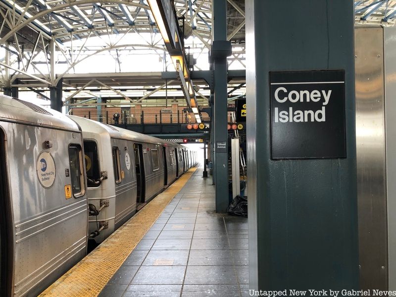
The last stop on the Q train at Coney Island-Stillwell Avenue is 14 miles away from its other endpoint back at 96th Street on the Upper East Side. The terminal is also the endpoint for the D, F, and N lines that the Q shares a track with on certain segments of its route. The station itself was designed around 1920 to accommodate the large swaths of people anticipated to visit Coney Island every summer. The number of platforms and lines terminating at the station was put in place to make sure that the resort area was as accessible as possible.
The neighborhood of Coney Island is mostly known for its beach and amusement parks that have been open since the 19th century. Much of the land on the peninsula was filled in to establish a much broader connection with the mainland of Long Island. The name “Coney Island” translates to “rabbit island” in Dutch, which comes from the large population of rabbits that lived on the peninsula during its earliest settlement period. In 1829, the Coney Island Bridge and Road Company constructed the Coney Island Hotel, which came to be the first actual beach resort structure in the area. Over the next several decades, developers continued to promote and invest in new projects until it became the largest amusement park in the United States in the late 1800s. It was a time and place of innovation and collective joy for New Yorkers looking to get away from city life.
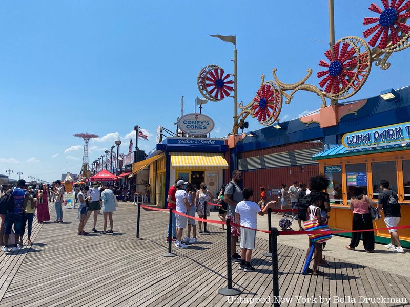
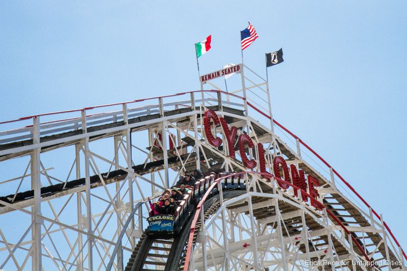
The amusement parks were divided into three separate ones: Luna Park (formerly Astroland), Steeplechase Park, and Dreamland. Because much of the technology was fairly new, a lot of the electronic components on the rides and attractions would spark fires and cause significant damage to the structures there. Officials would have to constantly renovate and rebuild in order to avoid further destruction and to reduce the danger to their customers. Major rides at the three parks are the Cyclone, the Wonder Wheel, the Thunderbolt, and the B&B Carousel.
The area is also a popular site for social gatherings, sporting events, and comedy shows. Seasonal congregations such as Noisefest and the Congress of Curious Peoples take place at theaters and other venues along the Coney Island boardwalk. The Nathan’s Hot Dog Eating Contest, an AVP Volleyball tournament, the Coney Island Film Festival, and the Freakshow are other examples of events held here. KeySpan Park, home of the minor league baseball team called the Brooklyn Cyclones, plays here as well.
Now, read about the secrets of Coney Island and the Upper East Side!

Subscribe to our newsletter
