

4. Ridgewood’s border with Bushwick, Brooklyn has remained in flux since the colonial period
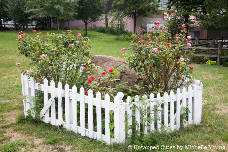
Since as early as 1661, the border between the boroughs of Brooklyn and Queens has been disputed, particularly among residents living in Bushwick, Brooklyn, and Ridgewood, Queens. During the colonial period, these disputes reflected the deeper conflict between Bushwick’s original Dutch settlers and Newton’s English inhabitants. To settle the debate, a bill was passed in 1786 to commission an official line between the townships. A year later, this border was measured from the Arbitration Rock, which also marked the dividing line between Queens County and Kings County. However, following the incorporation of Newton and Bushwick into the City of New York in 1898, Arbitration Rock began to lose its significance.
Eight years later in 1925, the Brooklyn-Queens border was redrawn to alleviate issues that arose as a result of the former boundary, which as a result of having been entirely straight often went through individuals’ homes — subjecting owners to double the taxes. As a result, the addresses of 2,543 persons were reassigned from Queens to Brooklyn and 135 from Brooklyn to Queens. Today, modern addresses along the border can be distinguished by the presence or absence of a hyphen in the house number, with Queens using a hyphen between the closest cross-street and the actual address. In Ridgewood, buildings on streets west of Forest Avenue and the Bay Ridge Branch follow the Queen’s numbering system while buildings on avenues running parallel to the country line bounded by Metropolitan Avenue do not.