


2. The Financial District Street Grid
The largest remnant of Dutch New Amsterdam, and one of New York City’s largest designated landmarks, is the street grid of the Finacial District. The street layout of Lower Manhattan appears today largely as it was in the 17th century, so you can quite literally walk the same paths as the earliest colonial New Yorkers. One of the streets even runs through a modern building.
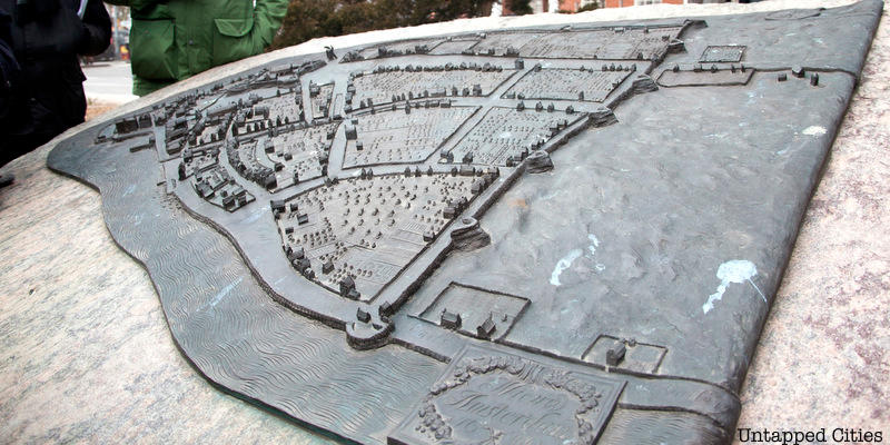
This original grid can be seen on the Castello Plan, a 1660 map of Dutch New Amsterdam. On the map, you’ll see street names like Begijn Gracht, Paerel Straet, and Brugh Straet. These names might not seem familiar at first glance, but their anglicized names are more recognizable: Beaver Street, Pearl Street, and Bridge Street. When the British took control in 1664, they changed many of the street names but kept the layout the same. Discover 10 streets from the original colonial NYC street grid here. A bronze sculpture of the map can be found at State Street, between the Staten Island Ferry and Whitehall Street.