How to Make a Subway Map with John Tauranac
Hear from an author and map designer who has been creating maps of the NYC subway, officially and unofficially, for over forty years!


Robert Caro, author of The Power Broker: Robert Moses and the Fall of New York, once referred to the Triborough Bridge (known officially as the Robert F. Kennedy Bridge) as “a traffic machine.” This nickname could not be more suited to the superstructure. Regarded as one of the most significant achievements of the Public Works Administration, the R.F.K. Bridge is comprised of a complex of three steel bridges that connect the Bronx, Manhattan, and Queens via 13,829 feet of roadway. Thousands of commuters speed over its roadways every day. Yet, despite its renown, it still holds many secrets.
According to New York Times columnist William Safire in 2008, the R.F.K. Bridge once held a sign, which advised travelers to drive off the bridge in the event of a nuclear attack. Since its roadway is located roughly 15 stories above the river, driving off the side of the bridge would have certainly resulted in death – surely not the route the sign intended. Safire first recalled the sign he saw in the 1950s in a 1993 Times article.
In the 2008 column, Safire also mentions the direct language used on signage that used to pepper New York City streets, like “Don’t even think of parking here” and “No Parking/No Standing/No Stopping/No Kidding.” The bridge sign, as Safire suggests, likely elicited a “wry smile” from passing motorists.
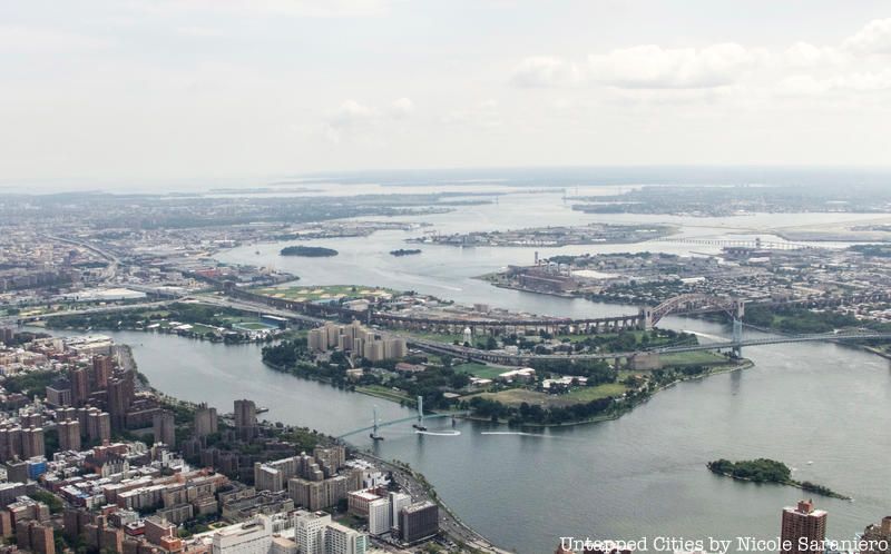
To avoid the mental institutions on Randall’s Island, the Triborough Bridge was originally intended to enter Manhattan at East 103rd, which would have been in direct line with Queens. Plans changed after a pause in construction during the Depression, after which the project came under the purview of Robert Moses at the WPA.
Instead, commuters must take a 25-block detour over Wards Island and Randall’s Island to East 125th Street due to the influence of William Randolph Hearst, who had wanted the city to purchase his deteriorating real estate in the area. Rather than hashing it out with Hearst, Moses decided to leave the Manhattan arm at 125th Street. This added 2.5 miles to every trip between midtown Manhattan and Queens.
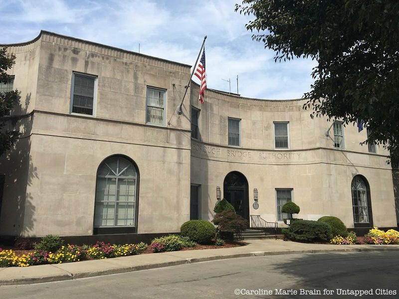
In 1937, the Robert Moses Building, originally called “the Administration Building,” was constructed on Randall’s Island next to the Triborough Bridge. It was designed by Aymar Embury II, the Chief Engineer behind the Triborough Bridge, the Queens Museum building from the 1939 World’s Fair, and the Bronx-Whitestone Bridge.
Although the Administration Building was meant to serve as the center of operations for the bridge, it eventually became office space for Robert Moses and the Triborough Bridge and Tunnel Authority, which currently oversees seven intrastate toll bridges and two tunnels in New York City. Forgotten NY writes that Moses was chauffeured to the building from Manhattan, as he did not know how to drive himself. As of 1982, drivers could still purchase tokens for the tollbooths from the Administration Building, as reported by the New York Times.
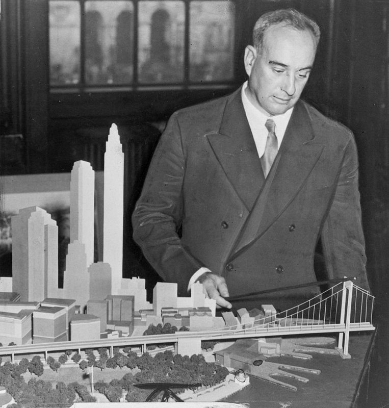
In 1966, a room was added to the old Administration Building to display Robert Moses’ collection of maps, charts, and models. Mockups of projects that were never constructed, including the Mid-Manhattan Expressway and the Long Island Sound Crossing, were stored there until the room was turned into office space following Moses’ retirement.
The models were then moved to various locations, including a storage area underneath the Robert F. Kennedy Bridge roadway. They were eventually transferred to the MTA Bridges and Tunnels Special Archive in the 1980s. Today, the archive holds a collection of 100,000 photos, 40,000 drawings, 50 scale models, and 40,000 feet of film footage. See a few photos from the archives of NYC’s famous bridges under construction here!
Although all three legs of the bridge have accessible sidewalks for pedestrians, walking across the Robert F. Kennedy Bridge isn’t as popular an activity as it is with other bridges in New York City. Due to safety concerns, the Triborough Bridge and Tunnel Authority Operations Force (TBTA) requires bicyclists to walk their bicycles across. The path is not continuous, so visitors heading from Queens to Manhattan or the Bronx must find a separate walkway in order to access the next span. Moreover, as reported by James Barron in the New York Times, the walkway puts pedestrians in close proximity to adjacent traffic.
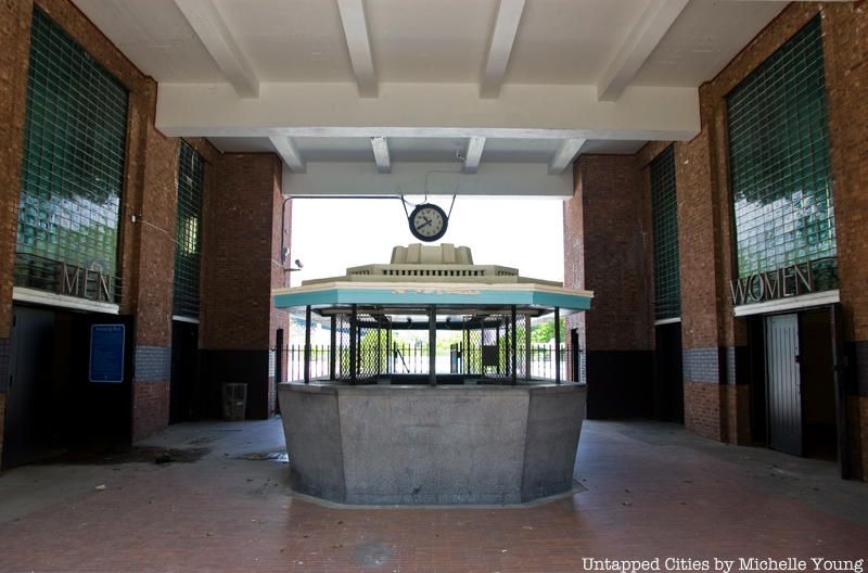
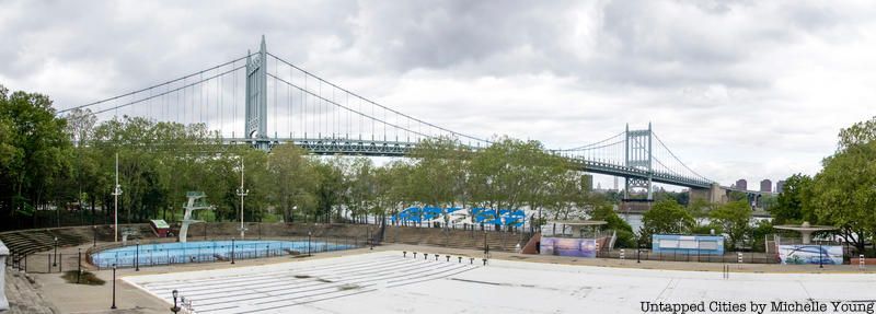
During the summer of 1936, Robert Moses initiated a campaign to open eleven new pools throughout the city. Today, Astoria Park, located along the East River, holds one of the largest swimming facilities in the country. According to legend, its main pool, which measures 330 feet in length, was purposefully designed to be grand because it held the best view of the Triborough Bridge, which was completed in the same year. Check out some of the fun Art Deco elements in this pool complex.
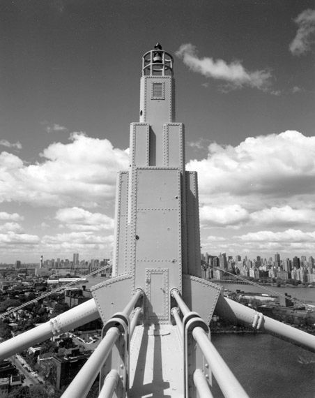
Othmar H. Ammann, the designer of the George Washington Bridge, was given the job to redesign the Triborough Bridge in the Art Deco style, which was characterized by geometric shapes and precise lines. This is why you can find four ornamental posts, held in place by a horizontal strut, between the legs of the bridge’s towers. Like the lamp posts and the tiered tips of the towers, these features serve no structural purpose.
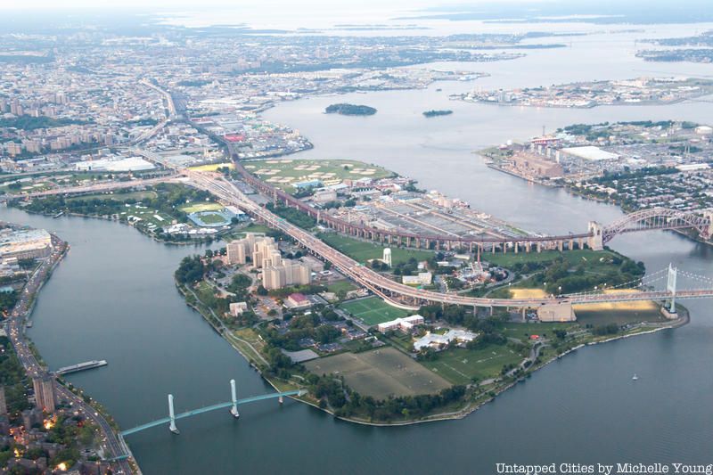
At the time of its construction, the scale of the Triborough Bridge project was truly unparalleled. According to Robert Caro, author of the Power Broker, entire apartment buildings had to be demolished to make way for its approach ramps. Even before its completion, its construction would have generated over 31,000,000 man-hours of work in 134 cities in twenty states.
Moreover, the total cost of the superstructure – $60.3 million in total – nearly matched the combined cost of all the Long Island projects Robert Moses had built in the previous ten years. Construction took seven years.
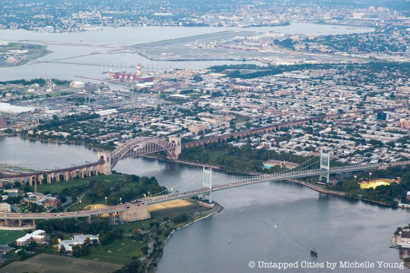
In 1931, the city obtained land in two parcels in Queens that would later make up the six Triborough Bridge Playgrounds. Located on Hoyt Avenue North and Hoyt Avenue South, between 21st and 26th streets, these playgrounds provide visitors with a range of recreational facilities, including swing sets, jungle gyms, and sitting areas, lined with trees.
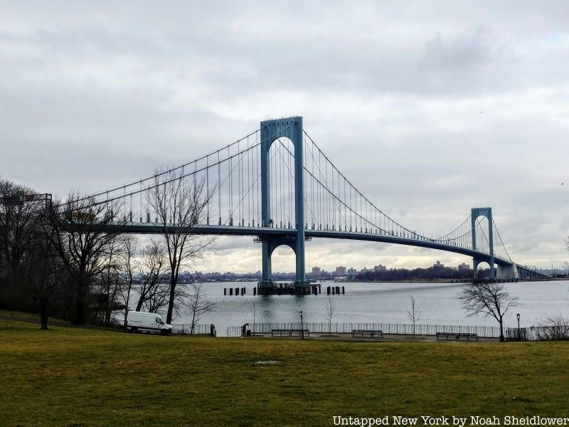
Aside from intercity travel, the Triborough Bridge was intended to connect Long Island state parks to the rest of the U.S. mainland. Upon its opening in 1936, drivers on their way to Jones Beach quickly began to congest the Grand Central Parkway. In order to provide relief from the traffic, Moses immediately moved forward with the construction of the Bronx-Whitestone Bridge.
Next, discover the Secrets of the George Washington Bridge and 5 Things You Can Blame on Robert Moses. Get in touch with the author Susan Xu, @heysuehey.
Subscribe to our newsletter