A Salvaged Banksy Mural is Now on View in NYC
This unique Banksy mural goes up for auction on May 21st in NYC!


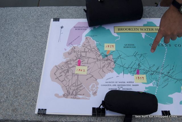
Once upon a time the independent city of Brooklyn considered its own fate as it faced both bankruptcy and drought as its quest to supply its own citizens with water was failing, and money was running out to provide vital services and keep roads paved. Ultimately Brooklyn chose to be annexed by the City of New York, at the time just Manhattan, to avert disaster. Water was a key turning point in this negotiation and, according to Manhattan Borough Historian Michael Miscione, certainly one of the main reasons Brooklyn–then the 3rd most populous city in the United States–chose to join what would become the uncontested largest city in America.
Although it was a failure, the Brooklyn’s attempt to supply its own citizens with water has left an interesting mark on the urban landscape of Brooklyn and Queens. We joined Matthew Malina of NYC H2O, a non-profit that focuses on environmental education, and Michael Miscione on a bike tour of the remnants of this system and received an in-depth history of how it was built and why it failed.
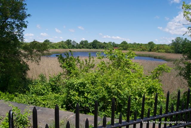
We met on a sunny Saturday just across the street from Highland Park on the border of Cypress Hills. Heading up Highland Boulevard, we came upon the first stop of the tour, Ridgewood Reservoir. While an aerial of the location makes it area look like just an extension of the park, an up-close view reveals this is actually reclaimed green space from a former man-made reservoir.
The reservoir was built in 1858 and held 154 million gallons to serve the growing, independent city of Brooklyn. That 154 million gallons would only supply Brooklyn for about 10 days however, so an additional supply was necessary. To fill the reservoir, water was pumped from collecting ponds that were created or purchased east, in more rural Queens. By 1889, the reservoir was the last link in the aqueduct system that collected water as far out as Nassau County. In 1891, the land surrounding the reservoir, now Upper Highland Park, was purchased by the City of Brooklyn to protect their reservoir system. The system should have worked in theory, but problems arose that engineers did not foresee. Land in Long Island was mostly sand or silt, which made the collecting ponds and reservoirs susceptible to leakage. Salt water intrusion from the inner bays was also a problem. To add to these problems, the system relied on steam engines to pump the water up to Ridgewood Reservoir, an expensive process that typically required 5,000 gallons of water a day. As the plans for Manhattan’s system were developed, it became apparent its gravity-forced system of collecting water from the Catskills would be both cheaper and of superior quality.
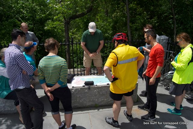
Manhattan Borough Historian Michael Miscione
The reservoir was designed by Brooklyn civil engineer Samuel McElroy and later altered by J.P. Kirkwood. Originally 2 basins were built next to each other, but as Brooklyn continued to grow a larger third basin was added. The outer two basins were drained decades ago and provide a unique opportunity to see forest succession at work. According to the Department of Parks and Recreation the east basin contains large sections of native plants such as Black Cherry, Grey Birch, Red Maple, and Sweet Gum trees. Sedges, grasses, rushes, and other wetland and upland plants thrive beneath them.
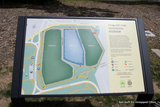
After the consolidation of 1898, it took another 20 years before Brooklyn could actually turn on the tap for Catskill/Delaware water. As that happened, the Ridgewood Reservoir became a redundant part of the system only used in case of drought. The third basin was connected with the NYC system, which allowed it to be used during a major drought in the 1960’s. From the 1970’s until the basin was drained in 1989, residents from the surrounding neighborhoods would sneak in the water to cool off in the summer and enjoy the upland breezes. Today, only Basin 2 is still filled with water and even then only a few feet deep, compared to the 20 feet it would be at capacity. Although smaller it still provides a nice habitat for migrating birds.
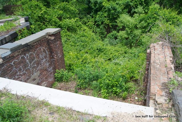
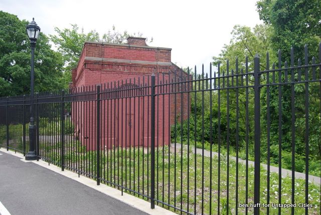
We rode our bikes around a newly-installed walking path that allows you to explore around each basin. Some of the original structures, including this gatehouse from the late 1800’s, line the path. Plans for their future are unclear, but there is an effort by local community groups to rehabilitate them to environmental education centers.
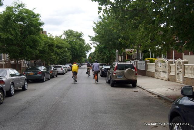
After the full exploration of Ridgewood, we took off on a route that is meant to mirror the path the force tube, or conduit that carried the water from collection ponds up to Ridgewood. This three by four foot tunnel could pump 14 million gallons of water a day up to the reservoir. As it happens, one of the roads we traveled is called Force Tube Ave. The avenue, along with Conduit Avenue and Sunrise Highway, were all built on top of the water system.
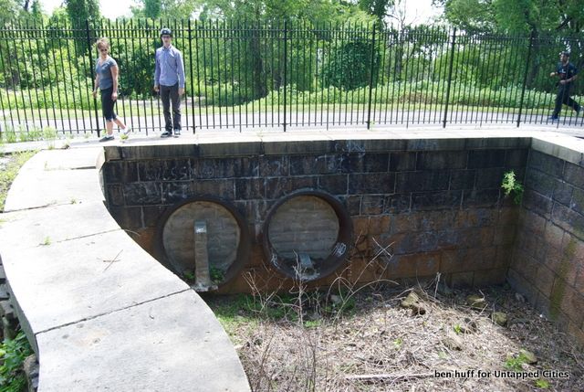
The abandoned force tubes that carried the water to Ridgewood Reservoir.

Before our final destination, we stopped outside a large piece of infrastructure that looked like a space saucer (above). This was a municipal well, another piece of water infrastructure which was built by the Jamaica Water Supply Company, a private water supplier. Wells get water by reaching deep enough to hit underground aquifers and pumping it to the surface. Jamaica Water Supply Company operated these until 1996 when the NYC Department of Environmental Protection bought them to become the sole supplier of water in the five boroughs. They operated in some capacity until 2007 when they were officially shut down. In the next few years, the Department of Environmental Protection plans to turn 33 of the 68 wells back on to supply the local area while it makes repairs the Delaware Aqueduct upstate.
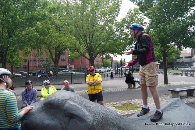
Riding on, we eventually reached our destination of Baisley Park Pond. As we entered through the playground, our tour guide made sure to show us his favorite part of the tour: a playground piece in the shape of the American Mastodon whose bones were unearthed by workers when they were dredging the land of nearby Baisley Pond. This creature probably hid in the area as the ice retreated at the end of the last Ice Age over 10,000 years ago.
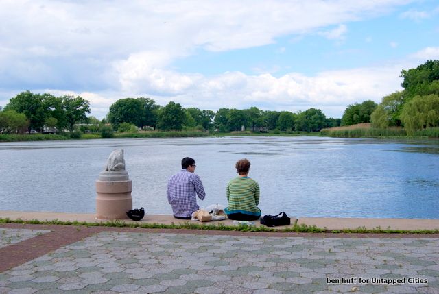
Baisley Pond itself is a modestly beautiful stretch of nature that was once a collecting pond for the Brooklyn City water supply. Surrounding streams collected groundwater runoff and fed into this low lying pond, which was then transported by pipes and pumping stations back to Ridgewood. This was the first collecting pond dredged by the Nassau Water Company, in which the city of Brooklyn owned a large share, in 1858. In the succeeding decades more and more were built, each further east than the last. On tours, NYC H2O sometimes travels as far out as Hempstead Lake in Nassau County, once part of the system. As Brooklyn’s system failed and was eventually replaced by the NYC water supply system, many of these sites sat unused for decades, before a young Robert Moses discovered he could easily link them together as parks–but that’s a story for another day (Robert Caro speaks a lot to this in his amazing The Power Broker

).
The tour was a great way to gain insight into the infrastructure that keeps the city running, and NYC H2O has two upcoming tours of the Bronx River (June 29) and Coney Island (July 3). Thanks again to NYC H2O’s Matt Malina for keeping us in the loop, and Manhattan Borough Historian Michael Miscione for his superb knowledge of abandoned water systems and New York City consolidation.
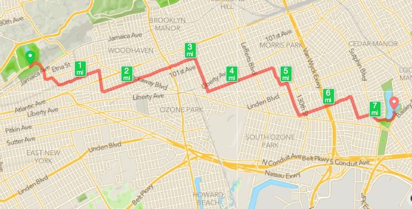
GPS tracking Map of our tour route.
Subscribe to our newsletter