A Salvaged Banksy Mural is Now on View in NYC
This unique Banksy mural goes up for auction on May 21st in NYC!


Yesterday, the 2014 Metropolitan Waterfront Alliance Conference fittingly took place aboard a Hornblower Cruise boat which took attendees on a tour around the New York City harbor while speeches and panels about rebuilding New York City’s waterfront took place.
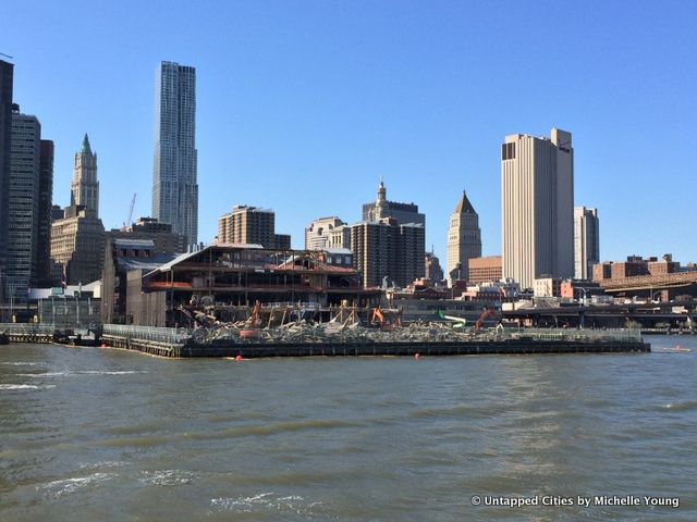
As the boat passed South Street Seaport, a small group congregated at the prow of the boat staring as plumes of dust seems to rise up from the river. The mall at Pier 17 was midway into demolition. Those working nearby said they had been documenting the demolition from their offices above, but the view from the river really brought a new perspective.

Meanwhile, aboard the boat speakers discussed the 19th century South Street Seaport Historic District, described by Jonathan Boulware, President of the South Street Seaport Museum as “truly at one point the front door to the United States of America.” General sentiments echoed some of the Untapped Cities readers, who feared about encroaching development that would leave out the communities that had long been overlooked nearby. See what the mall looked like the week it was closing and renderings of the new plans.
We posted an image to Instagram and found a genuine mix of reactions:
@untappedcities Terrible. Nothing is sacred anymore.
— Kyle Griswold (@KyleGriswold1) April 25, 2014
@k_ved @notsalome @untappedcities New York is overdue a few new interesting landmark designs…all that money – pedestrian architecture.
— richard lafette (@RichardLafette) April 24, 2014
@k_ved @BrooklynBrett @benhjacobs @untappedcities I’m gonna miss it. Was super fun as a kid in the 80s and early 90s
— Ed Bajwa (@EdBajwa) April 24, 2014
@untappedcities @PaulRieckhoff But where oh where will tourists shop? Oh wait… EVERYWHERE.
— Claire Silberman (@csilberman70) April 25, 2014
I’m gonna cry !!“@untappedcities: Demolition of South Street Seaport mall fully underway! #nyc pic.twitter.com/sLsSUZTcHF”
— NIRA (@j_nira) April 24, 2014
The end of an era. “@untappedcities: Demolition of South Street Seaport mall fully underway! #nyc pic.twitter.com/d8pv1pSk06”
— sngk (@sngk) April 24, 2014
Subscribe to our newsletter