Last Chance to Catch NYC's Holiday Notalgia Train
We met the voices of the NYC subway on our nostalgia ride this weekend!


If you’re a New Yorker who has ever complained about living far from the subway, we have news that will hopefully reassure you: there is someone who lives farther from a subway stop than you do. That is, of course, unless you’re that person. I Quant NY has quantifiably found the apartment farthest from a subway line in both Manhattan and Brooklyn. To obtain this data, the MTA Subway Station Entrance data set was combined with information on plots of land in NYC from PLUTO, an open data source also recently utilized in this fun map of building footprints in New York City. The distance from each lot to the nearest subway station was then found and measured against the rest.

Image via Tumblr: I Quant NY
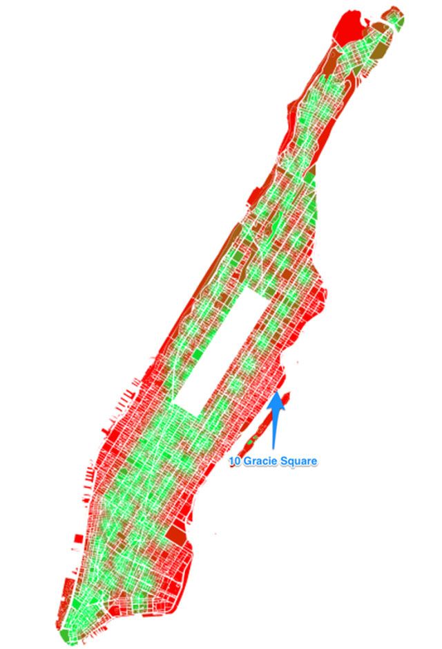
In this Manhattan map, red is the farthest and green is closest. The address found to be least convenient for a NYC subway user is 10 Gracie Square, just south of Gracie Mansion (the residence of the mayor). This address is a 0.8 mile walk from the 4, 5, 6 trains. But, with the 2nd Avenue subway line coming, the farthest residence from the subway in Manhattan will have to be recalculated.
To see where your Manhattan address stands, look it up on this I Quant NY Spreadsheet.
Meanwhile, in Brooklyn…..

Image via Tumblr: I Quant NY
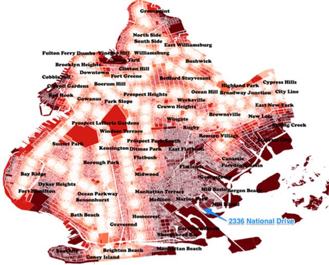
If you think the 0.8 mile walk that the residents of Gracie Square have to face is bad, then you’ll be shocked that these residents of Mill Basin in Brooklyn have 3.3 miles to walk to catch a subway. But if you consider the dock at 2336 National Drive, it might be worth it for quick access to any part of the city by boat!
So unless you’re a resident of 10 Gracie Square or own the lovely basin-side home at 2336 National Drive, you’re walk is not “the worst.” Check out more in our Fun Maps column.
Subscribe to our newsletter