How to Make a Subway Map with John Tauranac
Hear from an author and map designer who has been creating maps of the NYC subway, officially and unofficially, for over forty years!


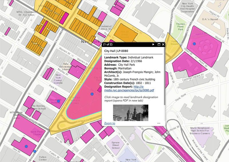
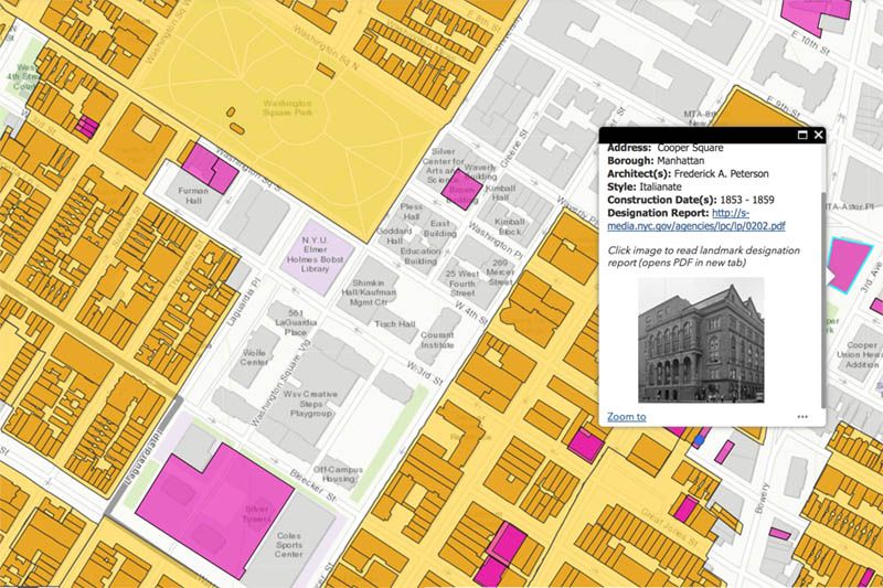
New York City is known for its stunning architecture, but much of what you will pass by on a daily basis holds little known or hidden histories. To make it easier for the public to learn the backstory behind historic buildings across the five boroughs, the Landmarks Preservation Commission (LPC) has launched an enhanced version of its 2016 interactive web map: Discover NYC Landmarks. Adding onto existing map information about 1,400+ New York City landmarks, this new iteration now includes detailed information on nearly 34,000 buildings located within New York City’s 141 historic districts.

“The launch of the enhanced web map will not only allow for a greater appreciation and understanding of our city’s rich architectural and cultural heritage, but it also brings greater transparency, efficiency, and public access to the agency,” said Landmarks Preservation Commission Chair Meenakshi Srinivasan. “This information is invaluable to all stakeholders, including homeowners who want to know more about their buildings, community groups, preservation advocates, historians, academics, and anyone who walks through New York City’s neighborhoods and marvels at our buildings.”
The Discover NYC Landmarks web map is based on data collected by LPC’s Historic Building Data Project. With the help of LPC staff and LPC’s GIS Administrator and Planning Analyst Daniel Watts, information about each building, collected from 50 years of the Commission’s historic district designation reports, was inputed into a Geographic Information System (GIS) database. Although this data has been available as scanned documents, LPC’s new map makes it much more accessible to the public — whether users are on their computers, smartphones or tablets.
In addition to providing background context, the maps offers information about a building’s construction date, its architect, its architectural style and more. Users can also filter out locations based on specific factors.
“The result is a highly accessible, robust and detailed set of information that can be easily searched and compared, allowing for a greater understanding of the City’s historic district buildings,’ said Lisa Kersavage, LPC Director of Special Projects and Strategic Planning.
The web map is just one of LPC’s initiatives to increase transparency and provide greater public access to a trove of information. View it here.
Next, check out this Interactive Map That Shows NYC in the 1980s and discover the Judgmental Map of NYC.
Subscribe to our newsletter