Celebrate St. Patrick’s Day in NYC 2025
Discover 10 ways to celebrate St. Patrick's Day in NYC this year, from eye-opening tours to Irish treats!


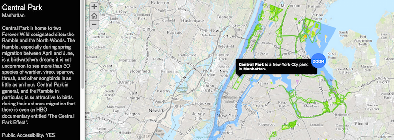
As the New York weather warms, the Natural Areas Conservancy has created a map to inform and encourage people to visit the parklands in the five boroughs. The Natural Areas Conservancy, which manages over 10,000 areas in New York City, recently underwent a massive undertaking to study over 51 parklands. After, they compiled all of their collected information into a new interactive map, which was unveiled yesterday.
“[The map] shows people what they can discover – the types of plant and animal species, including those that are rare or threatened – and what activities are most commonly found,” according to the press release. “An additional 10,800 acres of natural spaces managed by the State and Federal government were not included in the research,” it continues, “but speak to the vast landscape of natural areas within New York City’s boundaries.”

This enables any adventure seeker to easily look up information about his or her favorite New York City parks. Take for instance Central Park: it is almost a right of passage to visit this famous area. But even the seasoned New Yorker may not have known that it is filled with “more than 30 species of warbler, vireo, sparrow, thrush and other songbirds,” according to the map.
Nearly every area has a brief passage before the area is broken down by the numbers. It looks individually at the park size, forest, wetland, grassland and open water – if one clicks on any of these options, it will highlight the specific area.
But this is not only limited to the city’s most famous parks: any user can easily look up areas that are on the outskirts of the boroughs. For example, there is Marine Park, which is located in Brooklyn, just a few minutes away from Rockaway, Queens.
The residents in the area may not know that Marine Park was the site of a prehistoric Native American village and is the home to Brooklyn’s largest park, with it containing nearly 864 acres, according to the map. Much of that contains grassland, but it also has nearly 68 acres of forest and 41 acres of wetland.
This is just a fraction of the information that any nature lover could look up. There are 10,000 acres to explore, which anyone could do virtually before going there physically. “New Yorkers may be surprised to learn about the astounding natural diversity right in our backyard,” said Sarah Charlop-Powers, Executive Director of the Natural Areas Conservancy. “Our research will shape future conservation efforts as we work to make NYC’s wild places accessible to new audiences.”
Next, read about The Top 10 Secrets of NYC’s Central Park and 10 Under the Radar NYC Waterfront Parks Across the Five Boroughs.
Subscribe to our newsletter