Last-Minute NYC Holiday Gift Guide 🎁
We’ve created a holiday gift guide with presents for the intrepid New Yorker that should arrive just in time—


Map via Boston Public Library
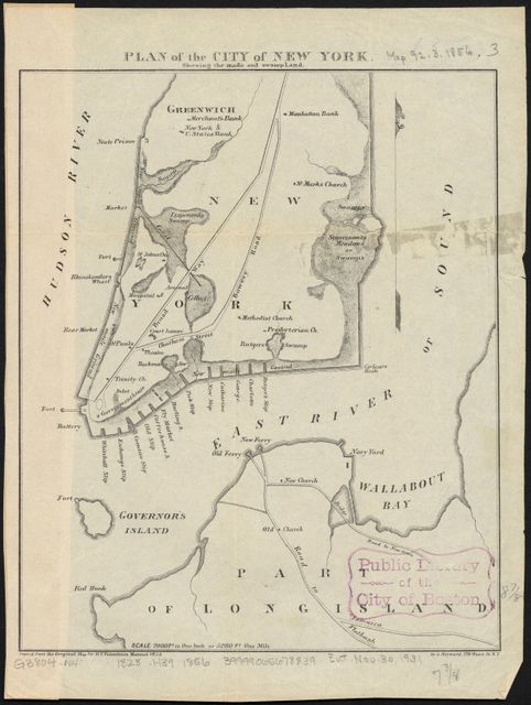
Back it the early days of New York, Manhattan was narrower, swampy and full of things called slips, narrow slivers of harbor left for boats as landfill extended the coastline. This map from D. T. Valentine’s Manual of the Corporation of the City of New York, currently on display at the Boston Public Library’s American Revolution exhibition We Are One: Mapping the Road from Revolution to Independence, maps the “made and swampland” of New York City and a bit of Brooklyn (then Long Island) in 1856.

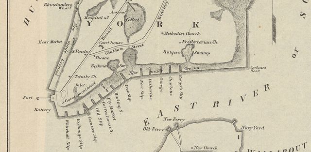
Along the coastline you’ll see the words “New Made Ground” for landfill, along with the many slips that existed along the East River side of Manhattan. Inlets, swamps and ponds dominate areas we know today as Tribeca, Chinatown, and Lower East Side. Fittingly, the slips have been filled in today but some remain in our street nomenclature and as parks, such as Coenties Slip, Catherine Slip and the future Peck Slip Park.

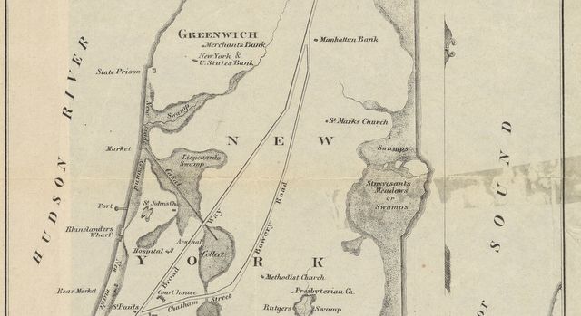
Like the 1811 Commissioners Plan that laid out the street grid, the important landmarks of the time are mapped, including Trinity Church, St. Paul’s Church, the courthouse at what is now City Hall, Castle Clinton fort then still in the harbor, the Red Fort off the coastline next to present-day Canal Street, Newgate State Prison in Greenwich Village, and St. Mark’s Church in the Bowery.
You’ll also notice the growing importance of banking during this era, with Manhattan Bank, Merchant’s Bank, and New York & United States Bank located on the map.
Next, check out 13 fun facts from the original 1811 Commissioners Plan for NYC and read more about the history of NYC’s slips. Get in touch with the author @untappedmich.
Subscribe to our newsletter