Last-Minute NYC Holiday Gift Guide 🎁
We’ve created a holiday gift guide with presents for the intrepid New Yorker that should arrive just in time—


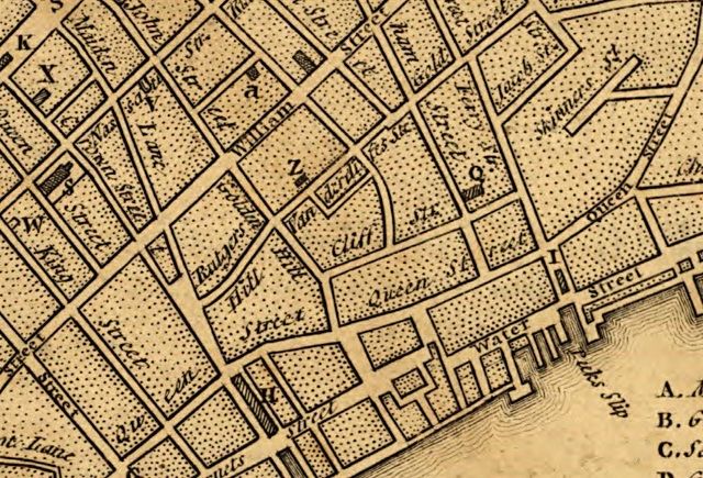
In this 1776 map, Great Queen Street is shown running diagonally, over modern-day Pearl Street. (via Library of Congress)
At the southern tip of Manhattan, the oldest part, the streets have names which often date back to colonial times. In a book by Don Rogerson entitled Manhattan Street Names Past and Present, he details the etymology of many New York City streets, often back to their Dutch roots. When the English took the city from the Dutch, they translated the old, more practical street names – Broadway for the broadest street, Bridge Street for the street with a bridge–while adding streets named after themselves and some named for royalty. If you look at a map of Lower Manhattan, you will see King Street and Prince Street. Where is Queen Street? Well naturally, there used to be several streets named for the Queen: Little Queen Street (now Cedar Street) and Great Queen Street (now Pearl Street).

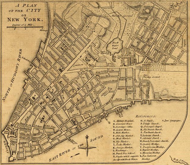
1776 map of Lower Manhattan drawn by Major Holland. (via Library of Congress)
Pearl Street is a special case because it now carries an English translation of its original name from 1660, Paerlstraet, around the time of the Castello Plan of New Amsterdam. The map above shows the street over a century later with its new moniker, Queen Street. Rogerson details that as New York City was the site of many battles in the American Revolution, it was a common for street names to be changed as a memorial for fallen soldiers or winning generals, anything to symbolize the newly severed ties to the crown.
What we now call Pine Street was called King Street on maps dated from 1693 to 1794. There was a second King Street that existed in this period as well. Modern-day William Street between Hanover Square and Wall Street was called King Street on the 1695 Miller Plan, according to the records on Old Streets. Interestingly, however, the name King Street remains until today–albeit as the name of an entirely different street, located one block south of W Houston St. running between Greenwich Street and MacDougal Street.
One block south of where today’s King Street ends is what we call Prince Street. Historically, the name Prince Street is drawn from an English translation (Prince’s Street) from the Dutch original name – Princess Straet. However, that name was used for a stretch of modern-day Beaver Street between Hanover Street and Wall Street prior to 1974. As Jim Henderson, prolific New York City photographer tells us, “Royal street names were abolished after Evacuation Day. King and Prince Streets are outside the urban area of the time. I suspect they received the surnames of later heroes.”
The only place where you can find a Queen or Princess Street in New York City today is Staten Island.
Don Rogerson has a great repertoire of maps he used in compiling his books at his website Manhattan Past. You can also look up the history of any street name at Old Streets. Read more from our History of NYC Streets series.
Subscribe to our newsletter