Last-Minute NYC Holiday Gift Guide 🎁
We’ve created a holiday gift guide with presents for the intrepid New Yorker that should arrive just in time—

Last night, the latest Blueprint video from NYCmedia about the transformation of The High Line premiered. Before the full episode is available for streaming, here’s a reminder of where we’ve come since the High Line was constructed in 1934.
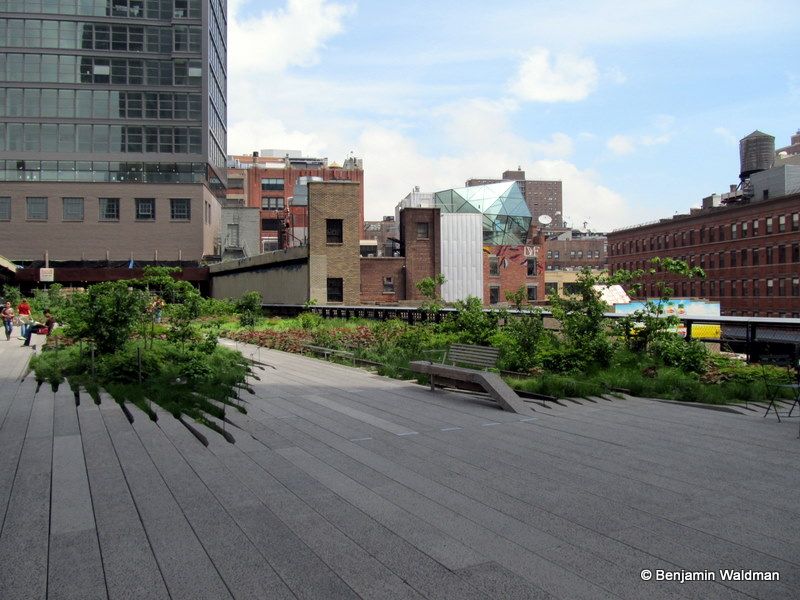
The High Line attracts nearly 6,000,000 visitors a year. Though thoroughly modern at every step, The High Line Park owes its success –and its very existence–to the past. In fact, the elevated train tracks that make up the current day park were originally constructed not only to deliver food to Manhattan, but also to save lives.
Prior to the construction of the elevated tracks, trains ran at street level, giving this stretch of Tenth Avenue the dubious nickname of Death Avenue. This corridor earned the moniker due to the consistent – and almost always gruesome – incidence of trains colliding with people along the busy thoroughfare, often resulting in fatalities. Before the trains were eventually elevated, the New York Central Railroad hired men on horseback armed with red flags to ride in front of the trains to signal its arrival. These men came to be known as The West Side Cowboys.
By 1934, Manhattan’s West Side Elevated Line was constructed as part of a massive urban redevelopment project, spearheaded in part by Robert Moses. This was not the only elevated train line in Manhattan at the time. Its novelty, however, came by way of its path, bisecting city blocks, rather than running directly over traffic. Trains running on the High Line unloaded their cargo directly into buildings on Manhattan’s West Side, such as the warehouses for the National Biscuit Company (Nabisco), the present-day Chelsea Market. The original High Line tracks ran as far south as Spring Street, almost twice its current length. Though by 1961, most of this southern section had been demolished.
As trucking became a more common form of freight transportation, the High Line saw a steady decline in use. Around this same time, industry decentralized from urban centers, further contributing to the decline in the High Line’s rail use as Manhattan’s West Side became the Meatpacking District in name only. Finally, in late 1980, the last train ran on the High Line carrying three carloads of frozen turkeys just in time for Thanksgiving.
As the 1980s made way for the 1990s, most residents of Manhattan’s West Side saw the High Line for what it unfortunately had become: a rusty relic, a bygone blight getting in the way of a neighborhood’s redevelopment. In certain places, the High Line literally got in the way of property owners desire for upward growth. And in late 2001, the tracks very nearly met their demise when Mayor Rudy Giuliani signed an order for their demolition just days before leaving office.
Meanwhile, up on the tracks, something unexpected was happening: nature was taking back the abandoned stretch of rail line. Seeds began depositing on the High Line by way of winds and passing birds. In a short time, wild flowers and other unintended growth began to take form. The tracks appeared rusted and muted to pedestrians and neighbors. But, along the mile-and-a-half stretch, nature was taking back that which the City had abandoned.
Explore the third section of the High Line, when it was still abandoned
This transformation was by no means a secret. Down at the street level, Joshua David and Robert Hammond founded Friends of the High Line, a nonprofit dedicated to repurposing the train tracks for public use. Around the same time, CSX Transportation, then owners of the tracks, commissioned photographer Joel Sternfeld to document the serene transformation afoot on the abandoned tracks. As these images circulated, public favor for the public space plan grew. Diane von Furstenberg being the nascent park’s most well known early advocate.

Luckily, Giuliani’s demolition orders never took hold, and in 2004, then Mayor Michael Bloomberg committed $50 million to the park’s redevelopment. By 2009, the first phase opened with the second and third phases following in 2011 and 2014 respectively. Hoping to emulate the High Line’s success, similar projects have popped up in Philadelphia, Chicago (with the Bloomingdale Trail), Manhattan’s Lower East Side, and Queens (with The Queensway), to name a few. While the High Line, once an artery of industry and nearly demolished in haste, stands as one of New York’s most unique attractions; one that upholds the legacy of New York’s history while at the same blazing the trail for future open space initiatives.
When Hudson Yards opens, the new development will hug the final section of The High Line, making a strong statement about the juxtaposition of old and new we now take for granted here in New York City.
Next, check out 10 “High Line” projects around the world, find the traces of the Nabisco Factory inside Chelsea Market today and take a walk through the formerly abandoned final section of the High Line.
Subscribe to our newsletter