Last-Minute NYC Holiday Gift Guide 🎁
We’ve created a holiday gift guide with presents for the intrepid New Yorker that should arrive just in time—


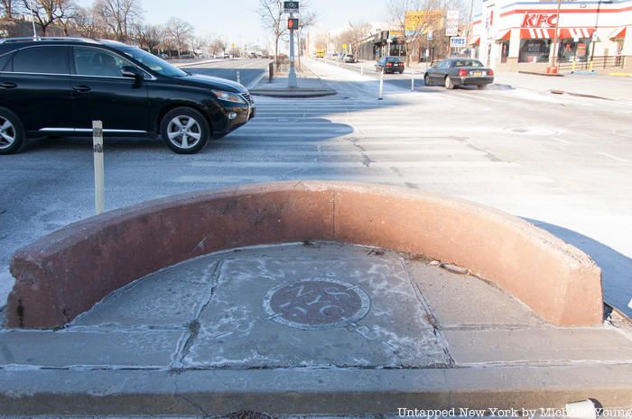
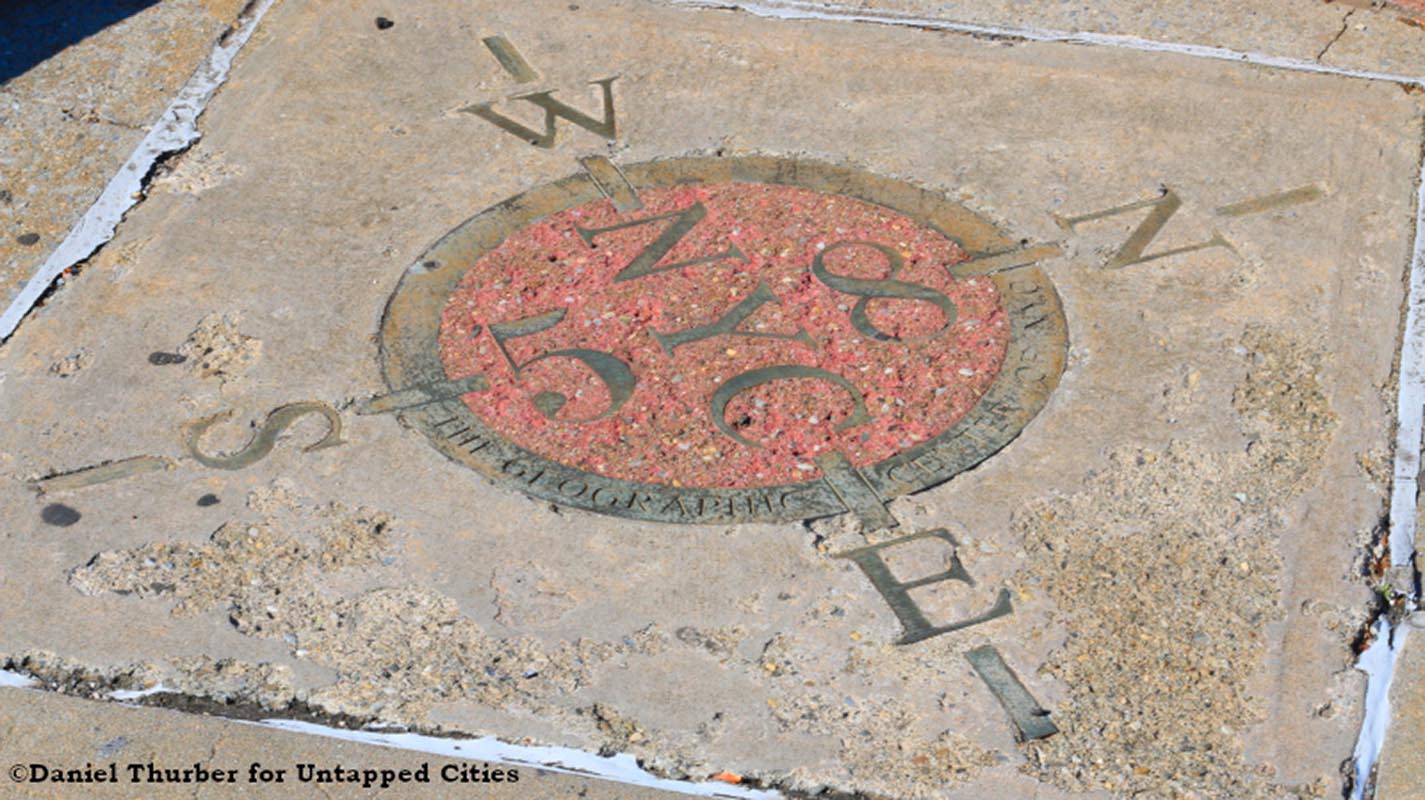
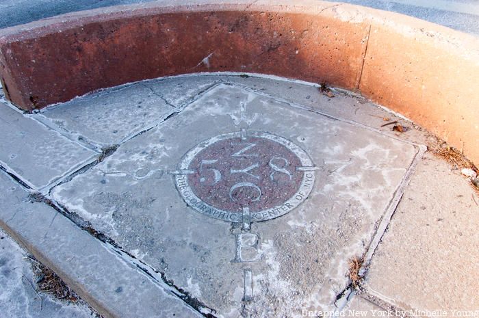
Embedded in the ground at a traffic median in Woodside, Queens along Queens Boulevard is a compass rose with the words, “The Geographic Center of NYC.” It sits mostly forgotten at the intersection of 58th Street and Queens Boulevard between a Walgreens and Calvary Cemetery, but the design seems pretty official. The cardinal directions are marked, and the number 58 seems to refer to the intersection. It would have taken some effort to get this installed. The only problem: it is NOT the geographic enter of New York City. So what is? Who installed this? And do we care?

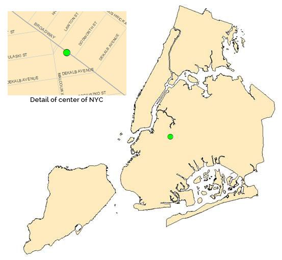
For half a century going back to at least 1942, the center of the city was allegedly in what is now Jesse Owens Playground in Bedford-Stuyvesant, Brooklyn (roughly here), though the origins of such a claim are unknown. In 2005, the Department of City Planning entered the fray, determining that the center of New York City is actually in Bushwick, Brooklyn. In 2015, the Department of City Planning told our writer Dan Thurber that they used the official NYC Borough Boundaries, clipped to the shoreline to calculate the center. Going by that, the center of New York City is on Broadway between Lawton Street and Dodworth Street, about five blocks northeast of Jesse Owens Playground.

Figures provided by NYC Department of City Planning
If you want the nitty gritty details, that map was called LION version 18C (projection NAD_1983_StatePlane_New_York_Long_Island_FIPS_3104_Feet), shown above. The Department of City Planning told Thurber that “the geographic center of NYC will vary depending upon how you define NYC, including what islands you include, what map projection is used, and whether you include areas under water.” The Department of City Planning opted to leave the areas underwater for its calculation.
In 2013, the NYC Department of Transportation also placed the center of New York City in Bushwick, but two blocks away at Broadway and Dekalb Avenue, about four blocks northeast of Jesse Owens Playground.
As explained in a previous video we published from Dan Thurber, finding the center of something has long been a popular query though not one with many practical applications (according to scientists). There have been different methods of determining the geographical center, including an early one involving balancing a cutout cardboard map of the United States and finding its balance point.

In a frustratingly noncommittal answer from the U.S. Coast and Geodetic Survey and Mathematician Oscar S. Adams in 1959, “It is inevitable that there are as many geographical centers of a state or country or other as there are persons determining them. Any reasonable method employed will give a center as satisfactory as another one. This is a case in which all may differ but all be right.” This of course assumes that the underlying assumptions as to the base map and other factors are reasonable.
Adams appeared to have dedicated some decades pondering questions related to this matter, publishing with the United States government tomes like The General Theory of Equivalent Projections in 1944 (which addresses calculations to account for the curvature of the earth) and the article “Geographic Center of the United States” where the above quote is pulled from. [In junior high, yours truly submitted a math paper that went on to win some Long Island math fair awards on “Non-Euclidian Geometry” and the globe in my parents’ home still bears the scars of those experiments in how to adapt the Pythagorean theorem to the curvature of the earth].

So back to the Queens marker…nobody seems to know the origin of the marker in Woodside, based on our digging.
The NYC Department of Transportation confirmed for us that neither its agency nor the New York State DOT was responsible for the installation of that marker. We then asked Queens expert, Kevin Walsh who runs the website Forgotten New York and involved with both the Greater Astoria Historical Society and the Newtown Historical Society. Although he did not have direct knowledge of the origins of the plaque, he reached out to the Newtown Historical Society. Walsh tells us his contact there “believes it was former Parks Commissioner Henry Stern. He was quirky, giving all the triangles and parks around town distinctive names, and was fond of installing compass roses all over the place.” Stern is credited with coming up with the name for Cough Triangle (off the Gowanus Expressway), an acronym with quite the sense of humor.
Stern died in spring of 2019 so we reached out to the NYC Parks Department for comment. A press officer there told us “I looked into this marker and confirmed that it’s located on property that is not under Parks jurisdiction or management. We have no background on its origins. Very mysterious!” Meanwhile, official distances measured to and from New York City have traditionally been measured from Columbus Circle, nowhere near Bushwick or Woodside. For now, we’ve reached a dead end in terms of official organizations so we’re opening it up for crowdsourcing. Do you have any clues or potential contacts that could solve the mystery of the marker’s origins?
Next, check out 16 must-visit places in Woodside. And discover more incorrect or lost plaques throughout New York City.
Subscribe to our newsletter