Last-Minute NYC Holiday Gift Guide 🎁
We’ve created a holiday gift guide with presents for the intrepid New Yorker that should arrive just in time—


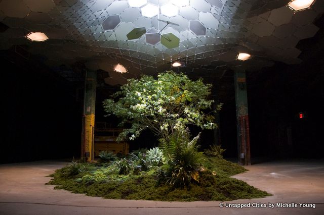
When we checked out the Lowline preview last year, it was clear that the radical idea of an underground photosynthetic park would require more than just technical expertise. It needed political and inter-agency support. Yesterday, the Lowline team announced that nine elected officials on the city, state and federal levels had pledged their support, requesting that the NYC Economic Development Corporation begin an official exploration of transferring the Lowline site from MTA to city control.
The officials include US Senators Charles Schumer and Kirsten Gillibrand; US Congressmembers Carolyn Maloney and Nydia Velazquez; NY State Assembly Speaker Sheldon Silver; Manhattan Borough President Scott Stringer; NY State Senator Daniel Squadron; and NYC Council Members Margaret Chin and Rosie Mendez.
The Lowline aims to transform an abandoned trolley station underneath Delancey Street into the world’s first underground public park. The station was built in 1903, the same year the Williamsburg bridge was completed to connect street trolleys to the new trains that crossed the bridge. It was an active part of the station until street trolleys ceased to exist in 1948.
As for next steps, the Lowline team writes, “This is a huge step forward for the Lowline, and we will continue to move the legal exploration process forward.” Read more on Untapped Cities about the technical aspects of how the Lowline will work. More on what the next steps are on Curbed.
Get in touch with the author @untappedmich.
Subscribe to our newsletter