Arts & Culture
Fiber Arts Take Over a Former Seaport Warehouse in NYC
See waterfalls of fabric, intricate threadwork, massive tapestries, and more!
See waterfalls of fabric, intricate threadwork, massive tapestries, and more!

A 7,500-pound eagle sculpture from the top of the original 1910 Penn Station building has been returned after years in hiding!
Uncover memorials and historic buildings in New York City tied to the tragic sinking of the Titanic.


Easily locate the nearest NYC public bathrooms with the City’s official public restroom map, now on Google!

Finding a public bathroom in New York City is always a struggle. There are 1,000 public restrooms across the five boroughs, but it’s not always easy to find out where they are. Using the city’s OpenData and scouting independently, many individuals and organizations like Got2Go have created tools to help make finding a bathroom easier. Now, New York City has created an official public restroom map that can be easily accessed as a layer on Google Maps, so you can “know where to go.”
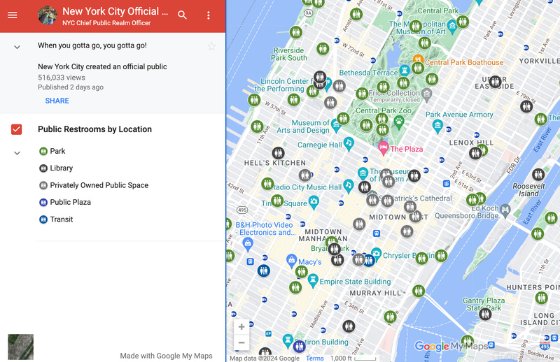
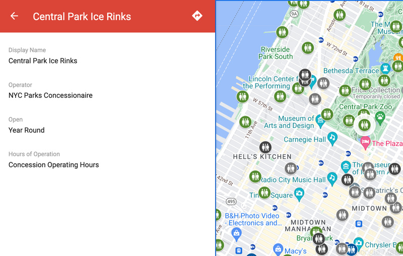
The map uses data from various city agencies including the NYC Department of Parks and Recreation, NYC Department of Transportation, the Department of City Planning, the MTA, and the New York, Brooklyn, and Queens Public Libraries. Using this data, the map displays bathrooms located in public parks, libraries, the transit system, and public spaces.
Each different type of location is denoted by a color in the map legend. When you click on a specific restroom, the legend shows the name, who operates it, when it’s open, and if it’s accessible. Most sites also show what type of bathroom it is including if it’s gendered, how many stalls it has, and if there is a changing table. You can use the search bar to type in your current location and quickly see the nearest facility.
The new map is part of the city’s punnily title campaign “Ur In Luck.” The new initiative is focused on making public restrooms more accessible and equitable. Over the next five years, the city plans to build 46 new restrooms and renovate 36 existing ones in the Bronx, Brooklyn, Manhattan, Queens, and Staten Island. According to Pix11 News, the latest new bathrooms have been added to Bronx Point/Mill Pond Park and Starlight Park in the Bronx, Wyckoff House Park in Brooklyn, Frederick Johnson Playground and Highbridge Park Adventure Playground in Manhattan, Maspeth Park in Queens, and Lopez Playground in Staten Island.
A series of advertisements will appear on LinkNYC kiosks and on Taxi TVs with a QR code that directs users to the map. The map will be updated bi-annually, so it does not show real-time data.
Next, check out an over-the-top
Titanic-themedbathroom in NYC!
Subscribe to our newsletter