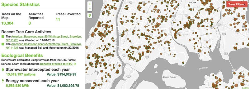

Image via NYC Parks: New York City Street Tree Map
There are 666,134 street trees spread out across New York City’s five boroughs. If that number sounds oddly specific, it’s only because the NYC Parks Department has spent more than a year gathering data for its latest Treescount! census. With the help of 2,241 volunteers, park officials were also able to create a new, highly interactive “Street Tree Map,” where trees are represented as dots, color-coded by genus.
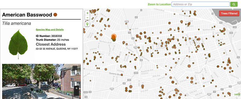
Clicking on a specific point will pull up a detailed section, outlining a tree’s leaf shape, species and trunk diameter; a Google Street View window also pinpoints a tree’s exact location, and a separate section catalogues its ecological benefits, such as the amount of air pollutants it removes each year, or the level of carbon dioxide it reduces annually. Moreover, users can also request maintenance for a tree, and personally record its history of care.
According to the new census, the amount of street trees in New York City has risen 12.5 percent since the last time a tree census was taken in 2006 (592,131 trees were documented back then). The dramatic increase can be attributed to the MillionTreesNYC initiative, which planted 164,000 street trees between 2007 and 2015. Since 2008, developers have also been required to plant one tree for every 25-feet of street bordering a property, according to Gothamist.

Image via NYC Parks: New York City Street Tree Map
The increase comes as exciting news, but as Jennifer Greenfeld, the park department’s assistant commissioner for forestry, horticulture and natural resources points out, there is still room for 200,000 additional trees to be planted on New York City streets. While it may be difficult to do so in bustling places like Midtown, Manhattan, there are quite a few sparsely planted locations across other NYC neighborhoods, such as Astoria, Queens. The unique, publicly accessible tool is designed to increase citizen engagement and to help the parks department with future maintenance work. In the meantime, New Yorkers are free (and encouraged) to care of street trees by watering them and weeding the surrounding soil.
See NYC Parks New York City Street Tree Map here.
Next, check out more fun maps, and see another interactive map of New York City’s tree distribution.


