After-Hours Tour of the Fraunces Tavern Museum: "Path to Liberty"
Explore a new exhibit inside the oldest building in Manhattan, a witness to history throughout the Revolutionary War Era!


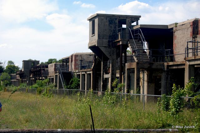
There’s more than meets the eye in Sandy Hook on the Jersey Shore. In addition to surf, sand and swim, the beach is also home to a military fort dating back to 1902 that provided protection for New York City until World War II. The fortifications were part of the Endicott System, mounted in concrete and invisible from the water. Today, the structures are still standing, albeit abandoned. Concrete stairs and iron ladders connect the various levels of the fortification along with interconnecting tunnels below.
 Sandy Hook is a 1,665 acre peninsula within view of the Manhattan Skyline
During the 1950s, nearby batteries became one of many installation sites for Project Nike, a project commissioned by the US Army for defense against the new jet aircraft (antiaircraft missiles), integral during the Cold War Era.

We don’t recommend trespassing so we’ll include photographs from inside the tunnels on our recent adventure.


In the tunnels:


Officer’s Row, military housing:

The Seastreak will take you from lower and midtown Manhattan to the beach:

Subscribe to our newsletter