Last Chance: The Annual Orchid Show Soars at the New York Botanical Garden
The vibrant colors of Mexico come to NYC for a unique Orchid Show at NYBG!


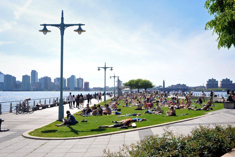
Hudson River Park, the waterfront park along Manhattan’s west side was founded in 1998 and in June, the park will be celebrating its 25th anniversary. The park, which sees 17 million visitors a year, functions not only as a vital recreational space and community asset, but also as an evolving natural resource (oysters! fish! birds! waterfront sanctuary!). We recently toured the park with Connie Fishman, Executive Director of Hudson River Park Friends, who was one of the founding members of the park, to learn about its secrets and fun facts:
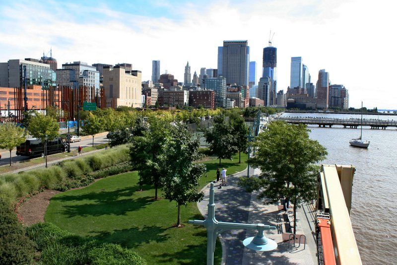
At 4.5 miles, Hudson River Park holds the title for longest riverfront park in the United States. It stretches from Chambers Street to 59th Street, serving the neighborhoods of Tribeca, Greenwich Village, Meatpacking, Chelsea, Midtown, and Hell’s Kitchen. The 4.5 acres encompass 550 acres of parkland, including 400 water acres. This makes it the second largest park in New York City, after Central Park and longer than other riverfront parks around the country, including Mud Island River Park in Tennessee, Santa Fe River Park in New Mexico, and Smale Riverfront Park in Cincinnati, OH.
Hudson River Park is notable for its diversity of activity, ranging from bicycle and pedestrian paths, recreational piers, restaurants and bars, sports facilities (including batting cages, beach volleyball, trapeze, and tennis courts), kid-friendly options (playgrounds, carousel, mini golf course), and water sports (kayaking, sailing). The bikeway was deemed the busiest bikeway in America, and extends even further south to Battery Park. For the history buffs, there is plenty as well, keep on reading to discover!
Hudson River Park was established through the Hudson River Park Act, and is run through a partnership between the Hudson River Park Trust and New York City and State. That being said, it relies solely on private funds to maintain the park and produce programming and public events.
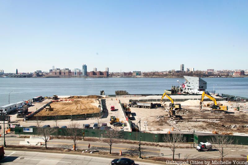
Even seasoned New Yorkers may not realize there is actually a 13th Avenue in New York City. It used to extend from West 11th Street up to 25th Street and was built on landfill. But when the large ocean liners, like the RMS Lusitania and the Carpathia (along with the Titanic, which was supposed to arrive at Pier 59), started docking in New York harbor, the landfill had to be removed and the waterfront dredged to accommodate them.
The stretch that remains of 13th Avenue is west of the West Side Highway, between Gansevoort Street and Little West 12th Street, and can even be seen on Google Maps. Until recently, this remaining peninsula of land was home to several Department of Sanitation buildings. Those buildings were demolished in preparation for a new section of the park. The best way to see 13th Avenue at the moment is from the upper levels of the Whitney Museum, which is just across the street but once the new park section opens, you’ll be able to pay tribute to this long forgotten avenue in New York City at a historic marker the park will put in place.
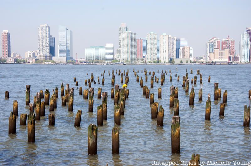
Hudson River Park is home to New York City’s only Estuarine Sanctuary, established in 1998 under New York State legislation to protect the 400 acres of water within Hudson River Park’s boundaries. Of the 315 miles the Hudson River spans from the Adirondacks to the New York harbor, half is considered a tidal estuary, where fresh and salt water mix. This confluence of waters creates a nutrient rich habitat that can support a high level of biodiversity. The waters along Hudson River Park are home to more than 70 species of fish, including white perch, bluefish, striped bass, oyster toadfish and American eel, as well as lined seahorses, and oysters.
The Estuarine Sanctuary is managed through environmental stewardship, with support towards scientific research, along with educational programs. Speaking of biodiversity, the park is also home to 2,000 trees, 100+ species of birds, and 85 species of insects, including 20 species of dragon flies.
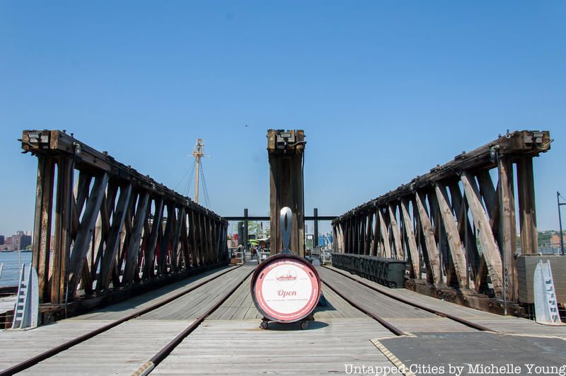
If you’ve ever visited the Frying Pan, a collection of floating boats and barges that make for a waterfront bar and restaurant hotspot, you’ve walked along a piece of historic infrastructure. The entrance to the Frying Pan, with its criss-crossed wooden beams and rail tracks at Pier 66, is a float bridge that was once part of the Baltimore & Ohio Railroad. Until as late as the 1970s, railroad cars would float to Manhattan by barge then link up with railroad tracks that used to run down the waterfront. The High Line is part of this rail infrastructure that still exists. The train cars would then pull into warehouses nearby, like the Starrett-Lehigh Building and the Nabisco building, which is now Chelsea Market, bringing sheep, cattle, produce and more.
While this floating rail line no longer exists, New York City still operates a barge rail line between New Jersey and Brooklyn – and you can see it in action here. The Lightship Frying Pan is permanently docked at Pier 66, along with a historic barge of the same type that could have served the B&O Railroad during its operation. Also accessible through the Frying Pan is the Fireboat John J. Harvey, a retired fireboat that served the city of New York from 1931 to 1994. The John J. Harvey certainly knows how to make an entrance, including showing up at the 2016 Dîner en Blanc to put on a spectacular water show. It also was part of the flotilla that accompanied an arrival of the Queen Mary 2 to New York harbor.
Elsewhere in Hudson River Park, you can find other historic remnants, including the Cunard Line’s Pier 54 archway, once part of the original Chelsea Piers building, and the Lilac Museum Steamship, a floating library and event space.
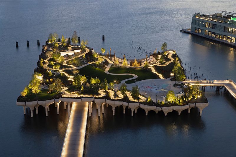
After much political drama, a futuristic new park at Pier 55 designed by Thomas Heatherwick, who is also behind The Vessel at Hudson Yards, is open! The undulating park sits atop modern piers and includes rolling lawns, a public plaza, and a 750-person amphitheater. The paths reach as high as 62 feet, making this a sure destination for views of the city and the river.
Pier 55’s design was selected through a competition by Hudson River Park and philanthropist Barry Diller with the requirements to create a public park with a world-class performance space. The design idea takes inspiration from the wooden pilings that remain of the old pier and extend 280 concrete piles out of the water, serving as large planters, and allowing for a landscape of different elevations. More than 100 species of trees are were planted on the new Pier 55, offering a haven from the busy highway just adjacent.
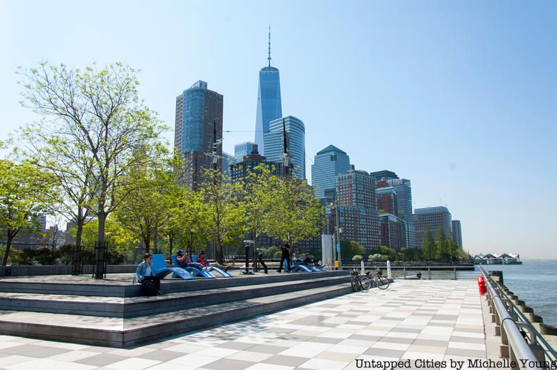
The decaying industrial waterfront along Manhattan was once a haven for the underground scene – be it the early days of the LGBTQ movement, the art scene in New York, or other avant-garde movements. On Pier 25, a rowdy open-air club called the Amazon Village Nightclub was a hotspot long before Hudson River Park came on the scene. It offered, according to the park, “the previously unheard-of combination of alcohol and bungee jumping.” There was also a notable 40-foot-long iguana sculpture that sat on the pier in the 1980s.
Today, Manhattan Youth, which includes the mini golf course, volleyball, Sweet Love Snack Bar, and the Art Shack, is located on Pier 25. At the end of the pier, there’s a great spot with lounge chairs for some waterfront rest. Next door, Pier 26 is now complete with an innovative ecological “Tide Deck” with great views of the river.
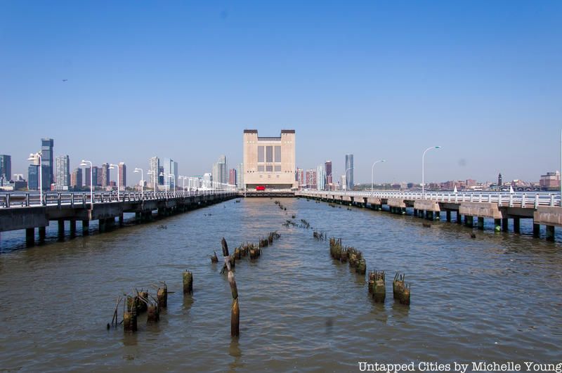
As you gaze along Pier 34, two walkways take you to the Holland Tunnel ventilation building with decaying, old piers between the walkways. Back in 1983, when the original pier still existed, the now-demolished Ward Line shipping terminal building housed an art gallery. It was a DIY operation that ran for an astounding two years, requiring visitors to trespass to access the space.
In 2016, the 205 Hudson Gallery, run by the Hunter College Art Galleries, programmed an exhibition that looked at the ephemeral art movement that existed on Pier 34 called “Something Possible Everywhere: Pier 34 NYC” featuring works by the artists involved in the gallery, along with recreations of some of the works that existed there.
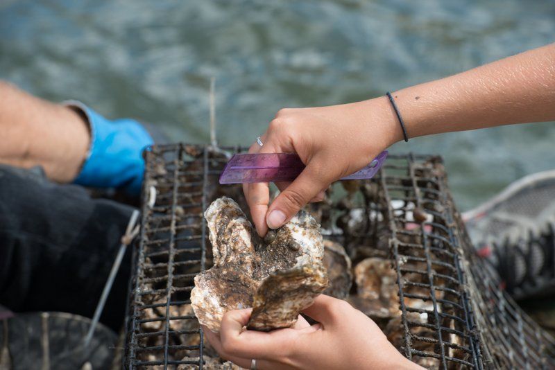
The Lower Hudson River estuary once had 350 square miles of oyster beds, with some biologists estimating that New York Harbor contained half of the world’s oysters. Oysters were a constant narrative for the early explorers, appearing in countless diaries of those who came to the New World. Oysters were introduced to these explorers by the Lenape Indians and the old oysters were big, often more than a foot long according to contemporary eyewitness accounts. Pollution over centuries made the oysters inedible, and they were officially declared to be too polluted to eat in 1927. The oyster beds along the future Hudson River Park waterfront were completely wiped out.
Hudson River Park has been restoring New York’s oyster population, not for consumption, but to assist in the filtering of water, as reef habitat, and to stabilize the shorelines. At Pier 32, 12 oyster wraps are around the old pier pilings and there are 15 oyster research stations run the Billion Oyster Project. In 2017 alone, 2400 oysters and spat on shell clusters were restored to the Hudson River. The Park estimates that 30,000 gallons of water are filtered by the oysters every six hours at Pier 32.
In 2018, the Hudson River Park Environment & Education Department found new clusters of wild oysters in Hudson River Park, a feat considering the complete eradication of the oysters and a testament to the cleaning efforts. One of the oysters was over 7 inches long, the largest documented wild oyster to be found in the estuary in over half a century.
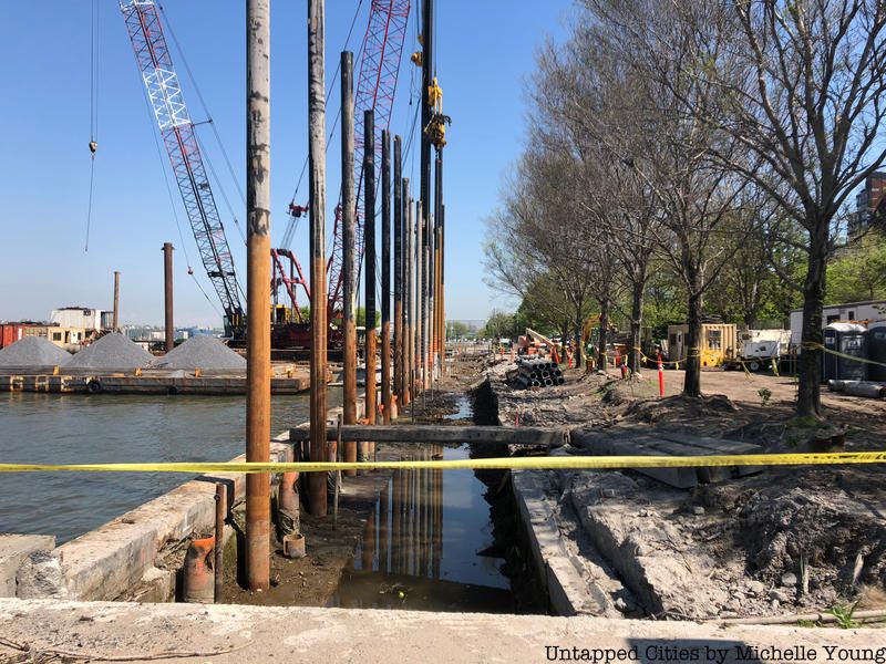
Much of the west side of Manhattan is built on landfill and some of the shoreline between Pier 40 and 45 in Greenwich Village near where the PATH tunnels run beneath the park has become unstable due over time, exacerbated by Hurricane Sandy in 2012. A project is underway to reconstruct the old historic bulkhead here.
Starting at where the numbered streets begin, if you subtract 40 from the pier number you will get the street number! So for example, Pier 62 at Chelsea Piers is at 22nd Street. This system was deliberately established, and according to William H. Miller, author of The Last Atlantic Liners: Getting There is Half the Fun, it was to make it easy for “passengers, visitors, taxis, freight vans, others” to have the street number.
Next, check out the Top 10 Secrets of the Hudson River
Subscribe to our newsletter