Last-Minute NYC Holiday Gift Guide 🎁
We’ve created a holiday gift guide with presents for the intrepid New Yorker that should arrive just in time—


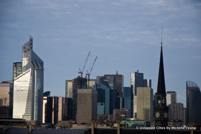
Take a guess where we shot this photograph from today?
This skyline, which may be reminiscent of London perhaps or a Midwest city in the United States is in fact Paris! This is the La Defénse business district, developed beginning in 1958, and gradually displaced the farmland, factories and slums that once existed there. Today, it is home to Tour First, the tallest skyscraper in Paris, in view on the left of the photograph.
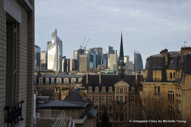
We photographed this image from an apartment in Neuilly-sur-Seine, a neighborhood that borders Paris and is home to former French president Nicholas Sarkozy. Photographed alone, it really highlights how our vision of cities can be determined by dominant architectural norms, as in Paris, or landmarks, as in New York City.
Here’s the same view but showing more recognizable Parisian architecture as context:

La Defénse is also home to 17 of the 20 tallest buildings in Paris. In the photo, you can see Tour Total, the second tallest building in La Defénse, and Tour T1, the curved sail-like building on the right that is the third tallest.
La Defénse is however most famous for its arch, designed by architect Johann Otto von Spreckelsen and Danish engineer Erik Reitzel that marks the end point of Paris’ grand axe historique (historical axis). Check out these amazing images of the La Defénse arch by photographer Ryan Southen.
Get in touch with the author @untappedmich.
Subscribe to our newsletter