

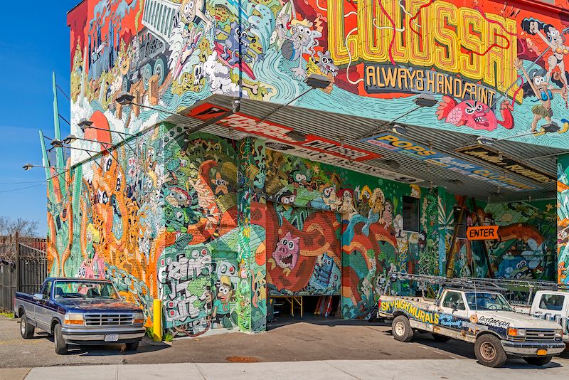
I moved with my family from Manhattan to Williamsburg, Brooklyn in 2008. At the time, only one or two high rises had been built along the East River waterfront, but it was clearly evident that the first big waves of gentrification were crashing around us. Our move had more to do with affordability than anything else. Sure, we were aware of Williamsburg’s reputation as artist/hipster enclave, but having lived in the East Village and the Lower East Side, I had no expectation that Williamsburg was exempt from the same evolution that transformed those neighborhoods.
My 1980 photographs of the Lower East Side captured a unique moment when creative energy burst from out of the rubble and destruction, and gave us a miraculous abundance of music and art. But it was an evanescent juncture in time, which is the nature of these things. Creativity is not the product of stasis, but of dynamic change.
Over the years, I thought about photographing Williamsburg, but other projects occupied my attention. Yes, the neighborhood was interesting, and I knew it was more complex than the myth of hipster paradise – or lost hipster paradise. And I was not aware of any other photographer who had tackled the subject in a comprehensive way. But I lacked a clear motive. Until the pandemic hit.
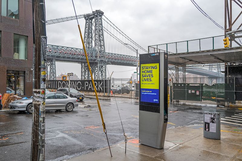
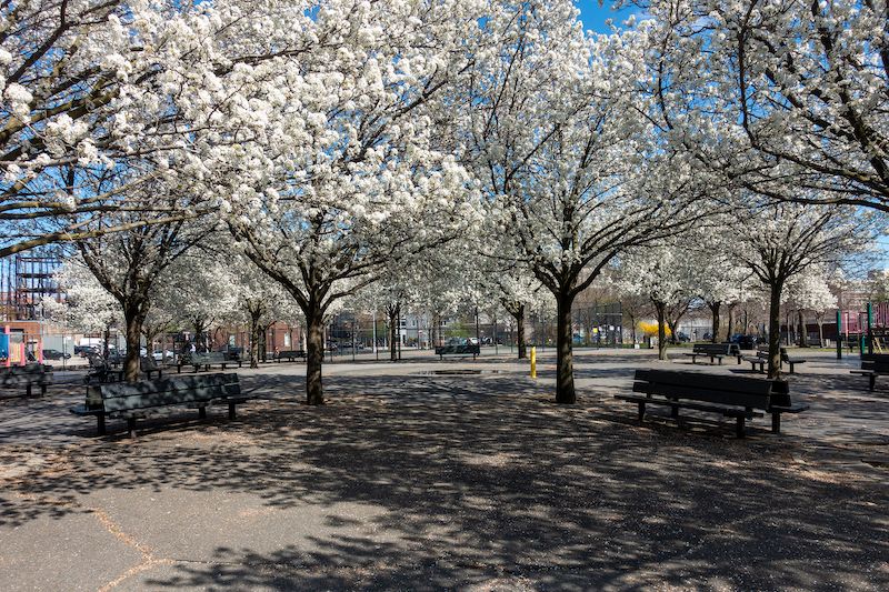
It was the spring of 2020 and the coronavirus known as Covid-19 swept over the city. All night, sirens wailed, chirped and stuttered, and the great metropolis of New York froze except for furtive masked figures fetching food, and running essential errands. There was no vaccine then. We were in lockdown, but Governor Cuomo, in his daily streaming communiqués urged us to get out and walk as long as we kept six feet apart. So, I got out with my camera and walked. Tentatively at first, I carried my Sony point-and-shoot, fanning out from home base on North 3rd Street, roaming an empty Bedford Avenue, exploring McCarren Park, its abandoned pathways lined with a profusion of flowering trees.
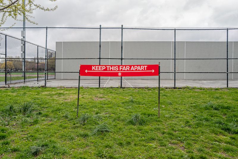
Within a few days, I knew that this was a major project. All my work up until that time had been done on film using a 4×5 view camera, but buying film and getting it processed was not going to happen during the lockdown. So, I rented a Leica online and in a few days had a superb digital camera at my disposal. Much like I had done photographing the Lower East Side decades ago, I consulted Google maps to plot out my routes. I wanted to cover every corner of the neighborhood: residential, commercial, industrial, from the new condos in the west to the factories and warehouses in the east. Once the lockdown was in full effect there were very few people about, and car traffic was light. So, I often was able to walk in the street, which gave me opportunities for pictures that I normally would not have been able to make.
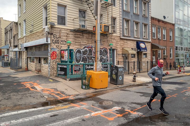
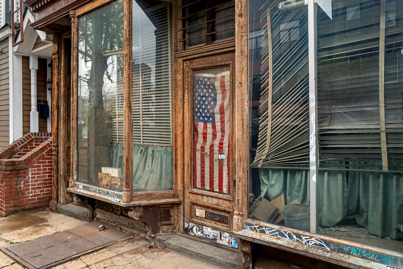
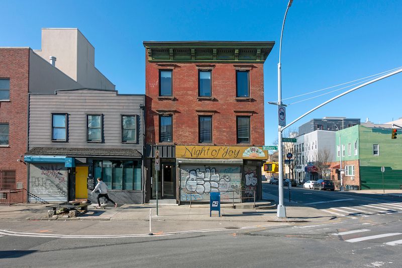
The new buildings of Williamsburg stood out starkly with their glassy facades, but the more I looked and the more photographs I took, I began to see a richer layered landscape, more visually diverse, and messier. Without the crowds, the streets were laid bare revealing the bones of an older neighborhood going all the way back to A Tree Grows in Brooklyn, a neighborhood of tenements and row houses, and factories. While it’s clear that Williamsburg has become much more upscale, the truth is that there is considerable poverty here once you look past the shiny new condos and glitzy shops. There are still pockets of Italians and Poles, and a sizable Latino population, while South Williamsburg remains ultra-orthodox Jewish.
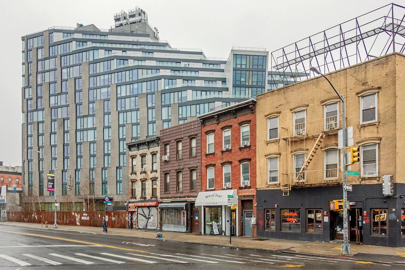
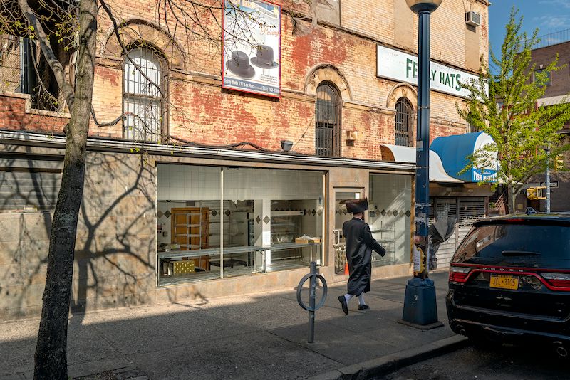
It is a not a classically beautiful New York neighborhood. No Park Slope or Fort Greene. The houses are mostly finished off with aluminum or vinyl siding and graffiti covers virtually every surface not actively maintained. The juxtapositions of wealth and poverty are often jarring and unexpected, and like other parts of the city, large housing projects disrupt the finer grained fabric of the urban landscape.
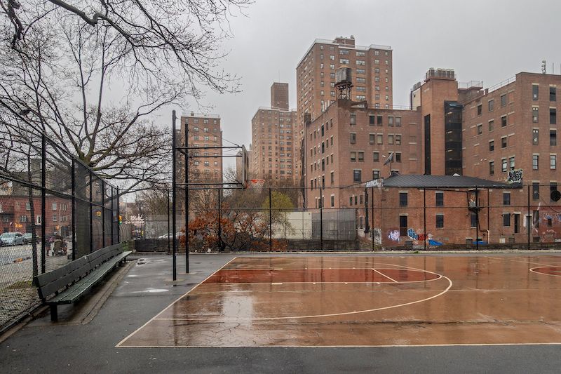
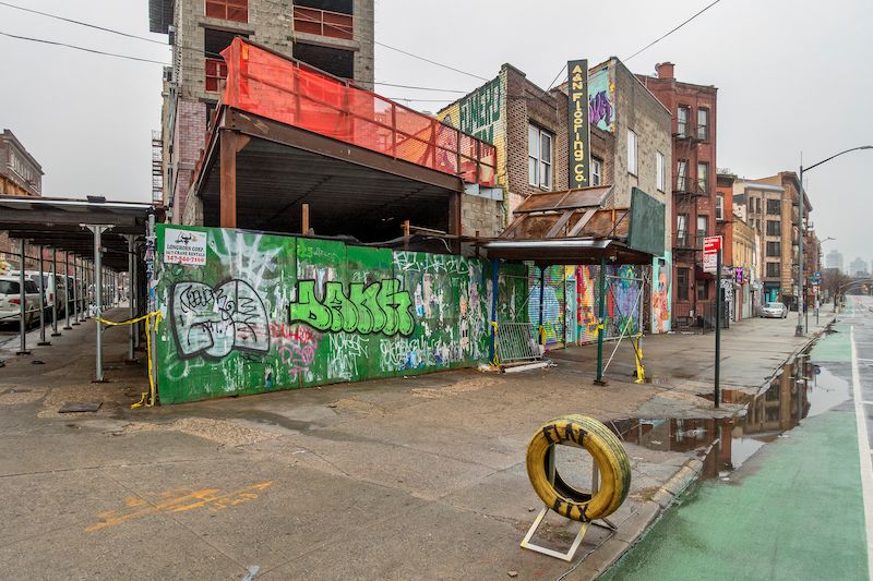
There are, in short, two Williamsburgs. The mythic place of hipsters, clubs, restaurants, and starving artists. And the other Williamsburg, a workaday place of people who jam the L train every morning to get to Manhattan. The cliché of artists as young people in paint-splattered overalls is misleading to say the least. Artists also work in television, web design, video, tech companies, advertising, architecture, music, photography – the list goes on and on. Williamsburg is full of these people with the same hopes and dreams of earlier generations of New Yorkers.
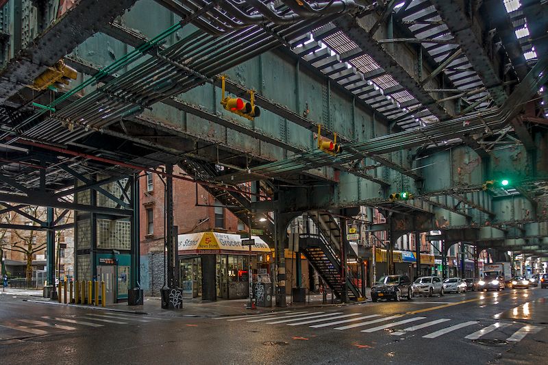
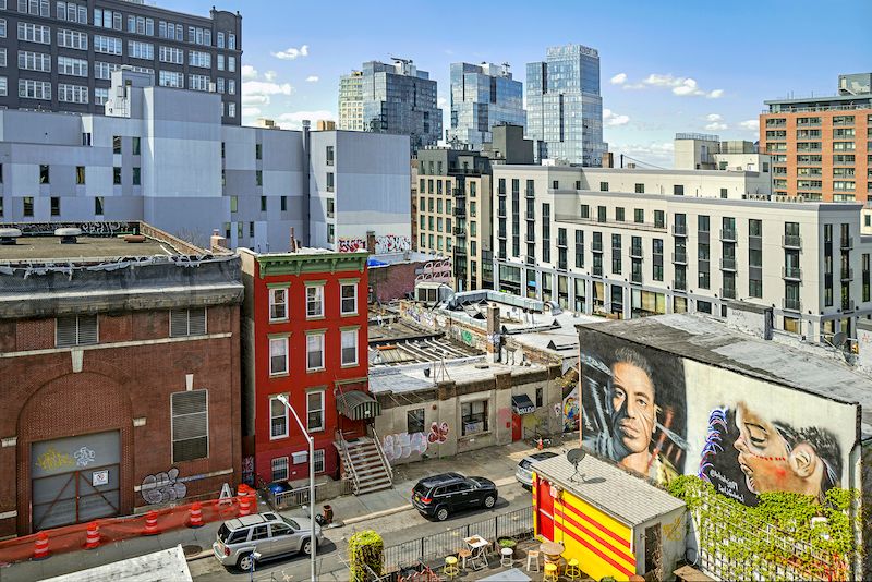
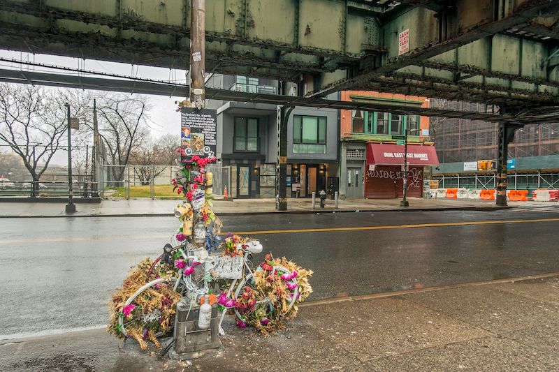
The suspended animation brought on by the pandemic not only revealed a neighborhood previously hidden, but also exposed a precarious social contract. As I walked around the desolated neighborhood I had this sense of impending doom. That all the stresses of the Trump era were coming to a head. That Covid was more than a physical disease, it was a metaphor for the times, every bit as much a plague as the virus itself. And then the dam broke with the news of the George Floyd killing, and the quarantine ended with tens of thousands taking to the streets, including here in Williamsburg, demanding justice.
“And indeed it could be said that once the faintest stirring of hope became possible, the dominion of plague was ended.”
-Albert Camus
Next, check out Brian’s photo essay, Time and Space on the Lower East Side! You can order a copy of his book, Williamsburg In Time of Plague here.

