
Free
Hidden Stories of Union Square's Public Art Tour
Explore the major works of public art on view in this Manhattan neighborhood!
Explore the major works of public art on view in this Manhattan neighborhood!
Discover where you can find fragments of the King George III statue toppled by Patriots in Bowling Green after the Declaration of Independence was signed!

This 21st-century building was designed to compliment the its historic neighbors on Manhattan's Upper East Side!


There are a handful of New York City records that exist solely for the undaunted few willing to attempt their completion. Currently, Matt Green leads the pack for attempting to walk every single block in New York City. For everyone else, there are some more attainable milestones, including walking the entire waterfront of Manhattan. As big fans of Phillip Lopate’s wonderful book, Waterfront: A Walk Around Manhattan, we thought it was worth discovering the changes that have occurred in the 7 years since its publication.
You could of course see the whole waterfront by boat or bike, but for more adventurous New Yorkers, circumambulation is the way to go. Walking Manhattan’s waterfront is not as simple as one might assume because Manhattan’s waterfronts are still not fully accessible despite the city’s waterfront redevelopment projects.
Despite this caveat, it is still well worth exploring. The easiest route to follow is the Waterfront Greenway Bike Path (print maps can be found at your local library amongst other places). I used it for my 9 hour walk around the island, which will take you along the waterfront for the majority of your journey, cutting inland where no waterfront path currently exists.
The Manhattan Waterfront Greenway was first designed by the New York City Department of City Planning in 1993. Since then, the City has constructed a 32 mile route that circumnavigates Manhattan. There are still segments missing from the route and some of those areas may never see pedestrian access to their waterfronts. The NYC Department of City Planning has waterfront planning goals for 2018 and for the very distant future.
Part I: The Hudson River
1. West Street (just north of Battery Park) to 14th Street.
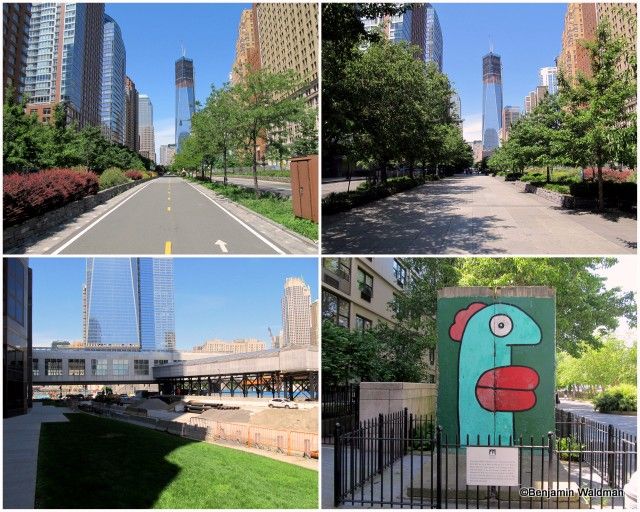
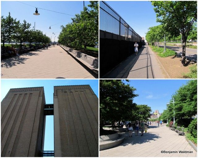
While it does not abut the waterfront, the West Street segment of the Greenway begins one of the widest and most well landscaped portions of the Greenway. The upper left photo shows the bike path and the upper right photo shows the adjoining pedestrian path. Part of this section of the Greenway is still under construction and necessitates a detour through Battery Park City. As you enter Battery Park City, you pass a piece of the Berlin Wall (another section can be found in Midtown).
The Battery Park City detour contains numerous landscaped areas, access to the waterfront, works of art, and the unique Irish Hunger Memorial.
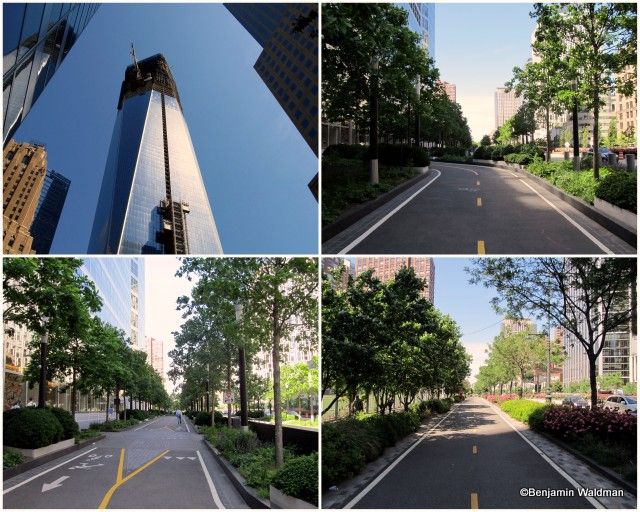
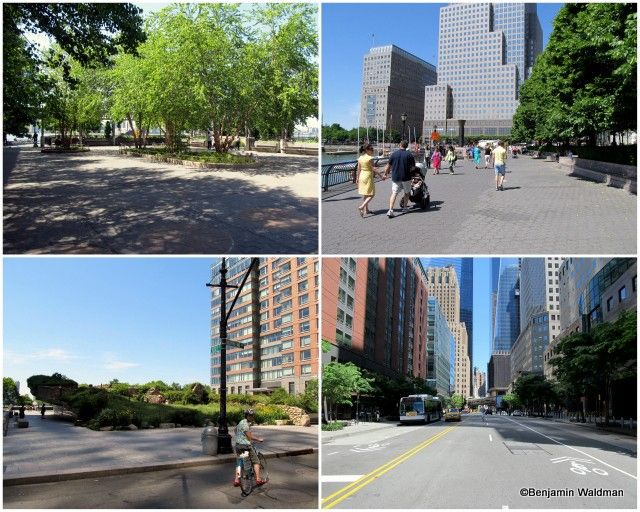
Continuing along West Street, passing in the shadow of the Freedom Tower, the Greenway is well developed, providing separate paths for bikes and pedestrians.
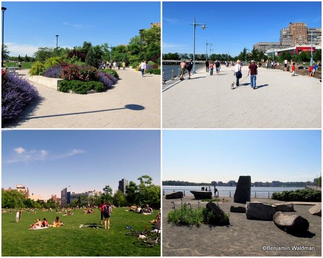
After a short period, access to the waterfront resumes in Tribeca. Some sections are still under construction, but the majority of this section of the Greenway has been completed. It is replete with sculptures, benches, trees, and grassy lawns.
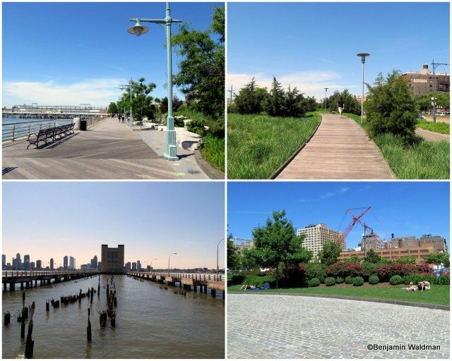
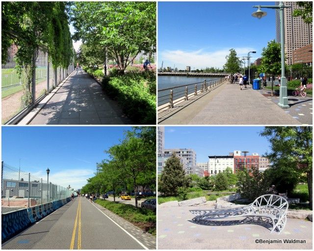
Further north in Tribeca, the segment of the Greenway possesses a boardwalk-esque feel with a planked floor and wooden paths that transverse the lawns like mini-High Lines. The Holland Tunnel‘s ventilation building is visible in the background.
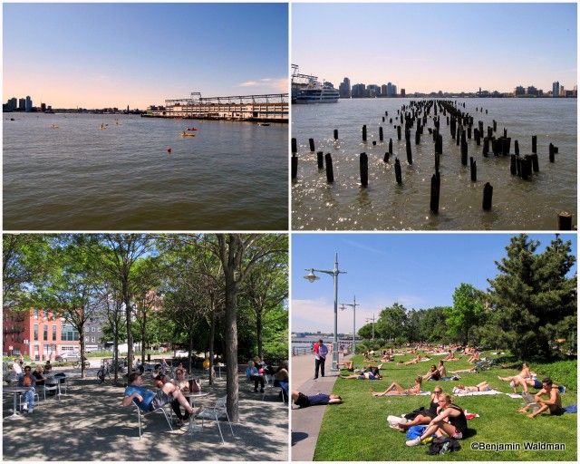
Numerous people were taking advantage of the free kayacking available in the Hudson River as well as using the numerous tables, chairs, and lawns to relax. The remnants of former piers dot the Hudson River.
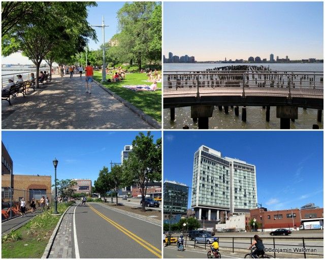
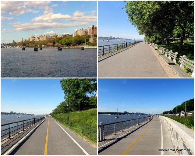
The lawns above are only available from the pedestrian path. The separate bike path runs parallel to them next to West Street. As the Greenway approaches the High Line and the Standard Hotel, the paths almost merge together, separated only by a thin strip of grass.
2. 14th Street to 59th Street
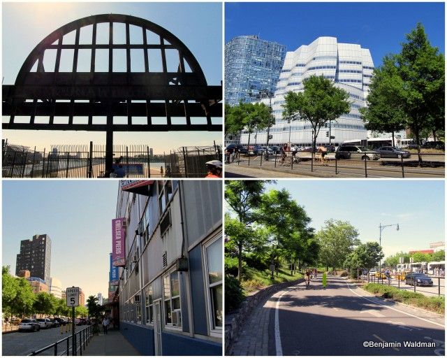
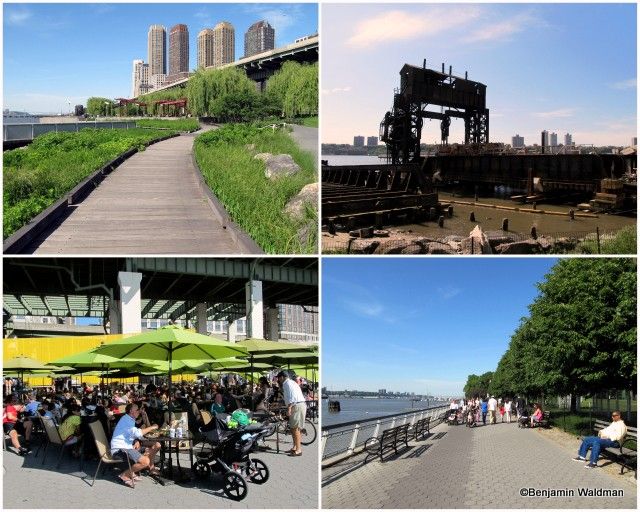
In this section, the remains of Pier 54, where the RMS Carpathia docked after rescuing over 700 passengers from the Titanic, Frank Gehry’s IAC Building and Chelsea Piers dot the landscape.
One of the benefits of walking the Greenway is being able to take a stroll through these lawns and plantings. These paths are technically off limits to bikes. The Lincoln Tunnel ventilation building is one of the few structures west of the path. The grandeur of the Greenway that bounds the lower Hudson River stems from the fact that it’s its own park. Hudson River Park was advocated for and funded by the Hudson River Park Trust and the Friends of the Hudson River Park.
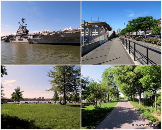
By the Intrepid at 46th Street, which is only one of Hudson River Park’s historic ships, the path once again becomes a simple asphalt path for a short period until the pedestrian path is once again surrounded by lawns and trees.
3. 59th Street to 72nd Street
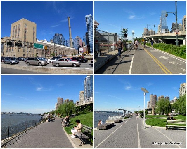
The McKim, Mead & White designed IRT Powerstation can be seen from this stretch of the Greenway bounded by the West Side Highway and some Sanitation Department buildings. This wide, but unassuming section of the Greeway, leads into the beautifully landscaped Riverside Park South.
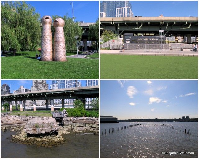
Riverside Park South was built through concessions made by Donald Trump in his skyscraper redevelopment of Riverside South. It is well landscaped, has beautiful views of the Hudson (and by extension New Jersey), cafes, numerous permenant and temporary works of art, and artifacts that harken back to its prior life as a New York Central Railyard, most notably a train engine and the remains of the New York Central Railroad 69th Street Transfer Bridge.
4. 72nd Street to 125th Street
The next segment of the Greenway is serene, except for the cars driving down the Henry Hudson Parkway. Don’t miss the open air 79th Street Boat Basin Cafe for food, drinks and a great view of the river.
5. 125th Street to 181st Street
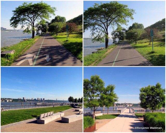
This section of the Greenway is well landscaped and paved. It is bounded (without a barrier) by the Hudson River to the West and the Henry Hudson Parkway to the East. The path is demarcated for walkers/joggers and cyclists. This part of the path is well populated with people running, biking, walking their dogs and even fishing. The two lower, and upper right, photos showcase the West Harlem Piers Park. The park is well landscaped, contains benches and sculptures, and has access into the Hudson River via its piers.
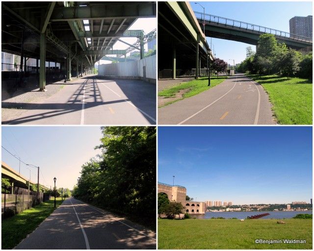
Just north of West Harlem Piers Park, the Greenway juts inland. The segment underneath the Henry Hudson Parkway possesses an industrial atmosphere and is bounded by the New York Central Railroad tracks to the east and a fenced off area to the west. The fencing provides security guards ample space to protect the North River Wastewater Treatment Plant. The sewage treatment plant, which was constructed between 1986 and 1991, is home to Manhattan’s only State Park. Riverbank State Park contains an Olympic size swimming pool, a roller/ice skating rink, a theater, a restaurant, and other amenities and is located on the roof of the treatment plant. Just past the park/sewage treatment plant, the greenway veers back towards the river bounded by a beautiful green.
6. 181st Street to the Cloisters
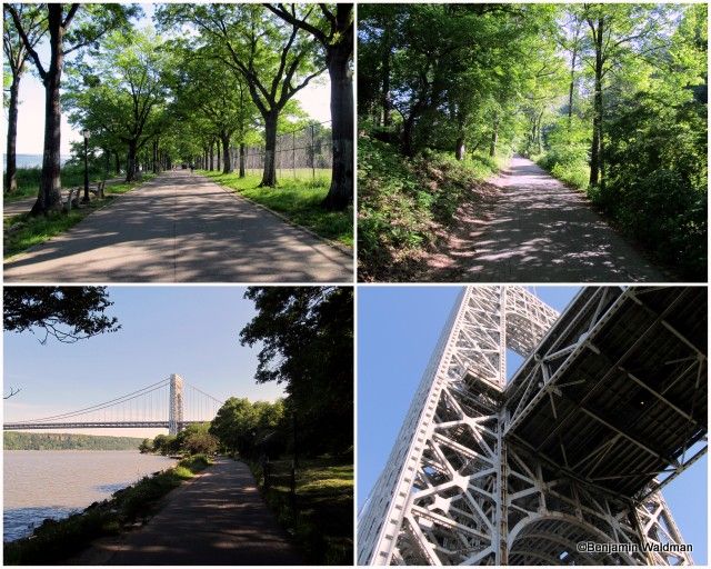
This section of the Greenway runs through Fort Washington Park. The park is often overlooked and even lacks a Wikipedia page. The land for the park was set aside as a result of the tireless work of Andrew Haswell Green and his American Scenic and Historic Preservation Society. (For more information about the park check out our previous article The Secrets of Fort Washington Park). This stretch of the Greenway provides waterfront access through part of the park and unbeatable views of the George Washington Bridge, which you go under, and the Little Red Lighthouse. Under the bridge, the path begins to veer inland.
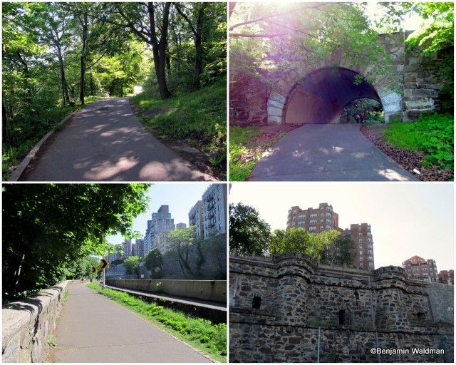
After a short span as a bucolic path, the Greenway exits the park through a tunnel and ends up (almost) at grade with the Henry Hudson Parkway. This section of the path does not provide much room for cyclists and pedestrians to share. One of the noteworthy sites along this expanse of the Castle Village’s retaining wall which is left over from Dr. Charles V. Paterno’s, Paterno Castle.
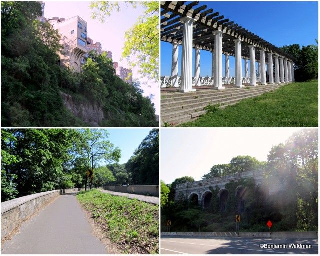
While this section of the Greenway itself is unexceptional, it allows passers-by to see a number of interesting curiosities. First, is the Pumpkin House, which received its name from the shape and illumination of its windows, next is Inspiration Point, a Grecian temple from the Henry Hudson Parkway’s early days, and lastly, the remnants of the Billings Estate, now occupied by Fort Tryon Park and the Cloisters.
Continue on to Part II of the series along the Harlem and Hudson Rivers.

Subscribe to our free newsletters
Free Newsletters
Get the best stories and things to do sent straight to your inbox.