Untapped Mailbag: What Were the Boundaries of Holmes Airport (now Bulova Building) in Queens?

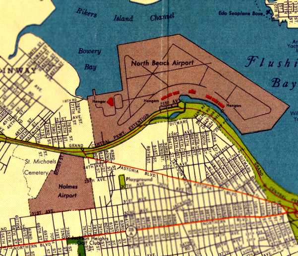
On the way to LaGuardia Airport along Grand Central, you’ve probably noticed the Art Deco Bulova Corporate Center. An Untapped Cities reader asked us recently, “Is there any info on the exact boundaries of Holmes Airport before the Bulova complex, etc., took its place?”
This website by Paul Freeman has a great overview and vintage images of the airport. The Holmes Airport was built in in 1929 by real estate developer E.E. Holmes on what was claimed the “largest piece of unobstructed property in the city.” The 220 acre tract included two hangars, an office, and two gravel runways. The first flights were to Miami aboard a Ford Trimotor plane. An advertisement for the airport targeted mail planes, which could transport mail via our favorite pneumatic tubes to New York City, and air freight companies.

Image from Airfields Freeman.
Holmes Airport also had a flight school and a Goodyear blimp hangar. The airport was unable to stop the construction of what would become LaGuardia Airport. Veterans housing and a Bulova watch factory were constructed on the land.


