
Free
"The Harlem Trilogy: Cool Machine" Downtown Walking Tour
Celebrate the release of Colson Whitehead's new NYC-set novel, "Cool Machine," on a walking tour of Manhattan!


The Urban Reviewer is an interactive map of NYC “master plans” (aka, urban renewal plans), where tenants were re-located in order to clear the way for urban development plans. The city has been funding urban development projects in neighborhoods they deemed “blighted” since 1949, but the maps starts in ’52. The map is by the 596 Acres group, which is dedicated to mapping publicly owned land so neighborhoods could access and utilize community owned spaces.
Master plans were used extensively for the past few decades, as shown below in the 1973 map, but began to fall off, as seen even in 1988 in the following. While some, like Lincoln Center, have reached fruition, many were abandoned or remain unused, such as the vacant lots of East New York and Bushwick.
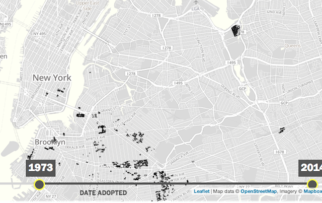
The 1973 map. Photo via Urban Reviewer
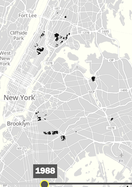
The 1988 map. Photo via Urban Reviewer
The map offers essays about urban renewal, an in-depth list of references, and is searchable by plan or address and a filter to examine which plans are active or expired. The slider along the bottom indicates plans that were adopted over the decades, with the last adoption occurring in 2008. All of these plans were at HPD in paper form, and have just become accessible to the public.
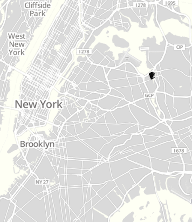
This 2008 master plan is the last recorded on the map. Photo via Urban Reviewer
Information gathered from City Lab. Check out more from our Fun Maps series, such as a map of the NYC Pneumatic Tube Network, and an active map of NYC’s work and home locations by hour.
Get in touch with the author @jimipage26

Subscribe to our free newsletters
Free Newsletters
Get the best stories and things to do sent straight to your inbox.