
Architecture
🏠 A Private Island of Frank Lloyd Wright Homes in the Hudson Valley
Tucked away on a heart-shaped island, two unique homes are waiting for you to come visit!
Tucked away on a heart-shaped island, two unique homes are waiting for you to come visit!

Find out what you can see from the 26th floor on an exclusive access tour!
Explore "Democracy Matters" on a docent led tour!


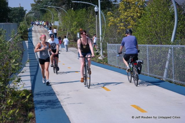
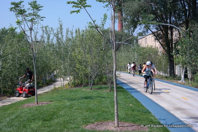
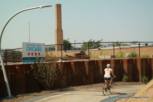
Standing on the 606, a new elevated park in Chicago, can be a bit disorienting. In some locations it does not feel like one is in the middle of a city but instead in a world of its own where runners, bicyclists, and walkers extend off into the horizon. In fact, the 606 is in the city, specifically an area that exemplifies one of Chicago’s nicknames – the City of Neighborhoods.
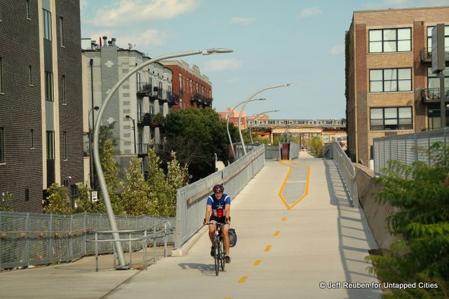
The 606 opened on June 6, 2015 (appropriately enough 6/06). Its centerpiece is the Bloomingdale Trail, a 2.7-mile long former freight rail line embankment that extends on an east-west alignment through several neighborhoods on the Northwest Side.
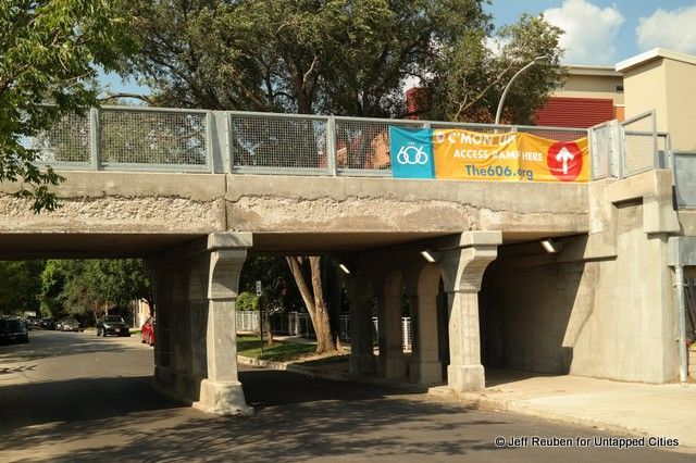
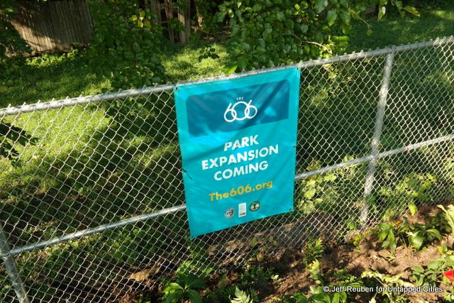
While the elevated park is about 20 feet above the ground, every few blocks there are ramps connecting it with the street. There are also existing and new parks (some still in the works) at the street level adjacent to some of the ramps.
Comparisons to the High Line in New York City and the Coulée Verte (aka Promenade Plantée) in Paris, are inevitable. While those projects provided the inspiration for the 606, the 606 is in many respects the anti-High Line.
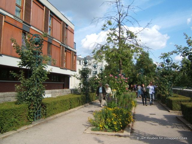
The Original: Coulée Verte in Paris
This is not to suggest the designers deliberately set out to define this elevated park in opposition to what came before, but rather that the 606 seems to have been developed on its own terms with a design and program fitting its surroundings.
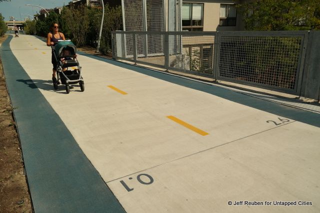
Near the east end of the 2.7-mile path; distance markers are located every tenth of a mile
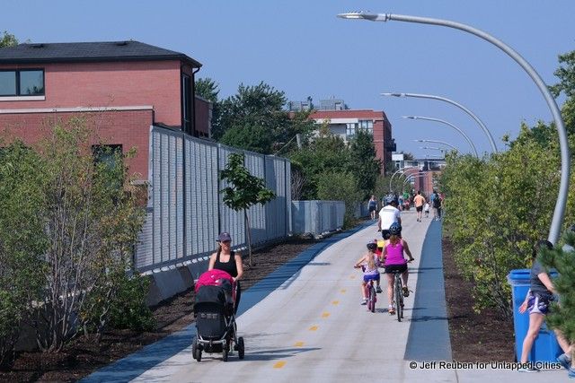
The 606 is first and foremost a recreational facility organized around a path where runners, bicyclists, and walkers can travel without the interruptions of motor vehicles. It includes vegetation and aesthetic elements, but these are the icing on the cake. By contrast the High Line does not permit bicycling and runners have to weave through the crowds who stop to admire the park’s many distinctive features.
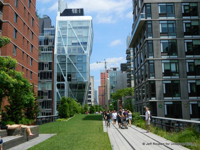
The High Line, New York City.
For lovers of the High Line’s creative reuse of historic elements, there likely will be disappointment that there are no historic rail tracks on the 606. But those who feel the High Line is too much of a spectacle may appreciate the 606’s more restrained, functional character.
In short, the High Line is a destination; the 606 is much more a place to move through.
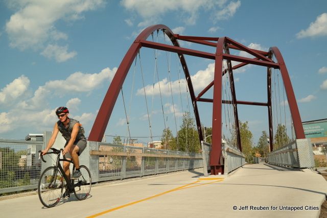
Milwaukee Avenue Bridge, which was reconstructed with new steel arches recycled from the original structure
Milwaukee Avenue Bridge before its reconstruction (Chicago Transit Authority Blue Line in the background)
There are few paths in Chicago, or for that matter any major city, that offer this type of extended separation from cars and city streets. Chicago has off-street recreation paths along Lake Michigan and there are similar paths along portions of the Chicago River. But a path cutting across the street grid is unique, which is a large part of the 606’s appeal just as is the case with the High Line. The 606 is both of the city and apart from it.
Ramp to Western Avenue at left, Chicago Transit Authority Blue Line in the background
The 606 is not directly connected to any other off-street paths. But, there are calls for an extension east to a redeveloping area along the North Branch of the Chicago River. This could someday provide a much longer continuous route if a riverside path is also developed.
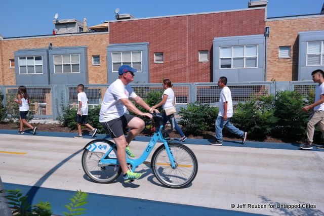
Divvy, Chicago’s Bike Share, provides access for visitors
For now, the 606 links several neighborhoods, from Bucktown and Wicker Park on the east to Logan Square and Humboldt Park on the west. To oversimplify a bit, these neighborhoods run the gamut from hipsters, to yuppies, long time residents, and immigrants, with diverse racial, ethnic, and economic populations, though often in separate enclaves. The 606 is providing the residents of these neighborhoods a shared space.
During two recent visits when the temperatures were still summery, it appeared that most of the users were locals. Many families were present and only a few of the bicyclists were riding Divvy bikes from Chicago’s bike share program.
For out-of-town visitors there is much to see. The 606 may not attract the crowds of Millennium Park and its iconic bean sculpture, but the 606 provides a window onto Chicago that differs from what is on display downtown.
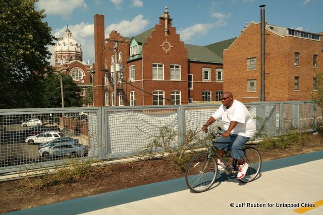
Views of St. Mary of the Angels Church are prominent along the eastern part of the 606
The 606 offers views of neighborhood streets, alleys, churches, residential architecture, and some industrial relics. There is also the “L” – an elevated train line passes above the 606 near its midpoint as if to stamp a Chicago trademark onto this new park.
In some sections, the right-of-way widens to provide lawns, extensive plantings, and side trails. Given the low-rise character of many of the adjoining buildings, these are the parts of the 606 that feel like another world where the familiar cityscape fades from view. In those areas, the 606’s Chicago character is defined less by the built environment than by the people. To see Chicago, one has to also see the Chicagoans and the 606 is a great place to do some people watching.
At the western end of the 606, with a commuter train in the background
Next, read about the top ten secrets of the High Line, a behind the scenes look at the conversion of the 606/Bloomingdale Trail and 10 Elevated High Line Projects Around the World.

Subscribe to our free newsletters
Free Newsletters
Get the best stories and things to do sent straight to your inbox.