
Things to Do
🛶 Canoe on the Gowanus Canal + More Ways to Summer in Brooklyn
Untapped New York's founder and author of Secret Brooklyn, Michelle Young, shares her favorite things to do!
Untapped New York's founder and author of Secret Brooklyn, Michelle Young, shares her favorite things to do!
Discover how the criminal justice system has impacted music history throughout the 20th century!

Join an exclusive behind-the-scenes tour with owner Joe Cooke!


Red Hook circa 1875. Image via Library of Congress
Red Hook, named after Staten Island’s characteristic red clay soil and the actual “Hoek” of land that protrudes from the coast of Brooklyn, boasts a rich history dating back to the 1600s. In the 400 years since the Dutch first settled the area (at the time, it was known as Roode Hoek), the neighborhood has undergone major transformations, claiming various titles in the process. By the 1920s, it had become the busiest freight port in the world. In 1990, it was labeled by Life magazine as one of the “worst” neighborhoods in the United States (and the crack capital of America) but has been undergoing a renaissance in recent years, while also fighting to build back after Hurricane Sandy.
PortSide NewYork, an organization focused on bringing urban waterways to life, is dedicated to preserving this provocative and heady history through its “WaterStories” programs in the arts, education, preservation and advocacy.
The Red Hook WaterStories project, headed by PortSide NewYork, helps to bring waterways back into the conversation through its online archive that features stories and information about the Brooklyn neighborhood, powered by an interactive map. This mission has become especially imperative as recent media stories increasingly begin to portray Red Hook as an isolated area due to the water that borders it on three sides. The team behind the Red Hook WaterStories project maintain that its waterways actually do the opposite, serving as a connector instead.
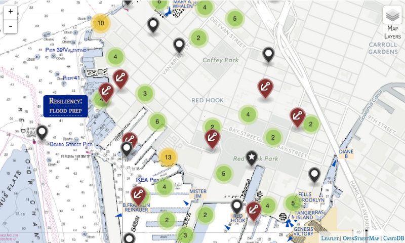
PortSide NewYork is providing the online resource for anyone – from locals and tourists to history buffs and urban-planners – to utilize. While a major section of the website focuses on historical trends and issues, there is also an interactive map with real-time data on commercial vessels, and plotted sections that outline local retail businesses, community resources (businesses, non-profits, schools, libraries) and transportation stations (Citi Bike, buses, MTA). Clicking on an item on the map will pull up text and any related images from the New York Public Library’s Digital Collections (NYPL OldNYC Images). Visitors can also access flood resiliency information, as well as in-depth essays (“features”), written by experts and commissioned by PortSide NewYork.
Altogether, the site helps to paint a more holistic picture of Red Hook and the stories of the people that reside there. It’s largely focused on history, but the aggregated information is necessary to plan for the future, especially in regards to flood preparation, ferry planning and the movement of goods by water. For more information, visit Red Hook WaterStories.
Next, take a look inside the Red Hook Grain Terminal, and read about the Forgotten Past of Red Hook Lane in Brooklyn.

Subscribe to our free newsletters
Free Newsletters
Get the best stories and things to do sent straight to your inbox.