
Free
"The Harlem Trilogy: Cool Machine" Downtown Walking Tour
Celebrate the release of Colson Whitehead's new NYC-set novel, "Cool Machine," on a walking tour of Manhattan!

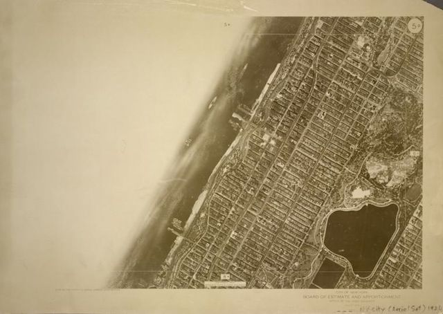
A set of aerial maps, comprised of 127 images, together form a complete map of New York City in 1924. Each square on the index below represents one photograph. It was created in 1924 by the New York Bureau of Engineering, specifically by the “Board of Estimate and Apportionment” (which sounds a bit like something out of The Phantom Tollbooth). Looking through the collection it is striking to see both the abundance of undeveloped land and the early dominance of the grid over the city. The photographs, with their awkwardly beautiful compositions and extreme detail are eery maps both of a physical structure and a moment in time: a series of snapshots of a growing city in its adolescence.
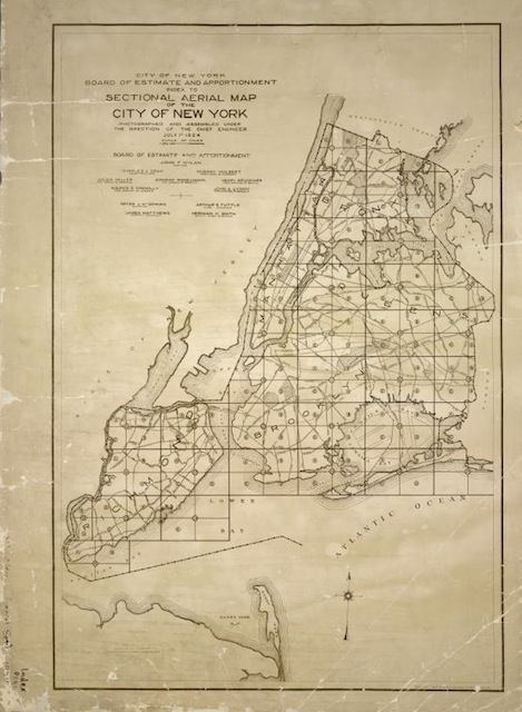
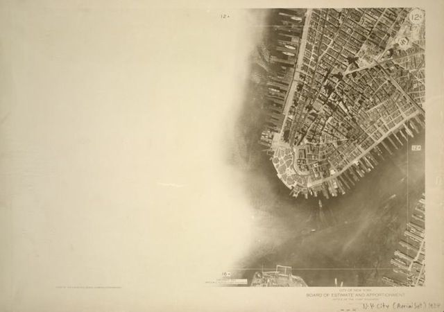
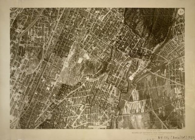
The entire set of these maps is available from the New York Public Library’s digital gallery in the Atlases of New York section under “Sectional aerial maps of the City of New York”.
Get in touch with the author @youngzokeziah.

Subscribe to our free newsletters
Free Newsletters
Get the best stories and things to do sent straight to your inbox.