
Fun Maps: The Changing Topographies of Manhattan 1836 to Now: Times Square, Bryant Park, Battery Park
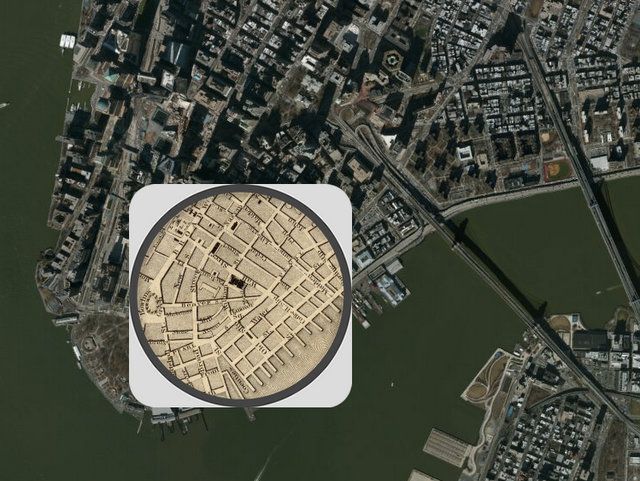
Map overlay 1836 to now from The Smithsonian
Drawing on comparisons between an 1836 topographical New York City map done by Joseph Colton and a current day Google satellite map, The Smithsonian has created a wonderful interactive map (which we discovered via CurbedNY) that allows you to see some of the drastic changes that may not be observable within a lifetime. The city itself has been flattened, expanded, and re-engineered to be the landscape we know today.
A lot has changed in New York City since 1836. Living above 14th Street is no longer considered the countryside, the Bowery has gone from respectable, to dangerous, to trendy, and both Brooklyn and Queens have sprouted their own skylines. These are shifts we know from just living in New York, but even more has changed than we can observe from just walking outside.
Here are some themes and locations we found interesting:
Times Square Then and Now:
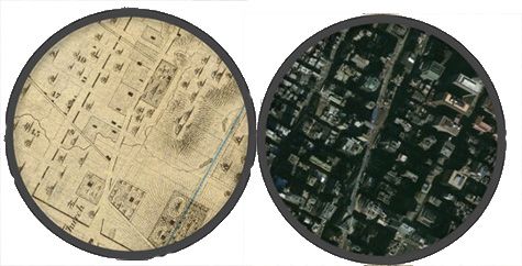
Times Square 1836 compared to now
It’s fun to see that the shape of Times Square today was already well-formed in 1836, due to the angle of Broadway, even if a lot of the land around it wasn’t developed (or flattened out) yet.
The Many Lives of Bryant Park:
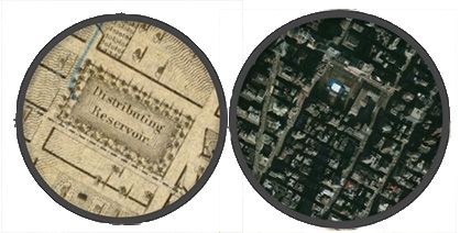
Bryant Park 1836 compared to now
The Croton or Murray Hill Distributing Reservoir opened up in 1842, extending from 40th to 42nd Street between 5th and 6th Avenues. 20,000 people attended the opening to witness the unveiling of the new structure, which was built in an Egyptian Revival style. Today of course, it’s now Bryant Park, but there are remains of the reservoir foundation that can still be seen inside the library.
Building into the Water
From South Brooklyn to Midtown West, the shorelines of New York City have expanded. These new manmade topographies include Battery Park City in Lower Manhattan, the Hudson Yards in Midtown West, Hunts Point development in Queens, as well as Governors Island which sits in Manhattan Bay.
What do these topographical changes suggest about New York City’s development? For one, when you run out of space, just make more (literally, and sometimes out of garbage!).
Some examples:
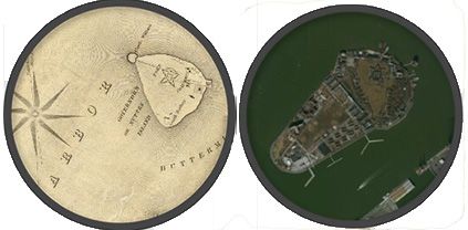
Governors Island 1836 compared to now: 60% of the island is made from dirt excavated from the 4/5/6 subway line construction and prior use as a landfill
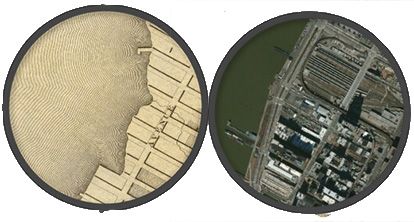
Hudson Yards 1836 compared to now, with more changes to come
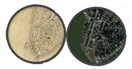
Battery Park 1836 compared to now, photos here of when Battery Park was used as a beach
The Lasting Effect of the Automobile
If automobiles effect on the development of the city wasn’t clear already, this topographical map comparison clears up any doubts. Take for instance, the northern part of the Harlem River whose glacial banks prevented easy access between Manhattan and the Bronx. With advances in technology, this previously hard-to-navigate terrain has been engineered to make way for the ribboning highways that one could presume came from or were born out of a Robert Moses’ era of planning.
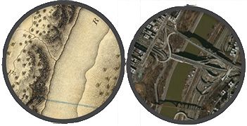
East River Roadway development
Play with the map on the Smithsonian website.

