
Architecture
NYC Views from the Gothic Windows of the Woolworth Building
Find out what you can see from the 26th floor on an exclusive access tour!
Find out what you can see from the 26th floor on an exclusive access tour!

Explore "Democracy Matters" on a docent led tour!
Discover how the criminal justice system has impacted music history throughout the 20th century!


Have you ever exited the subway and felt completely lost? Well, fear not because architect Candy Chan is here to rescue you! With her new Project NYC Subway, as seen on City Lab, you can visualize some of Manhattan’s most complex subway stations, blueprint style. Her first batch includes five stops down Broadway: Columbus Circle, Times Square, Herald Square, Madison Square, and Union Square.
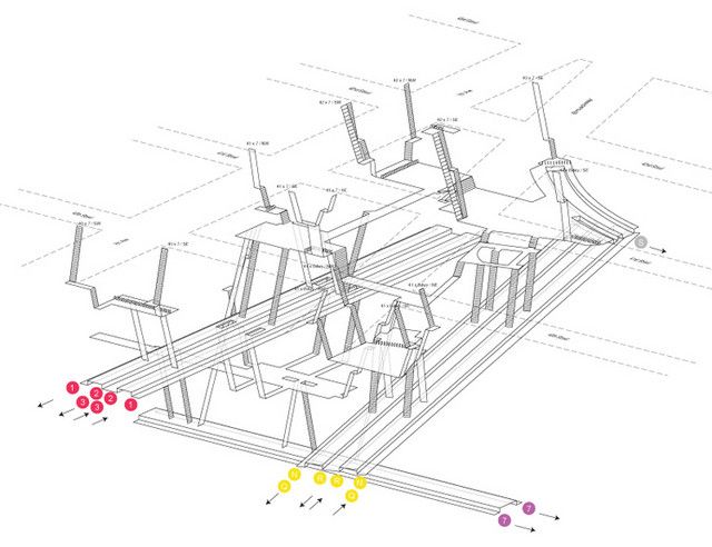
Times Square
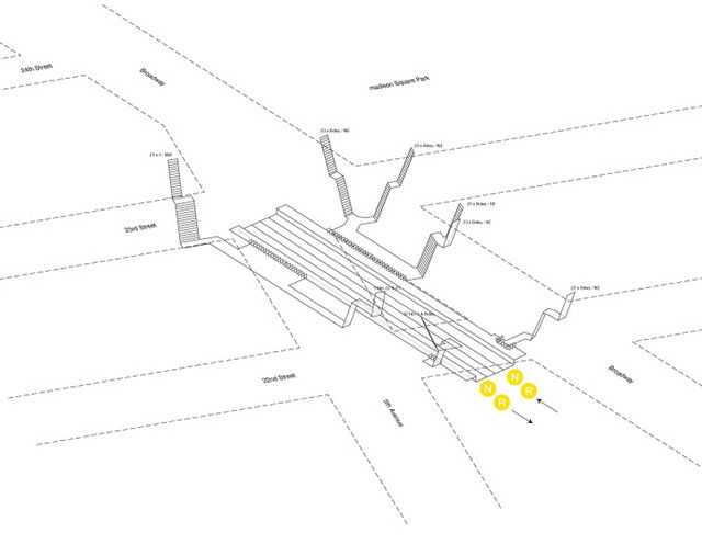
23rd Street
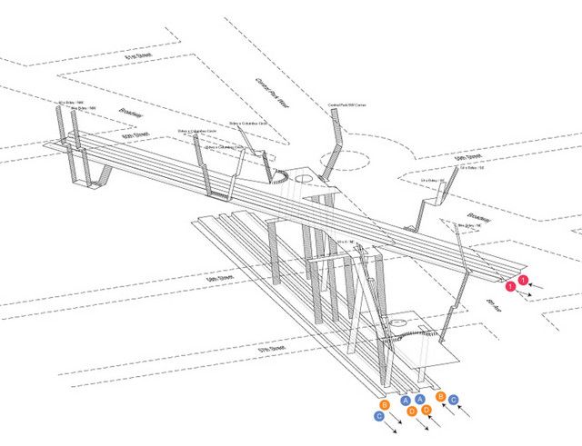
Columbus Circle
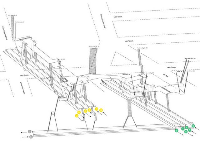
14th Street-Union Square
Chan was inspired by Hong Kong’s efficient subway stations that display a platform layout in every station. To execute her own vision for Manhattan, she went into the field. Chan counted subway tiles and stairs to estimate distances, utilized Google and MTA neighborhood maps to establish block lengths, and cross referenced photographs she took with hand-drawn sketches. After her preliminary sketches were transferred to the AutoCAD, she printed out the line work and took it back to the subway to verify the proportions. You can now enjoy her work by purchasing her layouts at her online shop.
Next, read about the secrets of New York’s subways and check out more of our fun maps on NYC transit.

Subscribe to our free newsletters
Free Newsletters
Get the best stories and things to do sent straight to your inbox.