New York Before New York Tour at NYHS
"New York Before New York" Exhibit Tour at NYHS
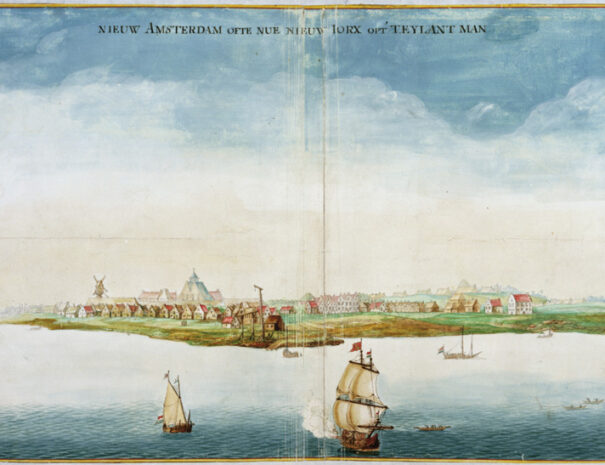
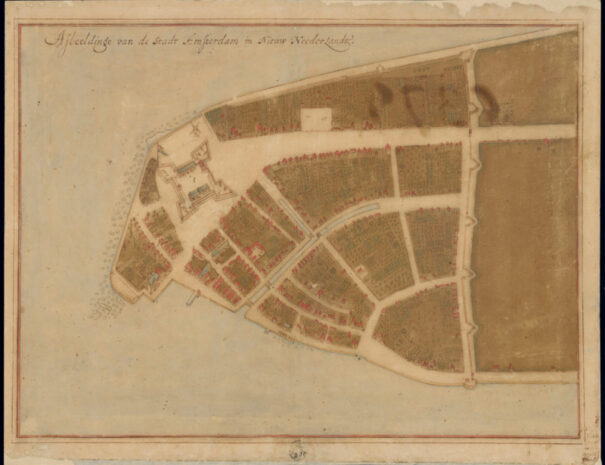
Header Image: Jacques Cortelyou (ca. 1625–1693), surveyor, Johannes Vingboons (1616–1670), Florence, The Biblioteca Medicea Laurenziana, ms. Carte di Castello 18
- April 13th
- 1:00 PM ET
- In-Person
- FREE for Insiders
- Registration Opens on March 30th at 12:00 PM ET
Mark the 400th anniversary of Dutch New Amsterdam with a guided tour of the new special exhibit New York Before New York: The Castello Plan of New Amsterdam at the New-York Historical Society!
- Discover what this rare 17th century map, visiting from Florence, Italy, reveals about the lives of settlers, Indigenous people, and enslaved Africans of New Amsterdam
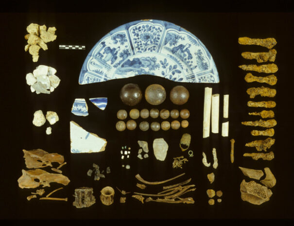
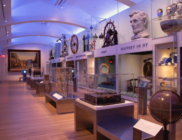
- See extraordinary artifacts from New Amsterdam including documents, coins, maps, and even a piece of the Dutch canal
- Go beyond the exhibit with a special highlights tour of the permanent collection at NYHS
About the event:
This special installation is organized around the Castello Plan, a map depicting New Amsterdam at the peak of its settlement circa 1660, just before the English took control. Through documents and objects, the installation explores how settlers, Indigenous people, and enslaved Africans experienced the world illustrated in the Castello Plan.
Accompanying the exhibition is a digital, 3D version of the Castello Plan. Created in partnership with the New Amsterdam History Center, the interactive map gives visitors the chance to explore select locations depicted on the Castello Plan, including the original City Hall, a house where enslaved Africans lived, and the trail created by the Lenape that would later become Broadway.
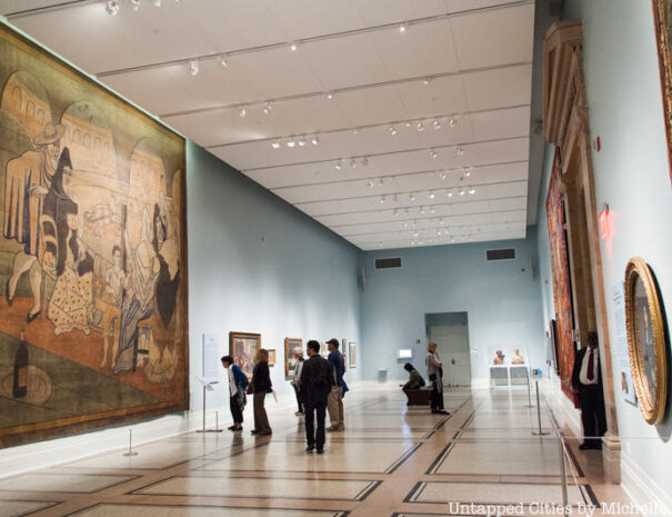
On this tour, Insiders will get a guided tour of New York Before New York, as well as a tour of highlights from the Historical Society’s permanent collection!
How do I sign up for this event?
If you are not an Insider yet, become an Insider today and join this event!
If you are an Untapped New York Insiders, simply login to your Insider account using the round icon in the bottom right corner of this screen. Once logged in, click on the “Book Now” button to book this event!
How many tickets can I reserve?
If you are an Insider level member ($20/month), you can reserve 1 ticket to this event. Explorer level members ($30/month) can reserve 2 tickets. If you are a Virtual level member but would like to attend, it’s easy to upgrade your account here!
Can’t login to your Insiders account?
Please make sure you are trying to sign in with the correct email address. If you have more than one email address please try logging in with all of them, that will solve this issue 99% of the time. Check out our FAQ for videos and more help documents.
The event is sold out?
In-person Insider tours may have limited capacity and are booked on a first come, first served basis.
But don’t worry! Sometimes spots open up closer to the event date if there are cancellations. We also repeat our most popular events when possible so you will have another opportunity to join us. There are also multiple other members-only events weekly that you can join in!
What if I need to cancel?
If you cancel more than 48 hours ahead of the scheduled event, you will receive a 100%. When canceled less than 48 hours before the start of your tour, you will receive a gift card that can be used on any future events. Please be courteous to your fellow Insiders and let us know if you can no longer attend so we can offer your spot to another person.