
Secrets of NYC
Top 10 Hidden Beaches of NYC
From Great Kills, Staten Island to Soundview Park in the Bronx, discover secret beaches in NYC for a day in the sun!
From Great Kills, Staten Island to Soundview Park in the Bronx, discover secret beaches in NYC for a day in the sun!

Discover how vacant storefronts are being transformed with works of art!


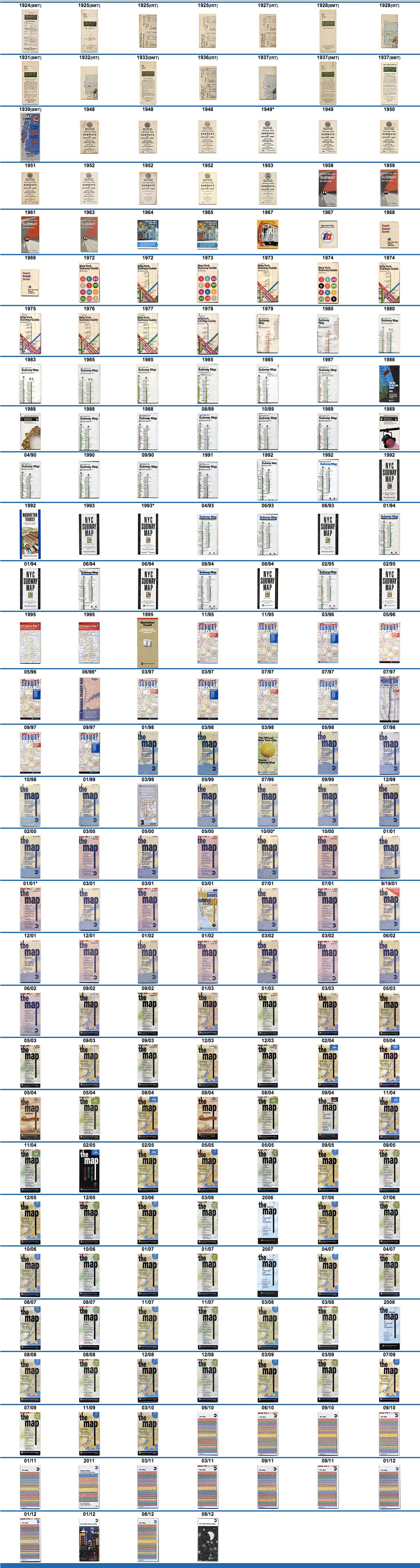
While researching about the disappearing and reappearing Rikers Island on MTA subway maps, we came across this website that has compiled the covers of New York City subway maps from 1924 to 2012. We screenshotted the scrolling website into one jpg file (click image below, then click it again when it opens to enlarge).
It’s pretty neat to see the changing evolution of graphic preferences, going from more text (pre-1950s) to illustration (1960s), stylized graphics (1970s), line maps (1980s and 90s), literal map (late 90s), to today’s recognizable “The Map”.
Next, discover the Top 10 Secrets of the NYC Subway System.

Subscribe to our free newsletters
Free Newsletters
Get the best stories and things to do sent straight to your inbox.
