


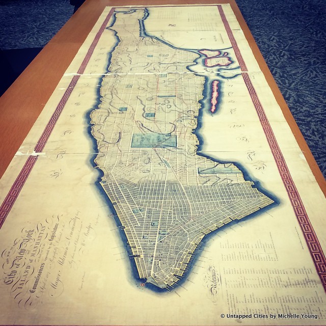
We all know the famous 1811 Commissioner’s Plan for New York City that laid out the grid system of Manhattan (fairly close to how it is today). There are various scanned versions online and different evolutions of the plan over time, but the original map of 1807 that was submitted to Congress in 1811 is still on file at the Library of Congress in Washington D.C. In honor of the 350th Anniversary of New York City on Monday, we spent the city’s birthday in the Library of Congress examining the original map. First thing to note: that map is HUGE! Here were some of our fun map finds:
1. Broadway Didn’t Go Beyond 23rd Street
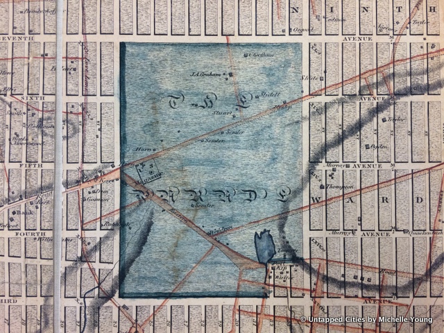
The red lines on the map represent some of the old streets and wagon ways that existed through Manhattan at the time. Bloomingdale Road, which began at today’s Union Square, continued through the area named The Parade (now part of present day Madison Square Park, which at some point was just a burial ground). But north of 23rd Street, the full grid system was supposed to take over. According to the book Manhattan in Maps 1527-1995 Broadway wasn’t included originally but was found that it “could not be eliminated.”