3. The Brooklyn-Flatbush Border Marker
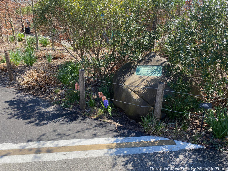
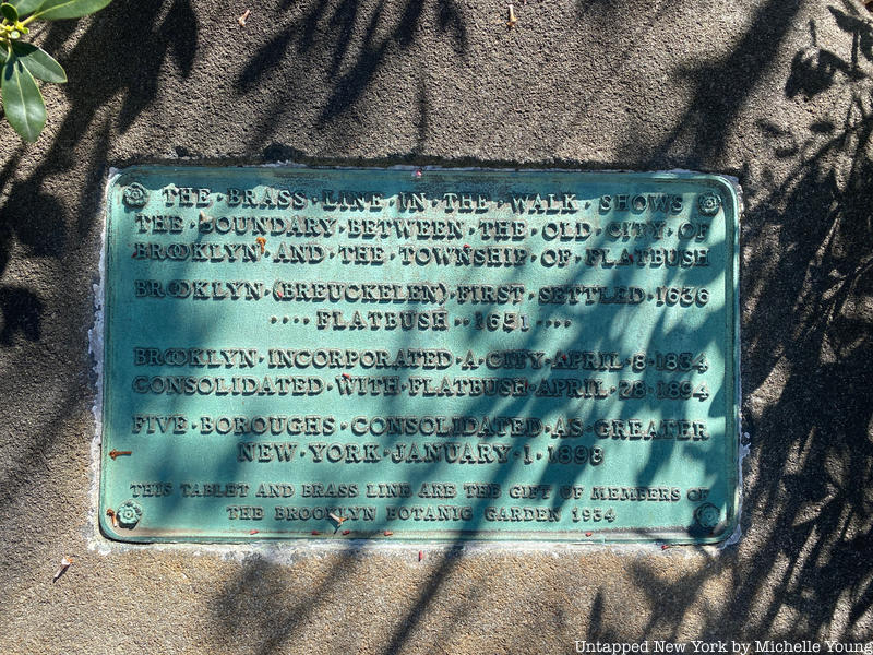
Tucked inside the Brooklyn Botanic Garden’s Flatbush Avenue entrance is a bronze patent line embedded into the asphalt that extends across the walkway. Few visitors will know that it denotes the former geographical boundary between Brooklyn and Flatbush. At one end of the line, a stone marker has a small bronze plaque that reads:
The brass line in the walk shows the boundary between the old city of Brooklyn and the township of Flatbush. Brooklyn (Breukelen) first settled in 1636. Flatbush 1651. Brooklyn incorporated a city April 8, 1834. Consolidated with Flatbush January 1, 1896. Five boroughs consolidated as greater New York January 1, 1898.
Before New York City encompassed the five boroughs it’s known for today, Brooklyn was its own city. Brooklyn (originally Breuekelen, in Dutch) was first settled in 1636 and incorporated as a city in 1843. Not long after came the village of Flatbush, which originates from the Dutch word Vlacke (meaning flat), first settled in 1651. Flatbush, though part of Brooklyn today, remained independent from its neighbor until 1894. That’s just a couple of years before New York City was “consolidated” into the five boroughs. The heart of the village of Flatbush was located where Flatbush Avenue and Church Avenue intersect today, and where the old Dutch Reformed Church, built in the last decade of the 18th century and Erasmus Hall, where an old clapboard schoolhouse dating to 1786 still exists. The northern border between Brooklyn and Flatbush runs through what is now Prospect Park and Brooklyn Botanic Garden.